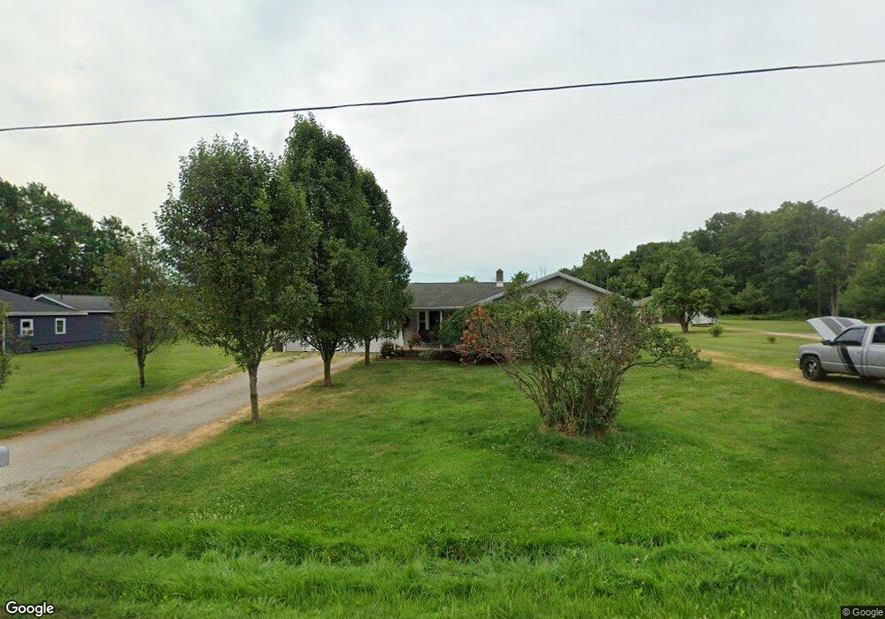
890 Hoover Rd Mansfield, OH 44905
Estimated Value: $129,000 - $223,000
2
Beds
1
Bath
1,096
Sq Ft
$156/Sq Ft
Est. Value
About This Home
This home is located at 890 Hoover Rd, Mansfield, OH 44905 and is currently estimated at $171,037, approximately $156 per square foot. 890 Hoover Rd is a home located in Richland County with nearby schools including Madison High School, Temple-Christian School, and St. Mary Catholic School.
Ownership History
Date
Name
Owned For
Owner Type
Purchase Details
Closed on
Mar 11, 2022
Sold by
Rose David F and Rose David F
Bought by
Manley Amber and Manley Jason
Current Estimated Value
Purchase Details
Closed on
Sep 5, 2019
Sold by
Stumbo Sheila K and Rose David F
Bought by
Rose David F and Rose Becky
Home Financials for this Owner
Home Financials are based on the most recent Mortgage that was taken out on this home.
Original Mortgage
$20,000
Interest Rate
3.7%
Mortgage Type
New Conventional
Purchase Details
Closed on
Aug 18, 1992
Sold by
Bush Richard M
Bought by
Rose William F
Create a Home Valuation Report for This Property
The Home Valuation Report is an in-depth analysis detailing your home's value as well as a comparison with similar homes in the area
Home Values in the Area
Average Home Value in this Area
Purchase History
| Date | Buyer | Sale Price | Title Company |
|---|---|---|---|
| Manley Amber | $40,000 | Southern Title | |
| Rose David F | $25,000 | Southern Title | |
| Rose William F | $38,000 | -- |
Source: Public Records
Mortgage History
| Date | Status | Borrower | Loan Amount |
|---|---|---|---|
| Previous Owner | Rose David F | $20,000 |
Source: Public Records
Tax History
| Year | Tax Paid | Tax Assessment Tax Assessment Total Assessment is a certain percentage of the fair market value that is determined by local assessors to be the total taxable value of land and additions on the property. | Land | Improvement |
|---|---|---|---|---|
| 2025 | $1,622 | $34,200 | $11,100 | $23,100 |
| 2024 | $1,622 | $34,200 | $11,100 | $23,100 |
| 2023 | $1,658 | $34,200 | $11,100 | $23,100 |
| 2022 | $1,459 | $26,730 | $9,920 | $16,810 |
| 2021 | $1,459 | $26,730 | $9,920 | $16,810 |
| 2020 | $1,470 | $26,730 | $9,920 | $16,810 |
| 2019 | $1,401 | $22,650 | $8,400 | $14,250 |
| 2018 | $1,310 | $22,650 | $8,400 | $14,250 |
| 2017 | $1,300 | $22,650 | $8,400 | $14,250 |
| 2016 | $1,318 | $22,490 | $7,980 | $14,510 |
| 2015 | $1,318 | $22,490 | $7,980 | $14,510 |
| 2014 | $1,252 | $22,490 | $7,980 | $14,510 |
| 2012 | $1,245 | $23,680 | $8,400 | $15,280 |
Source: Public Records
Map
Nearby Homes
- 961 Neil Cir N
- 573 Caldwell Ave
- 1246 Bellview Dr
- 0 Wesley
- 888 Beal Rd
- 1440 Barbara Ln
- 943 Yale Ave
- 690 Ashland Rd
- 1779 Ashland Rd
- 1168 ConcheMcO St
- 1217 Evergreen Ave W
- 683 Coachman Rd
- 672 Coachman Rd
- 646 Fleetwood Rd
- 1226 Evergreen Ave W
- 684 N Mcelroy Rd
- 644 Skyline Rd
- 602 Champion Rd
- 632 Coachman Rd
- 607 Skyline Rd
Your Personal Tour Guide
Ask me questions while you tour the home.