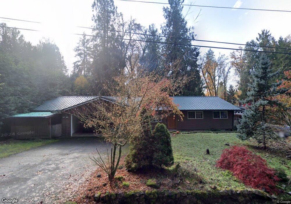
89058 Bridge St Springfield, OR 97478
Estimated Value: $493,252 - $538,000
3
Beds
2
Baths
1,401
Sq Ft
$367/Sq Ft
Est. Value
About This Home
This home is located at 89058 Bridge St, Springfield, OR 97478 and is currently estimated at $514,063, approximately $366 per square foot. 89058 Bridge St is a home located in Lane County with nearby schools including Walterville Elementary School, Briggs Middle School, and Thurston High School.
Ownership History
Date
Name
Owned For
Owner Type
Purchase Details
Closed on
Aug 18, 2025
Sold by
Grynick Kim L
Bought by
Rosenau Cody and Rosenau Kashia
Current Estimated Value
Home Financials for this Owner
Home Financials are based on the most recent Mortgage that was taken out on this home.
Original Mortgage
$18,025
Outstanding Balance
$3,686
Interest Rate
6.74%
Mortgage Type
New Conventional
Estimated Equity
$510,377
Purchase Details
Closed on
Aug 23, 2006
Sold by
Lewellen Donald E and Lewellen Marjorie C
Bought by
Grynick Kim L
Home Financials for this Owner
Home Financials are based on the most recent Mortgage that was taken out on this home.
Original Mortgage
$240,800
Interest Rate
6.7%
Mortgage Type
Purchase Money Mortgage
Purchase Details
Closed on
Nov 2, 2004
Sold by
Gamache Albert F
Bought by
Lewellen Donald E and Lewellen Marjorie C
Create a Home Valuation Report for This Property
The Home Valuation Report is an in-depth analysis detailing your home's value as well as a comparison with similar homes in the area
Purchase History
We collect this data history from publicly available records. To have your information removed, we recommend requesting removal directly through your county’s website.
| Date | Buyer | Sale Price | Title Company |
|---|---|---|---|
| Rosenau Cody | $515,000 | First American Title | |
| Grynick Kim L | $301,000 | Evergreen Land Title Co | |
| Lewellen Donald E | $165,000 | Western Pioneer Title Co |
Source: Public Records
Mortgage History
We collect this data history from publicly available records. To have your information removed, we recommend requesting removal directly through your county’s website.
| Date | Status | Borrower | Loan Amount |
|---|---|---|---|
| Open | Rosenau Cody | $18,025 | |
| Open | Rosenau Cody | $505,672 | |
| Previous Owner | Grynick Kim L | $240,800 |
Source: Public Records
Tax History
| Year | Tax Paid | Tax Assessment Tax Assessment Total Assessment is a certain percentage of the fair market value that is determined by local assessors to be the total taxable value of land and additions on the property. | Land | Improvement |
|---|---|---|---|---|
| 2025 | $3,116 | $274,138 | -- | -- |
| 2024 | $2,909 | $266,154 | -- | -- |
| 2023 | $2,909 | $258,402 | $0 | $0 |
| 2022 | $2,772 | $250,876 | $0 | $0 |
| 2021 | $2,707 | $243,569 | $0 | $0 |
| 2020 | $2,623 | $236,475 | $0 | $0 |
| 2019 | $2,485 | $229,588 | $0 | $0 |
| 2018 | $2,402 | $216,409 | $0 | $0 |
| 2017 | $2,313 | $216,409 | $0 | $0 |
| 2016 | $2,252 | $210,106 | $0 | $0 |
| 2015 | $2,193 | $203,986 | $0 | $0 |
| 2014 | $2,125 | $198,045 | $0 | $0 |
Source: Public Records
Map
Nearby Homes
- 41886 Deerhorn Rd
- 41929 Deerhorn Rd
- 41765 Madrone St
- 41895 Holden Creek Ln
- 0000 Whitewater Rd Unit 2332
- 41720 Madrone St
- 41536 Mckenzie Hwy
- 41577 Deerhorn Rd
- 0 Deerhorn Rd Unit 499554864
- 40211 Deerhorn Rd
- 0 Tonga Ln
- 40365 Tonga Ln
- 88175 Tiki Ln
- 88020 Keola Ct
- 88119 Tiki Ln
- 40168 Booth Kelly Rd
- 43950 Mckenzie Hwy
- 39200 Camp Creek Rd
- 39125 Easton Ln
- 90409 Mountain View Ln
- 89066 Bridge St
- 89074 Bridge St
- 41825 Madrone St
- 89050 Bridge St
- 41835 Madrone St
- 41843 Madrone St
- 89057 Bridge St
- 89065 Bridge St
- 89049 Bridge St
- 41845 Madrone St
- 41883 Deerhorn Rd
- 41823 Madrone St
- 27 Omlid Dr
- 89041 Bridge St
- 41853 Madrone St
- 41917 Deerhorn Rd
- 41919 Deerhorn Rd
- 41909 Deerhorn Rd
- 41832 Madrone St
- 41822 Madrone St
Your Personal Tour Guide
Ask me questions while you tour the home.