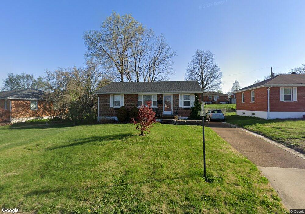
8912 Judith Ln Saint Louis, MO 63123
Estimated Value: $207,488 - $235,000
2
Beds
1
Bath
900
Sq Ft
$245/Sq Ft
Est. Value
About This Home
This home is located at 8912 Judith Ln, Saint Louis, MO 63123 and is currently estimated at $220,622, approximately $245 per square foot. 8912 Judith Ln is a home located in St. Louis County with nearby schools including Mesnier Primary School, Gotsch Intermediate School, and Rogers Middle School.
Ownership History
Date
Name
Owned For
Owner Type
Purchase Details
Closed on
Apr 23, 2009
Sold by
Johnson Jacob Michael
Bought by
Claunch Linda R
Current Estimated Value
Home Financials for this Owner
Home Financials are based on the most recent Mortgage that was taken out on this home.
Original Mortgage
$115,920
Outstanding Balance
$74,063
Interest Rate
5.14%
Mortgage Type
Purchase Money Mortgage
Estimated Equity
$146,559
Purchase Details
Closed on
Jul 7, 2006
Sold by
Spirk Robert E and Spirk Kathleen M
Bought by
Johnson Jacob Michael
Home Financials for this Owner
Home Financials are based on the most recent Mortgage that was taken out on this home.
Original Mortgage
$150,000
Interest Rate
6.85%
Mortgage Type
Purchase Money Mortgage
Purchase Details
Closed on
Feb 28, 2006
Sold by
Bild John F
Bought by
Spirk Robert E and Spirk Kathleen M
Home Financials for this Owner
Home Financials are based on the most recent Mortgage that was taken out on this home.
Original Mortgage
$96,800
Interest Rate
6.05%
Mortgage Type
Fannie Mae Freddie Mac
Create a Home Valuation Report for This Property
The Home Valuation Report is an in-depth analysis detailing your home's value as well as a comparison with similar homes in the area
Home Values in the Area
Average Home Value in this Area
Purchase History
| Date | Buyer | Sale Price | Title Company |
|---|---|---|---|
| Claunch Linda R | $144,900 | None Available | |
| Johnson Jacob Michael | $148,500 | Clt | |
| Spirk Robert E | $121,000 | None Available |
Source: Public Records
Mortgage History
| Date | Status | Borrower | Loan Amount |
|---|---|---|---|
| Open | Claunch Linda R | $115,920 | |
| Previous Owner | Johnson Jacob Michael | $150,000 | |
| Previous Owner | Spirk Robert E | $96,800 |
Source: Public Records
Tax History
| Year | Tax Paid | Tax Assessment Tax Assessment Total Assessment is a certain percentage of the fair market value that is determined by local assessors to be the total taxable value of land and additions on the property. | Land | Improvement |
|---|---|---|---|---|
| 2025 | $2,707 | $36,460 | $13,790 | $22,670 |
| 2024 | $2,707 | $33,290 | $9,840 | $23,450 |
| 2023 | $2,617 | $33,290 | $9,840 | $23,450 |
| 2022 | $2,517 | $27,420 | $9,840 | $17,580 |
| 2021 | $2,298 | $27,420 | $9,840 | $17,580 |
| 2020 | $2,288 | $25,480 | $9,670 | $15,810 |
| 2019 | $2,283 | $25,480 | $9,670 | $15,810 |
| 2018 | $2,263 | $22,320 | $6,760 | $15,560 |
| 2017 | $2,249 | $22,320 | $6,760 | $15,560 |
| 2016 | $2,017 | $21,260 | $3,910 | $17,350 |
Source: Public Records
Map
Nearby Homes
- 9047 Villaridge Ct Unit A
- 9038 Villaridge Ct Unit 49
- 9070 Villaridge Ct Unit 38
- 9924 Bunker Hill Dr Unit G
- 9924 Bunker Hill Dr Unit A
- 10031 Echoridge Ln Unit A
- 9925 Bunker Hill Dr Unit F
- 9117 Villaridge Ct Unit D
- 9965 Bunker Hill Dr Unit C
- 10069 N Bunker Hill Dr Unit A
- 4262 Eiffel Dr Unit 4262
- 9821 Zenith Dr
- 9208 Southview Ln
- 1841 Mansard Dr
- 4733 McCorry Dr
- 1928 Simba Cir
- 4005 Reavis Barracks Rd
- 2 Ashford at Grove at Grant’s Trail Manors
- 2 Royal II at Grove at Grant’s Trail Manors
- 2 Sterling at Grove at Grant’s Trail Manors
Your Personal Tour Guide
Ask me questions while you tour the home.