8917 Desarc Rd Ozone Park, NY 11417
Ozone Park NeighborhoodEstimated Value: $669,000 - $751,000
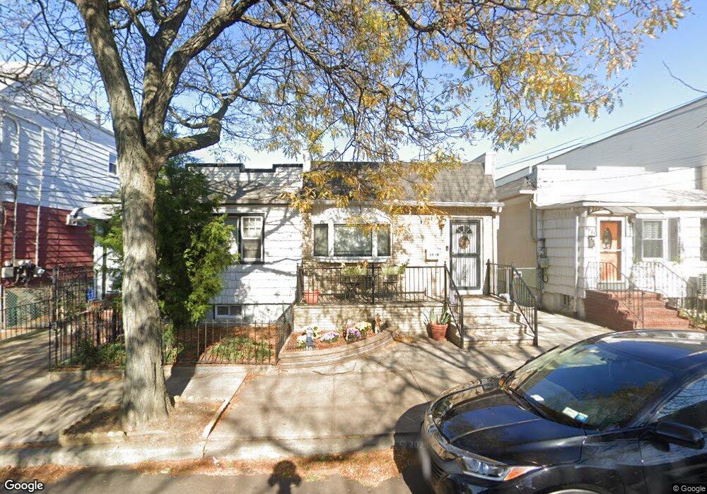
About This Home
This home is located at 8917 Desarc Rd, Ozone Park, NY 11417 and is currently estimated at $708,393, approximately $806 per square foot. 8917 Desarc Rd is a home located in Queens County with nearby schools including P.S. 63 - Old South and Robert H. Goddard High School.
Ownership History
We collect this data history from publicly available records. To have your information removed, we recommend requesting removal directly through your county’s website.
Purchase Details
Home Financials for this Owner
Home Financials are based on the most recent Mortgage that was taken out on this home.Purchase Details
Purchase Details
Home Values in the Area
Average Home Value in this Area
Purchase History
We collect this data history from publicly available records. To have your information removed, we recommend requesting removal directly through your county’s website.
| Date | Buyer | Sale Price | Title Company |
|---|---|---|---|
| $470,000 | -- | ||
| $470,000 | -- | ||
| -- | -- | ||
| -- | -- | ||
| -- | -- | ||
| -- | -- |
Mortgage History
We collect this data history from publicly available records. To have your information removed, we recommend requesting removal directly through your county’s website.
| Date | Status | Borrower | Loan Amount |
|---|---|---|---|
| Open | $352,500 | ||
| Closed | $352,500 |
Tax History
We collect this data history from publicly available records. To have your information removed, we recommend requesting removal directly through your county’s website.
| Year | Tax Paid | Tax Assessment Tax Assessment Total Assessment is a certain percentage of the fair market value that is determined by local assessors to be the total taxable value of land and additions on the property. | Land | Improvement |
|---|---|---|---|---|
| 2026 | $4,492 | $23,704 | $8,427 | $15,277 |
| 2025 | $4,238 | $22,363 | $9,567 | $12,796 |
| 2024 | $4,238 | $21,100 | $8,828 | $12,272 |
| 2023 | $3,998 | $19,906 | $9,153 | $10,753 |
| 2022 | $3,974 | $31,140 | $14,760 | $16,380 |
| 2021 | $4,157 | $32,880 | $14,760 | $18,120 |
| 2020 | $3,945 | $28,260 | $14,760 | $13,500 |
| 2019 | $3,678 | $29,460 | $14,760 | $14,700 |
| 2018 | $3,381 | $16,588 | $8,448 | $8,140 |
| 2017 | $3,381 | $16,588 | $9,424 | $7,164 |
| 2016 | $3,291 | $16,588 | $9,424 | $7,164 |
| 2015 | $1,887 | $15,530 | $12,218 | $3,312 |
| 2014 | $1,887 | $14,653 | $9,926 | $4,727 |
Map
- 8928 133rd Ave
- 89-12 Desarc Rd
- 8837 Pitkin Ave
- 8839 Pitkin Ave
- 9127 Gold Rd
- 9108 Sutter Ave
- 8612 133rd Ave
- 137-16 88th St
- 91-59 Chicot Rd
- 107-50 90th St
- 13326 86th St
- 133-42 86th St
- 8514 Sutter Ave
- 13723 Lafayette St
- 13503 Crossbay Blvd
- 107-11 90th St
- 133-22 85th St
- 107-49 93rd St
- 8511 Sutter Ave
- 85-02 Dumont Ave
- 8919 Desarc Rd
- 8919 Desarc Rd
- 8921 Desarc Rd
- 89-17 Desarc Rd Unit 2
- 89-17 Desarc Rd
- 8923 Desarc Rd
- 8925 Desarc Rd
- 8927 Desarc Rd
- 8929 133rd Ave
- 8915 Desarc Rd
- 8929 Desarc Rd
- 8928 133rd Ave
- 8929 Desarc Rd
- 89-38 Desarc Rd
- 8930 133rd Ave
- 8930 133rd Ave
- 8931 Desarc Rd
- 8918 Desarc Rd Unit 1R
- 89-18 Desarc Rd
- 8918 Desarc Rd Unit 1
Ask me questions while you tour the home.