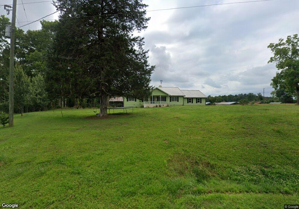
895 Stephens Salem Rd Stephens, GA 30667
Estimated Value: $229,000 - $275,000
3
Beds
2
Baths
2,016
Sq Ft
$124/Sq Ft
Est. Value
About This Home
This home is located at 895 Stephens Salem Rd, Stephens, GA 30667 and is currently estimated at $250,470, approximately $124 per square foot. 895 Stephens Salem Rd is a home located in Oglethorpe County with nearby schools including Oglethorpe County Primary School, Oglethorpe County Elementary School, and Oglethorpe County Middle School.
Ownership History
Date
Name
Owned For
Owner Type
Purchase Details
Closed on
Jul 14, 2004
Sold by
Gainesville Bank and Gainesville Ru
Bought by
Tompkins Darrius W
Current Estimated Value
Purchase Details
Closed on
Dec 23, 2002
Sold by
Hollis Hollis J and Hollis Dianne
Bought by
Gainesville Bank and Gainesville Ru
Purchase Details
Closed on
Nov 2, 1999
Sold by
Sanders Norman Howar
Bought by
Hollis Hollis J and Hollis Dianne
Create a Home Valuation Report for This Property
The Home Valuation Report is an in-depth analysis detailing your home's value as well as a comparison with similar homes in the area
Purchase History
| Date | Buyer | Sale Price | Title Company |
|---|---|---|---|
| Tompkins Darrius W | $340,000 | -- | |
| Gainesville Bank | -- | -- | |
| Hollis Hollis J | $490,000 | -- |
Source: Public Records
Tax History
| Year | Tax Paid | Tax Assessment Tax Assessment Total Assessment is a certain percentage of the fair market value that is determined by local assessors to be the total taxable value of land and additions on the property. | Land | Improvement |
|---|---|---|---|---|
| 2025 | $1,884 | $80,472 | $2,280 | $78,192 |
| 2023 | $2,007 | $80,152 | $2,160 | $77,992 |
| 2022 | $1,564 | $62,832 | $2,160 | $60,672 |
| 2021 | $1,404 | $50,904 | $1,960 | $48,944 |
| 2020 | $1,073 | $50,904 | $1,960 | $48,944 |
| 2019 | $1,416 | $50,904 | $1,960 | $48,944 |
| 2018 | $1,151 | $38,119 | $1,426 | $36,693 |
| 2017 | $1,082 | $37,644 | $951 | $36,693 |
| 2016 | $1,058 | $37,644 | $951 | $36,693 |
| 2015 | -- | $37,644 | $951 | $36,693 |
| 2014 | -- | $37,644 | $951 | $36,693 |
| 2013 | -- | $37,643 | $950 | $36,692 |
Source: Public Records
Map
Nearby Homes
- 0 Crawfordville Rd Unit 10674081
- 0 Crawfordville Rd Unit CL346865
- 125 Walker Gresham Rd
- 400 Salem Church Rd
- 0 Crawfordville Rd Unit 26541703
- 119 Ralph Bridges Rd
- 1 Union Point Rd
- 1774 Union Point Rd
- 1553 Washington Rd
- 0 Washington Rd Unit CL352378
- 0 Washington Rd Unit 10721696
- 290 Poplar Creek Rd
- 747 Washington Rd
- 0 Lovers Ln Unit 10690740
- 0 Lovers Ln Unit CL349036
- 30 Soggy Bottom Rd
- 473 E Church St
- 0 Georgia 77
- 0 Georgia 77 Unit CL339774
- 1707 Elberton Rd
- 900 Stephens Salem Rd
- 929 Stephens Salem Rd
- 861 Stephens Salem Rd
- 898 Stephens Salem Rd
- 939 Stephens Salem Rd
- 837 Stephens Salem Rd
- 957 Stephens Salem Rd
- 495 Hugh Culbreth Rd
- 825 Stephens Salem Rd
- 949 Stephens Salem Rd
- 915 Stephens Salem Rd
- 444 Hugh Culbreth Rd
- 996 Stephens Salem Rd
- 791 Stephens Salem Rd
- 1008 Stephens Salem Rd
- 805 Stephens Salem Rd
- 805 Stephens Salem Rd
- 997 Stephens Salem Rd
- 740 Stephens Salem Rd
- 785 Stephens Salem Rd
Your Personal Tour Guide
Ask me questions while you tour the home.