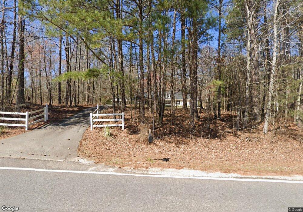
897 Elliott Rd McDonough, GA 30252
Estimated Value: $344,160 - $399,000
3
Beds
2
Baths
2,200
Sq Ft
$170/Sq Ft
Est. Value
About This Home
This home is located at 897 Elliott Rd, McDonough, GA 30252 and is currently estimated at $374,540, approximately $170 per square foot. 897 Elliott Rd is a home located in Henry County with nearby schools including East Lake Elementary School, Union Grove Middle School, and Union Grove High School.
Ownership History
Date
Name
Owned For
Owner Type
Purchase Details
Closed on
Apr 23, 2003
Sold by
Kerce Darryl K
Bought by
Kerce Darryl K and Kerce Carole
Current Estimated Value
Purchase Details
Closed on
Nov 2, 2001
Sold by
Kerce Darryl K
Bought by
Kerce Darryl K and Kerce Carole J
Home Financials for this Owner
Home Financials are based on the most recent Mortgage that was taken out on this home.
Original Mortgage
$85,500
Interest Rate
6.03%
Mortgage Type
New Conventional
Purchase Details
Closed on
Apr 30, 1998
Sold by
Phillips Gary and Phillips Donna
Bought by
Kerce Carole and Kerce Darryl
Home Financials for this Owner
Home Financials are based on the most recent Mortgage that was taken out on this home.
Original Mortgage
$80,000
Interest Rate
7.03%
Mortgage Type
New Conventional
Create a Home Valuation Report for This Property
The Home Valuation Report is an in-depth analysis detailing your home's value as well as a comparison with similar homes in the area
Home Values in the Area
Average Home Value in this Area
Purchase History
| Date | Buyer | Sale Price | Title Company |
|---|---|---|---|
| Kerce Darryl K | -- | -- | |
| Kerce Darryl K | -- | -- | |
| Kerce Carole | $119,100 | -- |
Source: Public Records
Mortgage History
| Date | Status | Borrower | Loan Amount |
|---|---|---|---|
| Previous Owner | Kerce Darryl K | $85,500 | |
| Previous Owner | Kerce Carole | $80,000 |
Source: Public Records
Tax History
| Year | Tax Paid | Tax Assessment Tax Assessment Total Assessment is a certain percentage of the fair market value that is determined by local assessors to be the total taxable value of land and additions on the property. | Land | Improvement |
|---|---|---|---|---|
| 2025 | $731 | $145,800 | $16,160 | $129,640 |
| 2024 | $731 | $138,320 | $14,480 | $123,840 |
| 2023 | $803 | $135,120 | $13,960 | $121,160 |
| 2022 | $890 | $113,120 | $12,880 | $100,240 |
| 2021 | $841 | $93,640 | $11,080 | $82,560 |
| 2020 | $814 | $82,840 | $10,400 | $72,440 |
| 2019 | $810 | $81,040 | $9,880 | $71,160 |
| 2018 | $778 | $68,800 | $9,120 | $59,680 |
| 2016 | $747 | $63,000 | $7,240 | $55,760 |
| 2015 | $404 | $61,560 | $7,720 | $53,840 |
| 2014 | $688 | $54,760 | $7,720 | $47,040 |
Source: Public Records
Map
Nearby Homes
- 1693 Campground Rd
- 112 Accolade Pkwy
- 1650 Campground Rd
- 330 Noah Place
- 210 Enfield Ln
- 209 Enfield Ln
- 1490 Campground Rd
- 565 Elliott Rd
- 229 Overland Trail
- 25 Bryans Dr
- 598 Elliott Rd
- 216 Overland Trail
- 1380 Elliott Rd
- 257 E Knight Rd
- 656 E Lake Rd
- 267 E Knight Rd
- 340 Bryans Dr
- 1245 Bent Creek Dr
- 277 E Knight Rd
- 610 Elliott Rd
- 901 Elliott Rd
- 893 Elliott Rd
- 400 W Knight Rd
- 386 W Knight Rd
- 902 Elliott Rd
- 926 Elliott Rd
- 872 Elliott Rd
- 1663 Campground Rd
- 380 W Knight Rd
- 370 W Knight Rd
- 930 Elliott Rd
- 914 Elliott Rd
- 842 Elliott Rd
- 934 Elliott Rd
- 1659 Campground Rd
- 1000 Elliott Rd
- 340 W Knight Rd
- 321 W Knight Rd
- 1645 Campground Rd
- 1697 Campground Rd
Your Personal Tour Guide
Ask me questions while you tour the home.