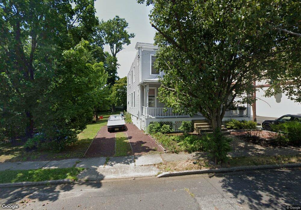
9 1/2 W Walnut Ave Haddon Township, NJ 08108
Estimated Value: $281,000 - $363,000
Studio
--
Bath
1,280
Sq Ft
$250/Sq Ft
Est. Value
About This Home
This home is located at 9 1/2 W Walnut Ave, Haddon Township, NJ 08108 and is currently estimated at $319,764, approximately $249 per square foot. 9 1/2 W Walnut Ave is a home located in Camden County with nearby schools including William G. Rohrer Middle School, Haddon Township High School, and Good Shepherd Regional School.
Ownership History
Date
Name
Owned For
Owner Type
Purchase Details
Closed on
Nov 20, 2024
Sold by
Barber Lawrence E
Bought by
Fowler Michael and Newell Lindsay
Current Estimated Value
Home Financials for this Owner
Home Financials are based on the most recent Mortgage that was taken out on this home.
Original Mortgage
$220,000
Interest Rate
6.69%
Mortgage Type
New Conventional
Purchase Details
Closed on
Aug 28, 1992
Bought by
Barber Lawrence
Create a Home Valuation Report for This Property
The Home Valuation Report is an in-depth analysis detailing your home's value as well as a comparison with similar homes in the area
Purchase History
| Date | Buyer | Sale Price | Title Company |
|---|---|---|---|
| Fowler Michael | $275,000 | Surety Title | |
| Fowler Michael | $275,000 | Surety Title | |
| Barber Lawrence | -- | -- |
Source: Public Records
Mortgage History
| Date | Status | Borrower | Loan Amount |
|---|---|---|---|
| Previous Owner | Fowler Michael | $220,000 |
Source: Public Records
Tax History
| Year | Tax Paid | Tax Assessment Tax Assessment Total Assessment is a certain percentage of the fair market value that is determined by local assessors to be the total taxable value of land and additions on the property. | Land | Improvement |
|---|---|---|---|---|
| 2025 | $5,643 | $246,000 | $109,800 | $136,200 |
| 2024 | $5,762 | $142,600 | $65,300 | $77,300 |
| 2023 | $5,762 | $142,600 | $65,300 | $77,300 |
| 2022 | $5,657 | $142,600 | $65,300 | $77,300 |
| 2021 | $5,421 | $142,600 | $65,300 | $77,300 |
| 2020 | $5,636 | $142,600 | $65,300 | $77,300 |
| 2019 | $5,432 | $142,600 | $65,300 | $77,300 |
| 2018 | $5,397 | $142,600 | $65,300 | $77,300 |
| 2017 | $5,305 | $142,600 | $65,300 | $77,300 |
| 2016 | $5,205 | $142,600 | $65,300 | $77,300 |
| 2015 | $5,035 | $142,600 | $65,300 | $77,300 |
| 2014 | $4,948 | $142,600 | $65,300 | $77,300 |
Source: Public Records
Map
Nearby Homes
- 6 E Albertson Ave
- 112 Virginia Ave
- 24 Cambridge Ave
- 119 French Ave
- 207 French Ave
- 222 Bradley Ave
- 15 W Cuthbert Blvd
- 237 Virginia Ave
- 1 Maple Ave
- 11 Elm Ave
- 79 Utica Ave
- 16 Akron Ave
- 403 Windsor Ave
- 405 E Melrose Ave
- 812 Princeton Ave
- 241 Addison Ave
- 501 Rhoads Ave
- 4 W Homestead Ave
- 215 Conard Ave
- 1017 Belmont Ave
- 9 W Walnut Ave
- 13 W Walnut Ave
- 100 Lindis Farne Ave Unit 2201
- 100 Lindis Farne Ave Unit 4303
- 100 Lindis Farne Ave Unit 1101
- 100 Lindis Farne Ave Unit 2101
- 100 Lindis Farne Ave Unit 4301
- 100 Lindis Farne Ave Unit 4105
- 100 Lindis Farne Ave Unit B-6
- 100 Lindis Farne Ave Unit 4302
- 100 Lindis Farne Ave Unit 2103
- 100 Lindis Farne Ave Unit A-3
- 100 Lindisfarne Ave
- 100 Lindis Farne Ave Unit 2101
- 100 Lindis Farne Ave Unit 1101
- 100 Lindis Farne Ave Unit 2103
- 100 Lindis Farne Ave Unit 4302
- 100 Lindis Farne Ave Unit 4303
- 100 Lindis Farne Ave Unit 4301
- 100 Lindis Farne Ave Unit 4105
Your Personal Tour Guide
Ask me questions while you tour the home.