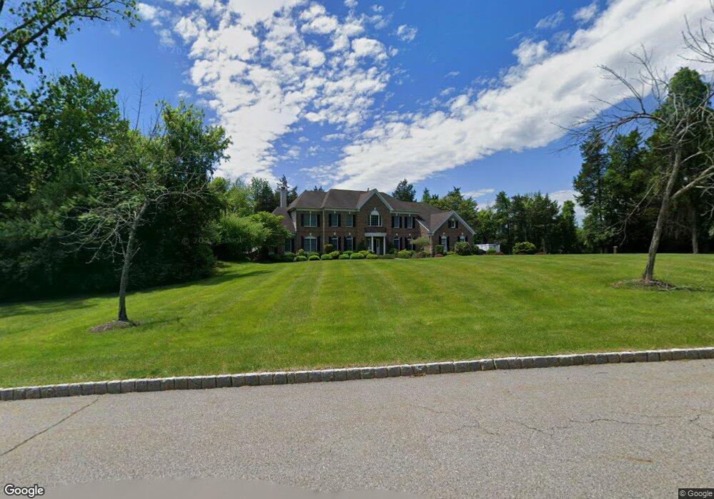
9 Green Tree Dr Andover, NJ 07821
Estimated Value: $968,000 - $1,221,000
Studio
--
Bath
4,768
Sq Ft
$226/Sq Ft
Est. Value
About This Home
This home is located at 9 Green Tree Dr, Andover, NJ 07821 and is currently estimated at $1,076,528, approximately $225 per square foot. 9 Green Tree Dr is a home located in Sussex County with nearby schools including Green Hills School and Tranquility Adventist School.
Ownership History
Date
Name
Owned For
Owner Type
Purchase Details
Closed on
Jun 23, 2015
Sold by
Nrz Reo Iv Corp
Bought by
Pretium Mortgage Acquistion Trust and Christiana Trust
Current Estimated Value
Purchase Details
Closed on
Jul 20, 2006
Sold by
Tolland Xxv Lp
Bought by
Sousa Nelson and Sousa Lisa
Home Financials for this Owner
Home Financials are based on the most recent Mortgage that was taken out on this home.
Original Mortgage
$620,000
Interest Rate
6.7%
Mortgage Type
Purchase Money Mortgage
Purchase Details
Closed on
Jan 16, 2004
Sold by
Federal Financial Co
Bought by
Toll Land Xxv Lp
Create a Home Valuation Report for This Property
The Home Valuation Report is an in-depth analysis detailing your home's value as well as a comparison with similar homes in the area
Home Values in the Area
Average Home Value in this Area
Purchase History
We collect this data history from publicly available records. To have your information removed, we recommend requesting removal directly through your county’s website.
| Date | Buyer | Sale Price | Title Company |
|---|---|---|---|
| Pretium Mortgage Acquistion Trust | -- | Title365 | |
| Sousa Nelson | $785,899 | None Available | |
| Toll Land Xxv Lp | $2,240,000 | Westminster Title Agency |
Source: Public Records
Mortgage History
We collect this data history from publicly available records. To have your information removed, we recommend requesting removal directly through your county’s website.
| Date | Status | Borrower | Loan Amount |
|---|---|---|---|
| Previous Owner | Sousa Nelson | $620,000 |
Source: Public Records
Tax History
| Year | Tax Paid | Tax Assessment Tax Assessment Total Assessment is a certain percentage of the fair market value that is determined by local assessors to be the total taxable value of land and additions on the property. | Land | Improvement |
|---|---|---|---|---|
| 2025 | $23,251 | $1,114,900 | $193,000 | $921,900 |
| 2024 | $23,084 | $597,400 | $149,200 | $448,200 |
| 2023 | $23,084 | $597,400 | $149,200 | $448,200 |
| 2022 | $21,960 | $597,400 | $149,200 | $448,200 |
| 2021 | $21,674 | $597,400 | $149,200 | $448,200 |
| 2020 | $21,148 | $597,400 | $149,200 | $448,200 |
| 2019 | $20,700 | $597,400 | $149,200 | $448,200 |
| 2018 | $21,787 | $597,400 | $149,200 | $448,200 |
| 2017 | $20,819 | $582,500 | $149,200 | $433,300 |
| 2016 | $20,207 | $582,500 | $149,200 | $433,300 |
| 2015 | $21,094 | $630,600 | $149,200 | $481,400 |
| 2014 | $20,520 | $630,600 | $149,200 | $481,400 |
Source: Public Records
Map
Nearby Homes
- 2 Stone Forge Rd
- 83 Creek Rd
- 112 Kennedy Rd
- 104 Creek Rd
- 10 Old Forge Rd
- 77 Decker Pond Rd
- 15 Spring Hunter Ct
- 14 Misty Ln
- 37 Pequest Rd
- 42 Scenic Dr
- 7 Woodfield Rd
- 569 Ervey Rd
- 0 Decker Pond Airport Rd Unit 3945534
- 15 Mountainview Dr
- 10 Sunny Ln
- 107 South St
- 17 Shotwell Rd
- 4 Tote Rd
- 195 Allamuchy Rd
- 1127 Dark Moon Rd
- 8 Stone Forge Rd
- 7 Green Tree Dr
- 6 Stone Forge Rd
- 7 Stone Forge Rd
- 14 Green Tree Dr
- 4 Carriage Dr
- 12 Green Tree Dr
- 20 Green Tree Dr
- 5 Stone Forge Rd
- 4 Stone Forge Rd
- 2 Carriage Dr
- 10 Green Tree Dr
- 3 Heron Way
- 18 Green Tree Dr
- 3 Stone Forge Rd
- 5 Heron Way
- 22 Green Tree Dr
- 6 Carriage Dr
- 1 Stone Forge Rd
- 16 Green Tree Dr
Your Personal Tour Guide
Ask me questions while you tour the home.