K
Seller's Agent in 2025
Kristin Piccone
Landing Real Estate
(207) 951-1393
5 in this area
47 Total Sales
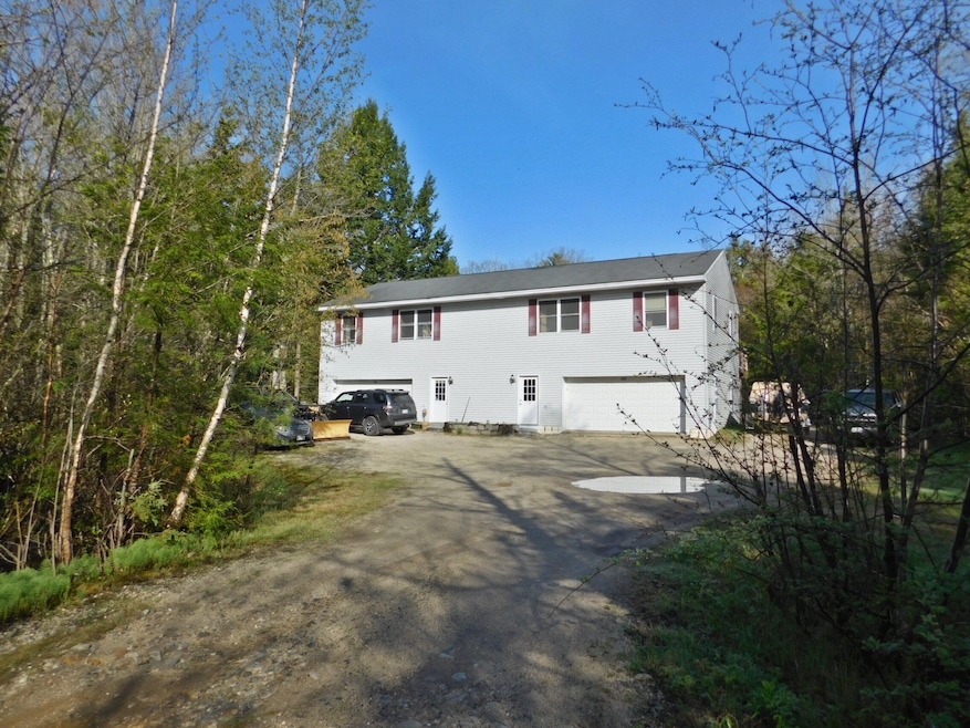
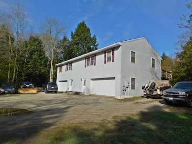
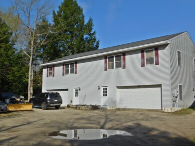
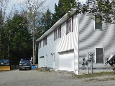
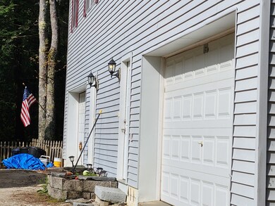
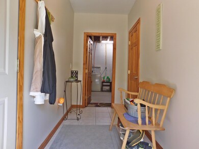
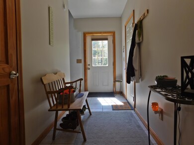
Efficient duplex situated on a private 4-acre lot offering an excellent opportunity for homeownership or investment. Each unit features an open-concept kitchen and living room, 2 bedrooms each, 1 full bath, laundry room, and storage area. Both units also include their own dedicated garage. The large yard offers many options for fun, relaxation, gardening and so much more. With frontage on Brandy Brook this is the place that you will want to be to unwind and relax; make it YOURS today!
Last Buyer's Agent
Kelly Walker
Keller Williams Realty
| Date | Type | Sale Price | Title Company |
|---|---|---|---|
| Warranty Deed | $440,000 | -- | |
| Warranty Deed | $440,000 | -- | |
| Deed | -- | -- | |
| Deed | -- | -- | |
| Warranty Deed | -- | -- | |
| Warranty Deed | -- | -- |
| Date | Status | Loan Amount | Loan Type |
|---|---|---|---|
| Open | $264,000 | Purchase Money Mortgage | |
| Closed | $264,000 | New Conventional | |
| Previous Owner | $229,368 | FHA |
| Date | Event | Price | List to Sale | Price per Sq Ft |
|---|---|---|---|---|
| 07/31/2025 07/31/25 | Sold | $440,000 | -12.9% | $262 / Sq Ft |
| 06/16/2025 06/16/25 | Pending | -- | -- | -- |
| 06/06/2025 06/06/25 | For Sale | $505,000 | -- | $301 / Sq Ft |
| Year | Tax Paid | Tax Assessment Tax Assessment Total Assessment is a certain percentage of the fair market value that is determined by local assessors to be the total taxable value of land and additions on the property. | Land | Improvement |
|---|---|---|---|---|
| 2025 | $3,883 | $251,029 | $62,950 | $188,079 |
| 2024 | $3,738 | $251,029 | $62,950 | $188,079 |
| 2023 | $3,587 | $251,029 | $62,950 | $188,079 |
| 2022 | $3,464 | $251,029 | $62,950 | $188,079 |
| 2021 | $3,464 | $251,029 | $62,950 | $188,079 |
| 2020 | $3,427 | $251,029 | $62,950 | $188,079 |
| 2019 | $2,929 | $173,300 | $30,400 | $142,900 |
| 2018 | $2,738 | $173,300 | $30,400 | $142,900 |
| 2017 | $2,703 | $173,300 | $30,400 | $142,900 |
| 2016 | $2,548 | $173,300 | $30,400 | $142,900 |
| 2015 | $2,539 | $173,300 | $30,400 | $142,900 |
| 2014 | $2,513 | $173,300 | $30,400 | $142,900 |
| 2013 | $2,331 | $173,300 | $30,400 | $142,900 |
K
Seller's Agent in 2025
Kristin Piccone
Landing Real Estate
(207) 951-1393
5 in this area
47 Total Sales
K
Buyer's Agent in 2025
Kelly Walker
Keller Williams Realty
Source: Maine Listings
MLS Number: 1625558
APN: NEWG-000003-000000-000078-B000000
Disclaimer: Certain information contained herein is derived from information provided by parties other than Homes.com. All information provided is deemed reliable, but is not guaranteed to be accurate and should be independently verified.
![]() Listing data is derived in whole or in part from Maine Real Estate Information System, Inc. (d/b/a Maine Listings) and is for consumers' personal, noncommercial use only. Dimensions are approximate and not guaranteed. All data should be independently verified.
Listing data is derived in whole or in part from Maine Real Estate Information System, Inc. (d/b/a Maine Listings) and is for consumers' personal, noncommercial use only. Dimensions are approximate and not guaranteed. All data should be independently verified.
© 2026 Maine Real Estate Information System, Inc. All Rights Reserved. Equal Housing Opportunity.
Homes.com, LLC, 17600 Laguna Canyon Rd Irvine, CA 92618 (888)-952-6393
![]()
Ask me questions while you tour the home.
