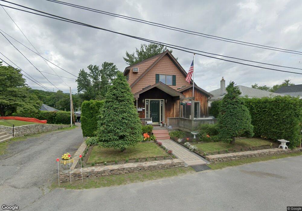
9 Ideal Rd Worcester, MA 01604
Grafton Hill NeighborhoodEstimated Value: $436,000 - $472,000
3
Beds
1
Bath
1,864
Sq Ft
$244/Sq Ft
Est. Value
About This Home
This home is located at 9 Ideal Rd, Worcester, MA 01604 and is currently estimated at $455,746, approximately $244 per square foot. 9 Ideal Rd is a home located in Worcester County with nearby schools including Calvin Coolidge Elementary School, Sherwood Middle School, and Oak Middle School.
Ownership History
Date
Name
Owned For
Owner Type
Purchase Details
Closed on
Aug 24, 2023
Sold by
Anger Lt and Anger
Bought by
Anger Irt and Anger
Current Estimated Value
Purchase Details
Closed on
Sep 13, 2018
Sold by
Anger Gary G and Anger Linda J
Bought by
Anger Lt and Anger
Create a Home Valuation Report for This Property
The Home Valuation Report is an in-depth analysis detailing your home's value as well as a comparison with similar homes in the area
Home Values in the Area
Average Home Value in this Area
Purchase History
| Date | Buyer | Sale Price | Title Company |
|---|---|---|---|
| Anger Irt | -- | None Available | |
| Anger Lt | -- | -- |
Source: Public Records
Tax History
| Year | Tax Paid | Tax Assessment Tax Assessment Total Assessment is a certain percentage of the fair market value that is determined by local assessors to be the total taxable value of land and additions on the property. | Land | Improvement |
|---|---|---|---|---|
| 2025 | $5,175 | $392,353 | $88,953 | $303,400 |
| 2024 | $4,908 | $356,953 | $88,953 | $268,000 |
| 2023 | $4,734 | $330,092 | $76,592 | $253,500 |
| 2022 | $4,397 | $289,107 | $61,307 | $227,800 |
| 2021 | $4,450 | $273,337 | $49,037 | $224,300 |
| 2020 | $4,192 | $246,600 | $48,900 | $197,700 |
| 2019 | $4,088 | $227,100 | $47,200 | $179,900 |
| 2018 | $4,062 | $214,800 | $47,200 | $167,600 |
| 2017 | $3,863 | $201,000 | $47,200 | $153,800 |
| 2016 | $4,015 | $194,800 | $39,600 | $155,200 |
| 2015 | $3,910 | $194,800 | $39,600 | $155,200 |
| 2014 | $3,806 | $194,800 | $39,600 | $155,200 |
Source: Public Records
Map
Nearby Homes
- 2 Salisbury St
- 23 Bay View Dr
- 469 Lake Ave
- 33 Lakeside Dr
- 15 Lakeside Dr
- 81 Bay View Dr
- 7 Atlas St
- 12 Bruce St
- 1195 Grafton St Unit 19
- 1195 Grafton St Unit 39
- 1205 Grafton St Unit 31
- 7 Clarissa St
- 16 Flint Pond Rd
- 53 Pointe Rok Dr Unit 53
- 47 Pointe Rok Dr Unit 47,G
- 1257 Grafton St
- 10 George St
- 1260 Grafton St
- 1459 Grafton Rd
- 11 Maplewood Rd
Your Personal Tour Guide
Ask me questions while you tour the home.