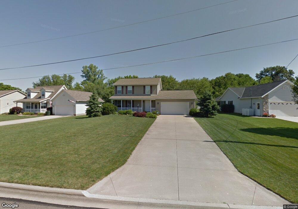
9 Longitude Dr Mount Vernon, OH 43050
Estimated Value: $283,010 - $343,000
3
Beds
2
Baths
1,512
Sq Ft
$209/Sq Ft
Est. Value
About This Home
This home is located at 9 Longitude Dr, Mount Vernon, OH 43050 and is currently estimated at $315,253, approximately $208 per square foot. 9 Longitude Dr is a home located in Knox County with nearby schools including Mount Vernon High School, St. Vincent de Paul School, and Ruscel Montessori Childrens House.
Ownership History
Date
Name
Owned For
Owner Type
Purchase Details
Closed on
Feb 13, 2002
Sold by
Schlabach Dennis R and Buckeye Plumbin
Bought by
Lord Stefanie
Current Estimated Value
Purchase Details
Closed on
Oct 13, 2000
Bought by
Buckeye Steel and Buckeye Plumbin
Purchase Details
Closed on
Nov 15, 1994
Bought by
Landcraft Inc An Ohio Cor
Create a Home Valuation Report for This Property
The Home Valuation Report is an in-depth analysis detailing your home's value as well as a comparison with similar homes in the area
Home Values in the Area
Average Home Value in this Area
Purchase History
| Date | Buyer | Sale Price | Title Company |
|---|---|---|---|
| Lord Stefanie | $25,000 | -- | |
| Buckeye Steel | $86,400 | -- | |
| Landcraft Inc An Ohio Cor | -- | -- |
Source: Public Records
Tax History
| Year | Tax Paid | Tax Assessment Tax Assessment Total Assessment is a certain percentage of the fair market value that is determined by local assessors to be the total taxable value of land and additions on the property. | Land | Improvement |
|---|---|---|---|---|
| 2025 | $2,865 | $75,960 | $12,680 | $63,280 |
| 2024 | $2,865 | $75,960 | $12,680 | $63,280 |
| 2023 | $2,929 | $75,960 | $12,680 | $63,280 |
| 2022 | $2,659 | $62,780 | $10,480 | $52,300 |
| 2021 | $2,659 | $62,780 | $10,480 | $52,300 |
| 2020 | $2,590 | $62,780 | $10,480 | $52,300 |
| 2019 | $2,513 | $56,780 | $10,190 | $46,590 |
| 2018 | $2,513 | $56,780 | $10,190 | $46,590 |
| 2017 | $2,468 | $56,780 | $10,190 | $46,590 |
| 2016 | $2,289 | $52,560 | $9,430 | $43,130 |
| 2015 | $2,299 | $52,560 | $9,430 | $43,130 |
| 2014 | $2,311 | $52,560 | $9,430 | $43,130 |
| 2013 | $2,359 | $51,130 | $11,820 | $39,310 |
Source: Public Records
Map
Nearby Homes
- 29 Longitude Dr
- 201 Rose Ave
- 749 Upper Fredericktown Rd
- 10 Buena Vista Ave
- 14700 Indian Hills Rd
- 203 James St
- 14463 Maple Ln
- 800 N Sandusky St
- 717 N Sandusky St
- 717 N Sandusky St Unit 14
- 14835 Indian Hills Rd
- 61 Mansfield Ave
- 13232 Mansfield Rd
- 329 Wooster Rd
- 13270 Rolling Hills Ct
- 13399 Old Mansfield Rd
- 301 Locust St
- 1 Highmeadow Dr
- 607 N Mulberry St
- 125 Morris St
- 7 Longitude Dr
- 11 Longitude Dr
- 5 Longitude Dr
- 13 Longitude Dr
- 15 Longitude Dr
- 10 Longitude Dr
- 3 Longitude Dr
- 8 Longitude Dr
- 6 Longitude Dr
- 12 Longitude Dr
- 17 Longitude Dr
- 4 Longitude Dr
- 306 Mansfield Rd
- 202 Mansfield Rd
- 202 Mansfield Ave
- 1 Longitude Dr
- 19 Longitude Dr
- 287 Fairgrounds Rd
- 4 Latitude Dr
- 1 Latitude Dr
Your Personal Tour Guide
Ask me questions while you tour the home.