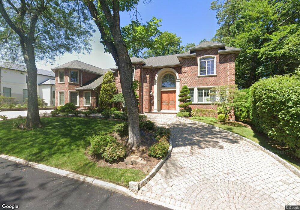
9 Loretta Ct Englewood Cliffs, NJ 07632
Estimated Value: $2,724,639 - $3,400,000
Studio
--
Bath
5,504
Sq Ft
$571/Sq Ft
Est. Value
About This Home
This home is located at 9 Loretta Ct, Englewood Cliffs, NJ 07632 and is currently estimated at $3,144,546, approximately $571 per square foot. 9 Loretta Ct is a home located in Bergen County with nearby schools including North Cliff Elementary School, Upper School Elementary School, and The Moriah School.
Ownership History
Date
Name
Owned For
Owner Type
Purchase Details
Closed on
Apr 15, 2008
Sold by
Ewing Rita M
Bought by
Khym Kwang W and Khym Hyunju
Current Estimated Value
Home Financials for this Owner
Home Financials are based on the most recent Mortgage that was taken out on this home.
Original Mortgage
$1,885,000
Outstanding Balance
$1,190,329
Interest Rate
5.91%
Mortgage Type
New Conventional
Estimated Equity
$1,954,217
Purchase Details
Closed on
Apr 20, 2005
Sold by
Bruni Eugene
Bought by
Ewing Rita
Purchase Details
Closed on
Apr 17, 2003
Sold by
Dowling Michael
Bought by
Bruni Eugene
Create a Home Valuation Report for This Property
The Home Valuation Report is an in-depth analysis detailing your home's value as well as a comparison with similar homes in the area
Home Values in the Area
Average Home Value in this Area
Purchase History
| Date | Buyer | Sale Price | Title Company |
|---|---|---|---|
| Khym Kwang W | $2,920,000 | -- | |
| Ewing Rita | $2,499,000 | -- | |
| Bruni Eugene | $660,000 | -- |
Source: Public Records
Mortgage History
| Date | Status | Borrower | Loan Amount |
|---|---|---|---|
| Open | Khym Kwang W | $1,885,000 |
Source: Public Records
Tax History
| Year | Tax Paid | Tax Assessment Tax Assessment Total Assessment is a certain percentage of the fair market value that is determined by local assessors to be the total taxable value of land and additions on the property. | Land | Improvement |
|---|---|---|---|---|
| 2025 | $24,255 | $2,100,000 | $868,100 | $1,231,900 |
| 2024 | $23,961 | $2,100,000 | $868,100 | $1,231,900 |
| 2023 | $23,583 | $2,100,000 | $868,100 | $1,231,900 |
| 2022 | $23,583 | $2,100,000 | $868,100 | $1,231,900 |
| 2021 | $18,128 | $2,100,000 | $868,100 | $1,231,900 |
| 2020 | $24,171 | $2,100,000 | $868,100 | $1,231,900 |
| 2019 | $22,701 | $2,100,000 | $868,100 | $1,231,900 |
| 2018 | $21,903 | $2,100,000 | $868,100 | $1,231,900 |
| 2017 | $20,958 | $2,100,000 | $868,100 | $1,231,900 |
| 2016 | $20,559 | $2,100,000 | $868,100 | $1,231,900 |
| 2015 | $19,530 | $2,100,000 | $868,100 | $1,231,900 |
| 2014 | $18,270 | $2,100,000 | $868,100 | $1,231,900 |
Source: Public Records
Map
Nearby Homes
- 45 Marjorie Terrace
- 111 Demarest Ave
- 140 Demarest Ave
- 144 Demarest Ave
- 577 Floyd St
- 2 Maple St
- 394 E Palisade Ave
- 48 Cambridge Place
- 365 Forest Dr
- 48 S Woodland St
- 231 N Woodland St
- 45 Beech Rd
- 320 Bolz St
- 200 Lincoln St
- 316 Bolz St
- 312 Bolz St
- 285 Maple St
- 292 Maple St
- 11 Roberts Rd
- 215 Brinckerhoff Ct
- 544 Floyd St
- 1 Loretta Ct
- 41 Marjorie Terrace
- 15 Loretta Ct
- 10 Loretta Ct
- 550 Floyd St
- 536 Floyd St
- 35 Marjorie Terrace
- 530 Floyd St
- 545 Floyd St
- 9 Roslyn Ave
- 541 Floyd St
- 23 Loretta Ct
- 11 Roslyn Ave
- 42 Marjorie Terrace
- 554 Floyd St
- 55 Marjorie Terrace
- 36 Marjorie Terrace
- 48 Marjorie Terrace
- 108 Demarest Ave
Your Personal Tour Guide
Ask me questions while you tour the home.