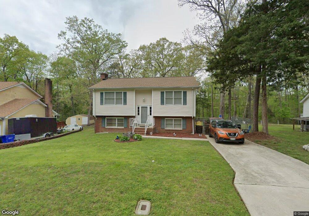
9 McBenson Place Durham, NC 27705
Duke Homestead NeighborhoodEstimated Value: $335,000 - $359,000
About This Home
This home is located at 9 McBenson Place, Durham, NC 27705 and is currently estimated at $351,383, approximately $212 per square foot. 9 McBenson Place is a home located in Durham County with nearby schools including Hillandale Elementary School, George L Carrington Middle, and Riverside High School.
Ownership History
We collect this data history from publicly available records. To have your information removed, we recommend requesting removal directly through your county’s website.
Purchase Details
Purchase Details
Purchase Details
Home Financials for this Owner
Home Financials are based on the most recent Mortgage that was taken out on this home.Home Values in the Area
Average Home Value in this Area
Purchase History
We collect this data history from publicly available records. To have your information removed, we recommend requesting removal directly through your county’s website.
| Date | Buyer | Sale Price | Title Company |
|---|---|---|---|
| -- | -- | ||
| -- | None Available | ||
| $125,000 | -- |
Mortgage History
We collect this data history from publicly available records. To have your information removed, we recommend requesting removal directly through your county’s website.
| Date | Status | Borrower | Loan Amount |
|---|---|---|---|
| Previous Owner | $125,000 |
Tax History
We collect this data history from publicly available records. To have your information removed, we recommend requesting removal directly through your county’s website.
| Year | Tax Paid | Tax Assessment Tax Assessment Total Assessment is a certain percentage of the fair market value that is determined by local assessors to be the total taxable value of land and additions on the property. | Land | Improvement |
|---|---|---|---|---|
| 2025 | $3,225 | $325,344 | $125,775 | $199,569 |
| 2024 | $2,569 | $184,150 | $38,790 | $145,360 |
| 2023 | $2,412 | $184,150 | $38,790 | $145,360 |
| 2022 | $2,357 | $184,150 | $38,790 | $145,360 |
| 2021 | $2,346 | $184,150 | $38,790 | $145,360 |
| 2020 | $2,291 | $184,150 | $38,790 | $145,360 |
| 2019 | $2,291 | $184,150 | $38,790 | $145,360 |
| 2018 | $1,985 | $146,314 | $25,860 | $120,454 |
| 2017 | $1,970 | $146,314 | $25,860 | $120,454 |
| 2016 | $1,904 | $146,314 | $25,860 | $120,454 |
| 2015 | $1,815 | $131,116 | $30,049 | $101,067 |
| 2014 | $1,815 | $131,116 | $30,049 | $101,067 |
Map
- 1510 Kirkwood Dr
- 1904 Stadium Dr
- 1206B River Rock Dr
- 1206A River Rock Dr
- 3256 Cascade Ln
- 3605 Britt St
- 3516 Preston Ave
- 3650 Guess Rd
- 3652 Guess Rd
- 3654 Guess Rd
- 3214 Duke Homestead Rd
- 2941 Duke Homestead Rd
- 2935 Duke Homestead Rd
- 2945 Duke Homestead Rd
- 1010 Wyldewood Rd
- 2307 W Carver St
- 8 Bair Cir
- 3216 Duke Homestead Rd
- 15 Moorefield Ct
- 812 Chalk Level Rd
- 11 McBenson Place
- 7 McBenson Place
- 5 McBenson Place
- 15 McBenson Place
- 10 McBenson Place
- 1512 Rowemont Dr
- 17 McBenson Place
- 1 McBenson Place
- 14 McBenson Place
- 4 Cairn Ct
- 8 Cairn Ct
- 1508 Rowemont Dr
- 19 McBenson Place
- 1504 Rowemont Dr
- 20 McBenson Place
- 18 McBenson Place
- 1513 Rowemont Dr
- 1517 Rowemont Dr
- 9 Cairn Ct
- 1509 Rowemont Dr
Ask me questions while you tour the home.