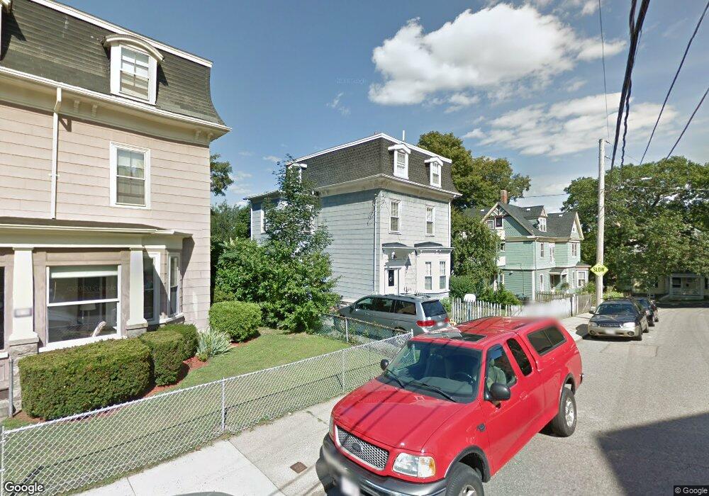
9 Prospect Ave Roslindale, MA 02131
Roslindale NeighborhoodEstimated Value: $1,063,310 - $1,354,000
5
Beds
3
Baths
2,418
Sq Ft
$477/Sq Ft
Est. Value
About This Home
This home is located at 9 Prospect Ave, Roslindale, MA 02131 and is currently estimated at $1,152,578, approximately $476 per square foot. 9 Prospect Ave is a home located in Suffolk County with nearby schools including Brooke Charter School Roslindale, Sacred Heart STEM School, and St. Clare High School.
Ownership History
Date
Name
Owned For
Owner Type
Purchase Details
Closed on
Nov 16, 2001
Sold by
Burns Theresa Est
Bought by
Wohlgemuth Michael J and Wohlgemuth Tara A
Current Estimated Value
Purchase Details
Closed on
Jun 1, 1988
Sold by
Earle Eric H
Bought by
Mitchell Warrick
Create a Home Valuation Report for This Property
The Home Valuation Report is an in-depth analysis detailing your home's value as well as a comparison with similar homes in the area
Home Values in the Area
Average Home Value in this Area
Purchase History
We collect this data history from publicly available records. To have your information removed, we recommend requesting removal directly through your county’s website.
| Date | Buyer | Sale Price | Title Company |
|---|---|---|---|
| Wohlgemuth Michael J | $320,000 | -- | |
| Mitchell Warrick | $100,000 | -- |
Source: Public Records
Mortgage History
We collect this data history from publicly available records. To have your information removed, we recommend requesting removal directly through your county’s website.
| Date | Status | Borrower | Loan Amount |
|---|---|---|---|
| Open | Mitchell Warrick | $332,000 | |
| Closed | Mitchell Warrick | $341,000 | |
| Closed | Mitchell Warrick | $293,420 |
Source: Public Records
Tax History
| Year | Tax Paid | Tax Assessment Tax Assessment Total Assessment is a certain percentage of the fair market value that is determined by local assessors to be the total taxable value of land and additions on the property. | Land | Improvement |
|---|---|---|---|---|
| 2025 | $11,237 | $970,400 | $314,400 | $656,000 |
| 2024 | $10,765 | $987,600 | $281,900 | $705,700 |
| 2023 | $9,909 | $922,600 | $263,300 | $659,300 |
| 2022 | $9,297 | $854,500 | $243,900 | $610,600 |
| 2021 | $8,649 | $810,600 | $234,500 | $576,100 |
| 2020 | $7,795 | $738,200 | $226,900 | $511,300 |
| 2019 | $7,408 | $702,800 | $178,100 | $524,700 |
| 2018 | $7,013 | $669,200 | $178,100 | $491,100 |
| 2017 | $6,042 | $570,500 | $178,100 | $392,400 |
| 2016 | $5,757 | $523,400 | $178,100 | $345,300 |
| 2015 | $5,236 | $432,400 | $158,000 | $274,400 |
| 2014 | $4,941 | $392,800 | $158,000 | $234,800 |
Source: Public Records
Map
Nearby Homes
- 68 Rowe St Unit 2
- 68 Rowe St Unit 3
- 224 Florence St Unit 3
- 41 Mount Hope St
- 26 Neponset Ave Unit 26
- 139 Florence St Unit 139
- 86 Hawthorne St
- 31 Harrison St Unit B
- 46 Murray Hill Rd
- 737 American Legion Hwy
- 59 Wyvern St
- 624 Hyde Park Ave Unit C3
- 146 Poplar St
- 951 Canterbury St
- 4164 Washington St Unit 6
- 25 Granfield Ave Unit 2
- 886 Canterbury St
- 2 Florence St
- 6 Dellmore Rd Unit 3
- 18 Kittredge St Unit 1
- 21 Rowe St Unit 1
- 21 Rowe St Unit 23
- 23 Rowe St
- 21 Rowe St Unit 21
- 23 Rowe St Unit 2
- 21-23 Rowe St
- 135 Brown Ave
- 15 Rowe St Unit 17
- 137 Brown Ave
- 131 Brown Ave Unit 2
- 131 Brown Ave Unit 1
- 131 Brown Ave Unit A
- 9 Rowe St Unit 11
- 9-11 Rowe St Unit 2
- 9-11 Rowe St Unit 1
- 9 Rowe St Unit 2
- 127 Brown Ave
- 127 Brown Ave Unit 2
- 127 Brown Ave Unit 1
- 35 Rowe St
Your Personal Tour Guide
Ask me questions while you tour the home.