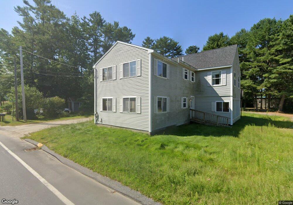
9 Purington Dr Harpswell, ME 04079
Estimated Value: $732,000 - $834,000
3
Beds
2
Baths
2,091
Sq Ft
$375/Sq Ft
Est. Value
About This Home
This home is located at 9 Purington Dr, Harpswell, ME 04079 and is currently estimated at $784,790, approximately $375 per square foot. 9 Purington Dr is a home located in Cumberland County with nearby schools including Mt Ararat High School.
Ownership History
Date
Name
Owned For
Owner Type
Purchase Details
Closed on
Apr 25, 2005
Sold by
Deady Lois M
Bought by
Deady Robert M and Deady Lois M
Current Estimated Value
Home Financials for this Owner
Home Financials are based on the most recent Mortgage that was taken out on this home.
Original Mortgage
$257,000
Interest Rate
5.87%
Mortgage Type
Purchase Money Mortgage
Create a Home Valuation Report for This Property
The Home Valuation Report is an in-depth analysis detailing your home's value as well as a comparison with similar homes in the area
Purchase History
| Date | Buyer | Sale Price | Title Company |
|---|---|---|---|
| Deady Robert M | -- | -- |
Source: Public Records
Mortgage History
| Date | Status | Borrower | Loan Amount |
|---|---|---|---|
| Closed | Deady Robert M | $257,000 |
Source: Public Records
Tax History
| Year | Tax Paid | Tax Assessment Tax Assessment Total Assessment is a certain percentage of the fair market value that is determined by local assessors to be the total taxable value of land and additions on the property. | Land | Improvement |
|---|---|---|---|---|
| 2025 | $4,086 | $613,500 | $347,600 | $265,900 |
| 2024 | $3,902 | $613,500 | $347,600 | $265,900 |
| 2023 | $3,742 | $613,500 | $347,600 | $265,900 |
| 2022 | $3,620 | $613,500 | $347,600 | $265,900 |
| 2021 | $3,376 | $499,400 | $286,400 | $213,000 |
| 2020 | $3,366 | $499,400 | $286,400 | $213,000 |
| 2019 | $3,346 | $499,400 | $286,400 | $213,000 |
| 2018 | $3,236 | $499,400 | $286,400 | $213,000 |
| 2017 | $3,226 | $499,400 | $286,400 | $213,000 |
| 2016 | $2,658 | $499,400 | $286,400 | $213,000 |
| 2015 | $3,116 | $499,400 | $286,400 | $213,000 |
| 2013 | $2,887 | $499,400 | $286,400 | $213,000 |
Source: Public Records
Map
Nearby Homes
- 0 Bayview Rd Unit 2 1632776
- Lot 2B Allen Point Rd
- 1 Mallard Pond Rd
- lot C Long Point Rd
- 45 Little Island Rd Unit 45
- 30 Spritsail Ln
- 42 Ridgeview Ln
- 30 Driftwood Tide Ln
- 31 Goose Ledge Rd
- 18 Ash Point Rd
- 1984 Harpswell Island Rd
- 197 Ash Point Rd
- Map 80 Lot 18-0 White Island
- 83 Central Ave
- 4 Osprey Ridge Rd
- 20 Holbrook St
- 19 Hugh Ave
- 70 Maquoit Dr
- 93 Governors Point Rd
- 0 Gundalo Gap Rd Unit 1638108
- 0 Elden Point Rd Unit 823899
- 0 Smuggler's Cove Unit 777324
- 0 Elden Point Rd Unit 1434743
- Lot 6 Charity Shore Rd
- Lot 00 Bragdon Island
- 229 Harpwell Neck Rd
- 1 Smugglers Cove
- 25 Oceanside Dr
- #4 & #6 Abner Point Rd
- Lot #3 Sea Escape Ln
- TBD Elden Point
- White Island
- 1 Sandy Ln
- 6 Cragmoor Ln
- 0 Elden Point Rd Unit 979270
- 0 Smuggler's Cove Unit 994905
- 8 Abner Point Rd
- 44 Littleroad - Orrs Island
- 10 White Island
Your Personal Tour Guide
Ask me questions while you tour the home.