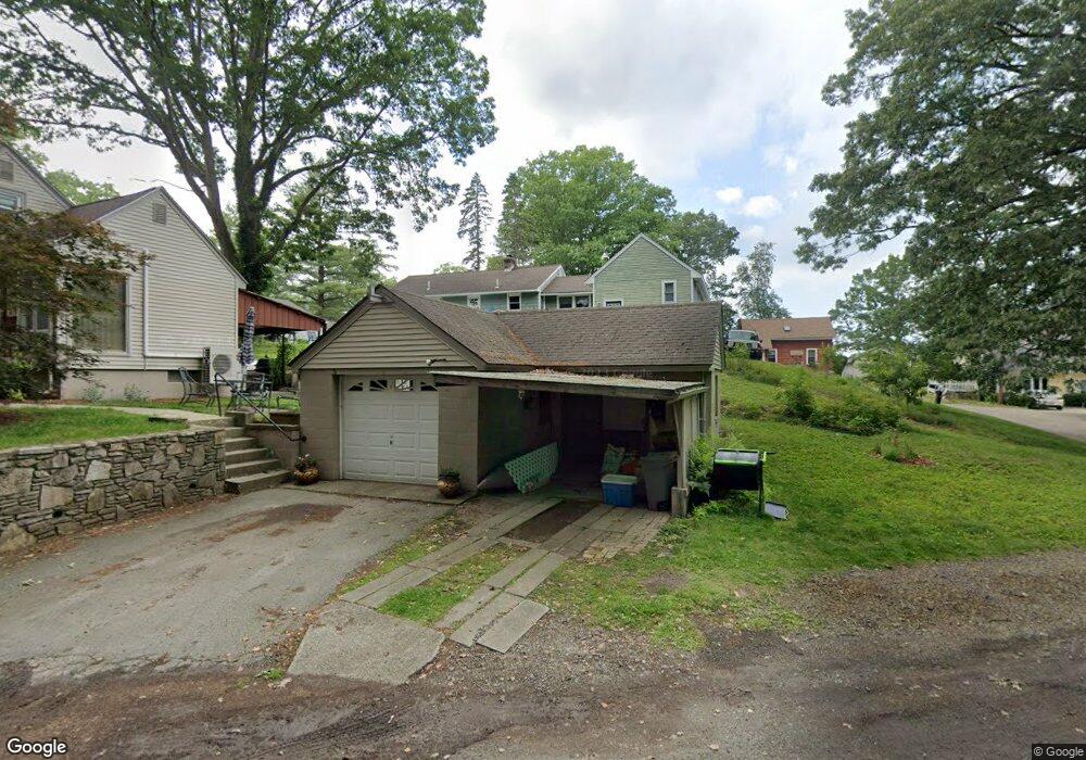
9 Stringer Dam Rd Shrewsbury, MA 01545
Edgemere NeighborhoodEstimated Value: $362,000 - $463,000
3
Beds
2
Baths
616
Sq Ft
$652/Sq Ft
Est. Value
About This Home
This home is located at 9 Stringer Dam Rd, Shrewsbury, MA 01545 and is currently estimated at $401,383, approximately $651 per square foot. 9 Stringer Dam Rd is a home located in Worcester County with nearby schools including Calvin Coolidge Elementary School, Sherwood Middle School, and Oak Middle School.
Ownership History
Date
Name
Owned For
Owner Type
Purchase Details
Closed on
Aug 10, 2023
Sold by
Walsh Michael
Bought by
Walsh Michael and Walsh Jean M
Current Estimated Value
Home Financials for this Owner
Home Financials are based on the most recent Mortgage that was taken out on this home.
Original Mortgage
$138,000
Outstanding Balance
$134,584
Interest Rate
6.81%
Mortgage Type
New Conventional
Estimated Equity
$266,799
Purchase Details
Closed on
Apr 1, 1976
Bought by
Walsh Gloria A
Create a Home Valuation Report for This Property
The Home Valuation Report is an in-depth analysis detailing your home's value as well as a comparison with similar homes in the area
Home Values in the Area
Average Home Value in this Area
Purchase History
| Date | Buyer | Sale Price | Title Company |
|---|---|---|---|
| Walsh Michael | -- | None Available | |
| Walsh Michael | -- | None Available | |
| Walsh Michael | -- | None Available | |
| Walsh Gloria A | -- | -- |
Source: Public Records
Mortgage History
| Date | Status | Borrower | Loan Amount |
|---|---|---|---|
| Open | Walsh Michael | $138,000 | |
| Closed | Walsh Michael | $138,000 |
Source: Public Records
Tax History
| Year | Tax Paid | Tax Assessment Tax Assessment Total Assessment is a certain percentage of the fair market value that is determined by local assessors to be the total taxable value of land and additions on the property. | Land | Improvement |
|---|---|---|---|---|
| 2025 | $39 | $322,900 | $210,400 | $112,500 |
| 2024 | $3,556 | $287,200 | $200,400 | $86,800 |
| 2023 | $3,553 | $270,800 | $200,400 | $70,400 |
| 2022 | $3,197 | $226,600 | $163,800 | $62,800 |
| 2021 | $2,841 | $215,400 | $153,400 | $62,000 |
| 2020 | $2,612 | $209,500 | $153,400 | $56,100 |
| 2019 | $2,606 | $207,300 | $151,200 | $56,100 |
| 2018 | $2,469 | $209,800 | $146,000 | $63,800 |
| 2017 | $2,427 | $189,200 | $129,200 | $60,000 |
| 2016 | $2,345 | $180,400 | $117,000 | $63,400 |
| 2015 | $2,257 | $171,000 | $109,600 | $61,400 |
Source: Public Records
Map
Nearby Homes
- 81 Bay View Dr
- 11 Point Rd Unit 2
- 23 Bay View Dr
- 33 Lakeside Dr
- 16-18 Fairfax St
- 15 Lakeside Dr
- 469 Lake Ave
- 2 Salisbury St
- 10 George St
- 190 S Quinsigamond Ave Unit 102
- 95 Grove St
- 13 Pocasset St
- 7 Atlas St
- 76 Grove St
- 12 Bruce St
- 143 Commonwealth Ave
- 2A Nonquit St Unit A
- 53 Pointe Rok Dr Unit 53
- 47 Pointe Rok Dr Unit 47,G
- 1195 Grafton St Unit 19
Your Personal Tour Guide
Ask me questions while you tour the home.