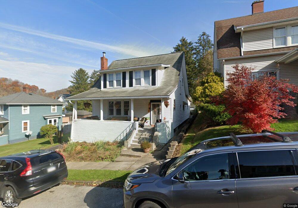
9 Webster Ave Wheeling, WV 26003
Elm Grove NeighborhoodEstimated Value: $176,000 - $193,000
4
Beds
3
Baths
1,979
Sq Ft
$92/Sq Ft
Est. Value
About This Home
This home is located at 9 Webster Ave, Wheeling, WV 26003 and is currently estimated at $182,519, approximately $92 per square foot. 9 Webster Ave is a home located in Ohio County with nearby schools including Wheeling Park High School, Sikora Montessori School, and St. Vincent de Paul School.
Ownership History
Date
Name
Owned For
Owner Type
Purchase Details
Closed on
Aug 7, 2022
Sold by
Prather John R
Bought by
Miller Dennis H and Miller Melonie A
Current Estimated Value
Home Financials for this Owner
Home Financials are based on the most recent Mortgage that was taken out on this home.
Original Mortgage
$101,134
Interest Rate
5.13%
Mortgage Type
FHA
Purchase Details
Closed on
Mar 11, 2010
Sold by
Jorden Lisa J
Bought by
Bisceglia Shelia C and Bisceglia Michael E
Create a Home Valuation Report for This Property
The Home Valuation Report is an in-depth analysis detailing your home's value as well as a comparison with similar homes in the area
Home Values in the Area
Average Home Value in this Area
Purchase History
| Date | Buyer | Sale Price | Title Company |
|---|---|---|---|
| Miller Dennis H | $103,000 | -- | |
| Bisceglia Shelia C | -- | -- |
Source: Public Records
Mortgage History
| Date | Status | Borrower | Loan Amount |
|---|---|---|---|
| Previous Owner | Miller Dennis H | $101,134 |
Source: Public Records
Tax History
| Year | Tax Paid | Tax Assessment Tax Assessment Total Assessment is a certain percentage of the fair market value that is determined by local assessors to be the total taxable value of land and additions on the property. | Land | Improvement |
|---|---|---|---|---|
| 2025 | $1,289 | $86,460 | $7,800 | $78,660 |
| 2024 | $1,289 | $82,920 | $7,800 | $75,120 |
| 2023 | $2,465 | $82,920 | $7,800 | $75,120 |
| 2022 | $2,482 | $82,920 | $7,800 | $75,120 |
| 2021 | $2,455 | $82,020 | $7,800 | $74,220 |
| 2020 | $2,438 | $81,600 | $7,800 | $73,800 |
| 2019 | $2,431 | $80,460 | $7,740 | $72,720 |
| 2018 | $2,231 | $78,660 | $7,740 | $70,920 |
| 2017 | $2,195 | $75,900 | $7,500 | $68,400 |
| 2016 | $2,073 | $71,880 | $7,320 | $64,560 |
| 2015 | $1,006 | $70,980 | $7,140 | $63,840 |
| 2014 | $1,006 | $69,660 | $6,900 | $62,760 |
Source: Public Records
Map
Nearby Homes
- 0 Route 40 National Rd Unit 139992
- 2400 Overbrook Ave
- 219 Springdale Ave
- 1 1/2 E Paxton Ave
- 15 Lewis St
- 1963 Decatur Ave
- 143 Springdale Ave
- 231 Kruger St
- 4 Russell St
- 6 Vernon Ave
- 103 Idabelle Ave
- 182 Idabelle Ave
- 142 Courtland Ave
- 101 Park Place
- 145 & 146 Idabelle Ave
- 9 Timberview Dr
- 0 Castlyn Dr
- 351 View Point Ln
- 111 Fernwood Ave
- 18 Barrows Rd
Your Personal Tour Guide
Ask me questions while you tour the home.