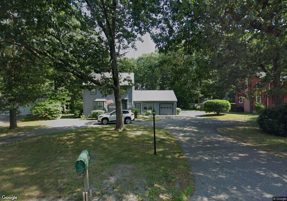
90 High Plain St Walpole, MA 02081
Estimated Value: $717,000 - $804,714
4
Beds
3
Baths
2,199
Sq Ft
$344/Sq Ft
Est. Value
About This Home
This home is located at 90 High Plain St, Walpole, MA 02081 and is currently estimated at $755,679, approximately $343 per square foot. 90 High Plain St is a home located in Norfolk County with nearby schools including Old Post Road School, Walpole Middle School, and Walpole High School.
Ownership History
Date
Name
Owned For
Owner Type
Purchase Details
Closed on
Aug 31, 1998
Sold by
Kane Martin J and Kane Maureen
Bought by
Kane Paul F and Kane Carissa A
Current Estimated Value
Home Financials for this Owner
Home Financials are based on the most recent Mortgage that was taken out on this home.
Original Mortgage
$140,000
Interest Rate
6.9%
Mortgage Type
Purchase Money Mortgage
Purchase Details
Closed on
Jul 26, 1990
Sold by
Fisher William E
Bought by
Kane Martin J
Create a Home Valuation Report for This Property
The Home Valuation Report is an in-depth analysis detailing your home's value as well as a comparison with similar homes in the area
Home Values in the Area
Average Home Value in this Area
Purchase History
We collect this data history from publicly available records. To have your information removed, we recommend requesting removal directly through your county’s website.
| Date | Buyer | Sale Price | Title Company |
|---|---|---|---|
| Kane Paul F | $175,000 | -- | |
| Kane Martin J | $167,500 | -- |
Source: Public Records
Mortgage History
We collect this data history from publicly available records. To have your information removed, we recommend requesting removal directly through your county’s website.
| Date | Status | Borrower | Loan Amount |
|---|---|---|---|
| Open | Kane Martin J | $317,463 | |
| Closed | Kane Martin J | $140,000 |
Source: Public Records
Tax History
| Year | Tax Paid | Tax Assessment Tax Assessment Total Assessment is a certain percentage of the fair market value that is determined by local assessors to be the total taxable value of land and additions on the property. | Land | Improvement |
|---|---|---|---|---|
| 2025 | $8,406 | $655,200 | $288,600 | $366,600 |
| 2024 | $8,137 | $615,500 | $277,600 | $337,900 |
| 2023 | $7,780 | $560,100 | $241,300 | $318,800 |
| 2022 | $7,288 | $504,000 | $223,300 | $280,700 |
| 2021 | $6,910 | $465,600 | $210,700 | $254,900 |
| 2020 | $6,561 | $437,700 | $188,300 | $249,400 |
| 2019 | $6,297 | $417,000 | $181,000 | $236,000 |
| 2018 | $6,006 | $393,300 | $164,400 | $228,900 |
| 2017 | $5,810 | $379,000 | $158,200 | $220,800 |
| 2016 | $5,592 | $359,400 | $162,700 | $196,700 |
| 2015 | $5,167 | $329,100 | $138,000 | $191,100 |
| 2014 | $4,897 | $310,700 | $138,000 | $172,700 |
Source: Public Records
Map
Nearby Homes
- 53 Highland St
- 2 Rainbow Pond Dr Unit 7
- 19 Rainbow Pond Dr Unit B2
- 7 Lilac Ct
- 10 Country Club Dr
- 1108 Pennington Dr Unit 1108
- 2301 Pennington Dr Unit 2301
- 65-67 Diamond St
- 404 Centre Ln
- 29 Pilgrim Way
- 40 Neal St
- 1 Providence Hwy
- 29 Clapp St
- 881 Main St Unit 5
- 24 Riverside Place
- 7 Haynes St
- Unit 4 Powder House Ln Unit 4
- 635 Old Post Rd Unit 303
- 510 Common St
- 16 York Cir
- 100 High Plain St
- 82 High Plain St
- 106 High Plain St
- 76 High Plain St
- 66 High Plain St
- 116 High Plain St
- 120 High Plain St
- 58 High Plain St
- 67 High Plain St
- 52 High Plain St
- 55 High Plain St
- 653 Washington St
- 645 Washington St
- 44 High Plain St
- 45 High Plain St
- 731 Washington St
- 640 Washington St
- 34 High Plain St
- 640 Washington St
- 733 Washington St
Your Personal Tour Guide
Ask me questions while you tour the home.