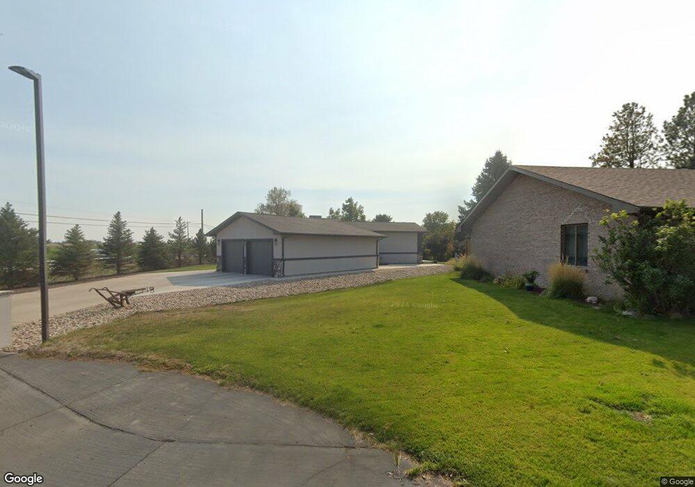
902 Mockingbird Dr Scottsbluff, NE 69361
Estimated Value: $306,000 - $577,000
4
Beds
3
Baths
1,450
Sq Ft
$286/Sq Ft
Est. Value
About This Home
This home is located at 902 Mockingbird Dr, Scottsbluff, NE 69361 and is currently estimated at $414,365, approximately $285 per square foot. 902 Mockingbird Dr is a home located in Scotts Bluff County with nearby schools including Westmoor Elementary School, Bluffs Middle School, and Scottsbluff Senior High School.
Ownership History
Date
Name
Owned For
Owner Type
Purchase Details
Closed on
Mar 27, 2020
Sold by
Mrg Enterprises Llc
Bought by
Kroy Construction Llc
Current Estimated Value
Home Financials for this Owner
Home Financials are based on the most recent Mortgage that was taken out on this home.
Original Mortgage
$31,000
Interest Rate
3.4%
Mortgage Type
Commercial
Purchase Details
Closed on
Jun 12, 2009
Sold by
Marlin James F and Marlin Carolyn Y
Bought by
York Casey A and York Kama R
Home Financials for this Owner
Home Financials are based on the most recent Mortgage that was taken out on this home.
Original Mortgage
$124,000
Interest Rate
4.83%
Mortgage Type
New Conventional
Create a Home Valuation Report for This Property
The Home Valuation Report is an in-depth analysis detailing your home's value as well as a comparison with similar homes in the area
Home Values in the Area
Average Home Value in this Area
Purchase History
| Date | Buyer | Sale Price | Title Company |
|---|---|---|---|
| Kroy Construction Llc | $31,000 | Title Express Services Llc | |
| York Casey A | $155,000 | -- |
Source: Public Records
Mortgage History
| Date | Status | Borrower | Loan Amount |
|---|---|---|---|
| Closed | Kroy Construction Llc | $31,000 | |
| Previous Owner | York Casey A | $124,000 |
Source: Public Records
Tax History
| Year | Tax Paid | Tax Assessment Tax Assessment Total Assessment is a certain percentage of the fair market value that is determined by local assessors to be the total taxable value of land and additions on the property. | Land | Improvement |
|---|---|---|---|---|
| 2025 | $4,170 | $304,835 | $46,520 | $258,315 |
| 2024 | $4,186 | $304,835 | $46,520 | $258,315 |
| 2023 | $4,186 | $193,119 | $43,978 | $149,141 |
| 2022 | $4,186 | $193,119 | $43,978 | $149,141 |
| 2021 | $3,985 | $181,645 | $43,978 | $137,667 |
| 2020 | $3,772 | $170,278 | $43,978 | $126,300 |
| 2019 | $3,836 | $174,241 | $47,941 | $126,300 |
| 2018 | $3,839 | $174,241 | $47,941 | $126,300 |
| 2017 | $3,835 | $174,241 | $47,941 | $126,300 |
| 2016 | $3,834 | $174,241 | $47,941 | $126,300 |
| 2015 | $3,824 | $174,241 | $47,941 | $126,300 |
| 2014 | $3,573 | $174,241 | $47,941 | $126,300 |
| 2012 | -- | $170,562 | $47,941 | $122,621 |
Source: Public Records
Map
Nearby Homes
- 910 Mockingbird Dr
- 3918 Avenue D
- 2307 W 42nd St Unit 46
- 501 W 38th St
- 4501 Cottonwood Ave
- 16 Bluestem
- TBD W 36th St
- 0 W 36th St Unit 20254154
- 1012 W 36th St
- 2817 W 42nd St
- 3405 Ross Ave
- 721 W 33rd St
- 410 Sandra Ct
- 60260 Highway 71
- 908 E 42nd St
- 3918 Hilltop Estate Place
- TBD U S Highway 26
- Lot 1 31st St
- 1010 W 29th St
- Lot 2 31st St
- 901 Peacock Dr
- 918 Mockingbird Dr
- 1002 Mockingbird Dr
- 5414 Cardinal Dr
- 5410 Cardinal Dr
- 5406 Cardinal Dr
- 5402 Cardinal Dr
- 1018 Mockingbird Dr
- 901 Flamingo Ct
- 905 Flamingo Ct
- 1102 Peacock Dr
- 5314 Cardinal Dr
- 917 Flamingo Ct
- 5310 Cardinal Dr
- 1110 Mockingbird Dr
- 1110 Peacock Dr
- 901 Meadowlark Dr
- 911 Meadowlark Dr
- TBD Peacock Dr
- 1202 Peacock Dr
Your Personal Tour Guide
Ask me questions while you tour the home.