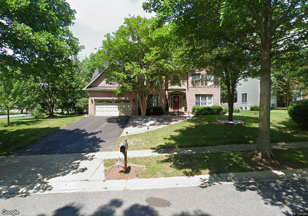
902 Plattner Ct Annapolis, MD 21401
Parole NeighborhoodEstimated Value: $741,000 - $1,104,000
4
Beds
4
Baths
3,858
Sq Ft
$233/Sq Ft
Est. Value
About This Home
This home is located at 902 Plattner Ct, Annapolis, MD 21401 and is currently estimated at $897,805, approximately $232 per square foot. 902 Plattner Ct is a home located in Anne Arundel County with nearby schools including Rolling Knolls Elementary School, Wiley H. Bates Middle School, and Annapolis High School.
Ownership History
Date
Name
Owned For
Owner Type
Purchase Details
Closed on
Dec 1, 2009
Sold by
Pasewark Richard A
Bought by
Pomerleau Mario and Pomerleau Olga
Current Estimated Value
Home Financials for this Owner
Home Financials are based on the most recent Mortgage that was taken out on this home.
Original Mortgage
$460,000
Outstanding Balance
$301,728
Interest Rate
5.01%
Mortgage Type
New Conventional
Estimated Equity
$596,077
Purchase Details
Closed on
Jun 27, 2002
Sold by
Thorncroft L C
Bought by
Pasewark Richard A and Pasewark Marsha C
Create a Home Valuation Report for This Property
The Home Valuation Report is an in-depth analysis detailing your home's value as well as a comparison with similar homes in the area
Home Values in the Area
Average Home Value in this Area
Purchase History
We collect this data history from publicly available records. To have your information removed, we recommend requesting removal directly through your county’s website.
| Date | Buyer | Sale Price | Title Company |
|---|---|---|---|
| Pomerleau Mario | $684,000 | -- | |
| Pasewark Richard A | $510,010 | -- |
Source: Public Records
Mortgage History
We collect this data history from publicly available records. To have your information removed, we recommend requesting removal directly through your county’s website.
| Date | Status | Borrower | Loan Amount |
|---|---|---|---|
| Open | Pomerleau Mario | $460,000 | |
| Closed | Pasewark Richard A | -- |
Source: Public Records
Tax History
| Year | Tax Paid | Tax Assessment Tax Assessment Total Assessment is a certain percentage of the fair market value that is determined by local assessors to be the total taxable value of land and additions on the property. | Land | Improvement |
|---|---|---|---|---|
| 2025 | $7,814 | $706,433 | -- | -- |
| 2024 | $7,814 | $679,867 | $0 | $0 |
| 2023 | $7,608 | $653,300 | $213,500 | $439,800 |
| 2022 | $7,239 | $651,533 | $0 | $0 |
| 2020 | $7,165 | $648,000 | $233,500 | $414,500 |
| 2019 | $7,172 | $648,000 | $233,500 | $414,500 |
| 2018 | $6,571 | $648,000 | $233,500 | $414,500 |
| 2017 | $7,683 | $716,400 | $0 | $0 |
| 2016 | -- | $708,233 | $0 | $0 |
| 2015 | -- | $700,067 | $0 | $0 |
| 2014 | -- | $691,900 | $0 | $0 |
Source: Public Records
Map
Nearby Homes
- 809 Midship Ct
- 907 Beacon Way
- 905 Yardarm Ln
- 848 Deerwood Ct
- 860 Woodmont Rd
- 2550 Golfers Ridge Rd
- 847 Mission Valley Ln
- 100 1st St
- 838 Boatswain Way
- 92 Clifford Blvd
- 869 Clubhouse Village View
- 860 Boatswain Way
- 2650 Compass Dr
- 903 Scupper Ct
- 2627 Compass Dr
- 2607 Compass Dr
- 906 Perry Landing Ct
- 720 Fantail Ct
- 2579 Hidden Cove Rd Unit 159
- 921 Boom Way
- 805 Eastern Point Rd
- 803 Eastern Point Rd
- 527 Coover Rd
- 530 Coover Rd
- 801 Eastern Point Rd
- 526 Coover Rd
- 2510 Eastern Point Ct
- 525 Coover Rd
- 799 Eastern Point Rd
- 532 Coover Rd
- 2508 Eastern Point Ct
- 528 Coover Rd
- 904 Plattner Ct
- 904 Plattner Ct Unit 904
- 523 Coover Rd
- 797 Eastern Point Rd
- 520 Coover Rd
- 522 Coover Rd
- 2506 Eastern Point Ct
- 798 Eastern Point Rd
Your Personal Tour Guide
Ask me questions while you tour the home.