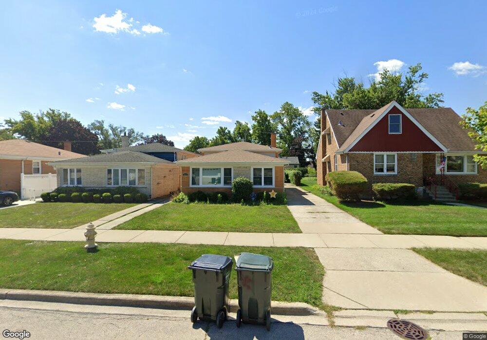
9023 29th St Brookfield, IL 60513
Estimated Value: $328,000 - $370,000
About This Home
This home is located at 9023 29th St, Brookfield, IL 60513 and is currently estimated at $350,226, approximately $333 per square foot. 9023 29th St is a home located in Cook County with nearby schools including S. E. Gross Middle School, Brook Park Elementary School, and Riverside Brookfield High School.
Ownership History
We collect this data history from publicly available records. To have your information removed, we recommend requesting removal directly through your county’s website.
Purchase Details
Home Financials for this Owner
Home Financials are based on the most recent Mortgage that was taken out on this home.Purchase Details
Purchase Details
Home Values in the Area
Average Home Value in this Area
Purchase History
We collect this data history from publicly available records. To have your information removed, we recommend requesting removal directly through your county’s website.
| Date | Buyer | Sale Price | Title Company |
|---|---|---|---|
| $287,000 | Attorneys Ttl Guaranty Fund | ||
| $265,000 | Cti | ||
| $172,500 | None Available |
Mortgage History
We collect this data history from publicly available records. To have your information removed, we recommend requesting removal directly through your county’s website.
| Date | Status | Borrower | Loan Amount |
|---|---|---|---|
| Open | $272,650 |
Tax History
We collect this data history from publicly available records. To have your information removed, we recommend requesting removal directly through your county’s website.
| Year | Tax Paid | Tax Assessment Tax Assessment Total Assessment is a certain percentage of the fair market value that is determined by local assessors to be the total taxable value of land and additions on the property. | Land | Improvement |
|---|---|---|---|---|
| 2025 | $4,850 | $13,585 | $2,337 | $11,248 |
| 2024 | $4,850 | $13,585 | $2,337 | $11,248 |
| 2023 | $5,080 | $13,585 | $2,337 | $11,248 |
| 2022 | $5,080 | $12,194 | $2,003 | $10,191 |
| 2021 | $5,141 | $12,719 | $2,002 | $10,717 |
| 2020 | $5,008 | $12,719 | $2,002 | $10,717 |
| 2019 | $3,824 | $9,697 | $1,835 | $7,862 |
| 2018 | $3,672 | $9,697 | $1,835 | $7,862 |
| 2017 | $3,385 | $9,697 | $1,835 | $7,862 |
| 2016 | $3,263 | $8,767 | $1,669 | $7,098 |
| 2015 | $3,137 | $8,767 | $1,669 | $7,098 |
| 2014 | $3,091 | $8,767 | $1,669 | $7,098 |
| 2013 | $3,533 | $10,728 | $1,669 | $9,059 |
Map
- 9101 27th St
- 3108 Oak Ave
- 2711 Maple Ave
- 9120 26th Place
- 3147 Sunnyside Ave
- 1106 Alima Terrace
- 3229 Maple Ave
- 3233 Madison Ave
- 3335 Sunnyside Ave
- 2536 S 5th Ave
- 9333 Jackson Ave
- 2322 S 17th Ave Unit 5
- 2263 S 14th Ave
- 1434 Blanchan Ave
- 3321 Harrison Ave
- 2263 S 17th Ave
- 2233 S 14th Ave
- 3501 Vernon Ave
- 1511 Kemman Ave
- 9328 Jefferson Ave
- 9010 Bartlett Ave
- 9014 Bartlett Ave
- 2914 Sunnyside Ave
- 2918 Sunnyside Ave
- 9018 Bartlett Ave
- 2910 Sunnyside Ave
- 9011 29th St
- 9015 29th St
- 2904 Sunnyside Ave
- 9019 29th St
- 9022 Bartlett Ave
- 2926 Sunnyside Ave
- 2926 Sunnyside Ave
- 9023 29th St
- 2900 Sunnyside Ave
- 9011 Bartlett Ave
- 9017 Bartlett Ave
- 9025 29th St
- 9021 Bartlett Ave
- 9030 Bartlett Ave
Ask me questions while you tour the home.