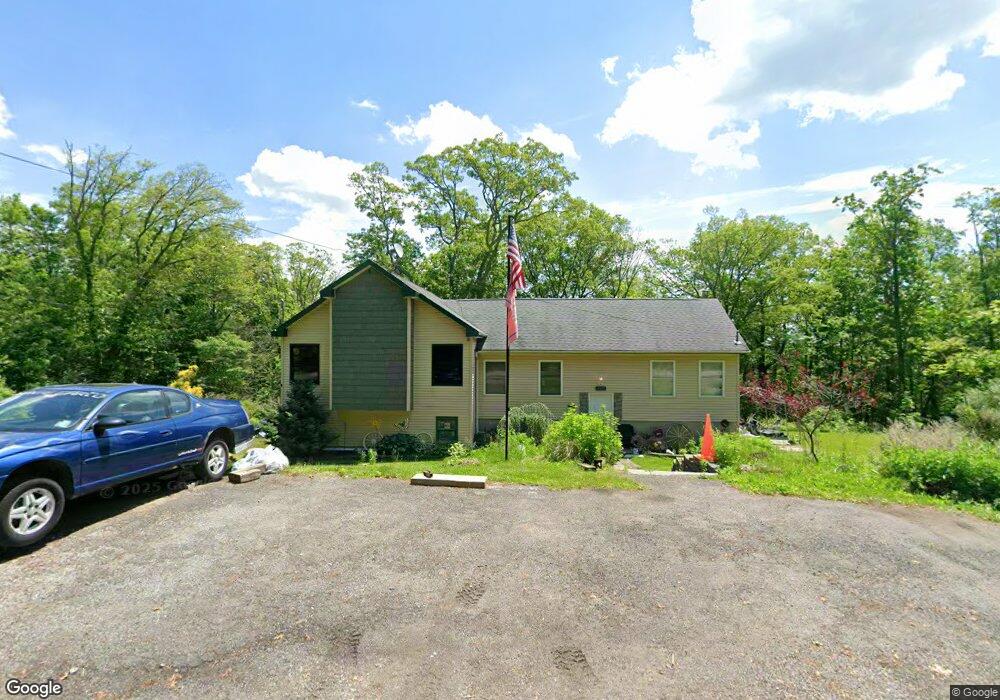
904 Spruce Trail Newton, NJ 07860
Estimated Value: $332,012 - $408,000
Studio
--
Bath
1,634
Sq Ft
$233/Sq Ft
Est. Value
About This Home
This home is located at 904 Spruce Trail, Newton, NJ 07860 and is currently estimated at $380,003, approximately $232 per square foot. 904 Spruce Trail is a home located in Sussex County with nearby schools including Stillwater Township School and Kittatinny Regional High School.
Ownership History
Date
Name
Owned For
Owner Type
Purchase Details
Closed on
Mar 31, 1999
Sold by
Maio Perry
Bought by
Norman Daniel K and Norman Maria E
Current Estimated Value
Home Financials for this Owner
Home Financials are based on the most recent Mortgage that was taken out on this home.
Original Mortgage
$107,771
Outstanding Balance
$24,776
Interest Rate
6.92%
Mortgage Type
FHA
Estimated Equity
$355,227
Purchase Details
Closed on
Mar 25, 1997
Sold by
Pannozzo Matilda and Reybold Carolyn P
Bought by
Maio Perry
Create a Home Valuation Report for This Property
The Home Valuation Report is an in-depth analysis detailing your home's value as well as a comparison with similar homes in the area
Home Values in the Area
Average Home Value in this Area
Purchase History
| Date | Buyer | Sale Price | Title Company |
|---|---|---|---|
| Norman Daniel K | $107,850 | -- | |
| Maio Perry | $30,000 | -- |
Source: Public Records
Mortgage History
| Date | Status | Borrower | Loan Amount |
|---|---|---|---|
| Open | Norman Daniel K | $107,771 |
Source: Public Records
Tax History
| Year | Tax Paid | Tax Assessment Tax Assessment Total Assessment is a certain percentage of the fair market value that is determined by local assessors to be the total taxable value of land and additions on the property. | Land | Improvement |
|---|---|---|---|---|
| 2025 | $7,394 | $203,800 | $52,300 | $151,500 |
| 2024 | $7,157 | $203,800 | $52,300 | $151,500 |
| 2023 | $7,157 | $203,800 | $52,300 | $151,500 |
| 2022 | $6,937 | $203,800 | $52,300 | $151,500 |
| 2021 | $6,785 | $203,800 | $52,300 | $151,500 |
| 2020 | $6,540 | $203,800 | $52,300 | $151,500 |
| 2019 | $6,277 | $203,800 | $52,300 | $151,500 |
| 2018 | $6,293 | $203,800 | $52,300 | $151,500 |
| 2017 | $6,193 | $203,800 | $52,300 | $151,500 |
| 2016 | $6,020 | $203,800 | $52,300 | $151,500 |
| 2015 | $5,984 | $203,800 | $52,300 | $151,500 |
| 2014 | $5,943 | $203,800 | $52,300 | $151,500 |
Source: Public Records
Map
Nearby Homes
- 000 Pepperidge Dr
- 903 Aspen Ct
- 901 Chestnut Path
- 68 W Shore Dr
- 40 E Shore Dr
- 121 W Shore Dr
- 27 Plaza Dr
- 24 Plaza Dr
- 15 Copeley Rd
- 31 Kent Rd
- 17 17 West Owassa Tnpk
- 0 Mount Benevolence Rd
- 90 Kemah Mecca Lake Rd
- 00 Plymouth Lake Dr
- 239 E Shore Lake Owassa Rd
- 951 Owassa Rd
- 40 Martin Ln
- 4 Grove St
- 1071 County Road 521
- 15 Ike Williams Rd
- 908 Spruce Trail
- 1072 Mount Benevolence Rd
- 0 Spruce Trail
- 1070 Mount Benevolence Rd
- 910 Spruce Trail
- 1067 Mount Benevolence Rd
- 931 Tulip Trail
- 929 Tulip Trail
- 912 Spruce Trail
- 1074 Mount Benevolence Rd
- 1065 Mount Benevolence Rd
- 1068 Owassa Rd
- 1060 Mount Benevolence Rd
- 912 Poplar Terrace
- 1063 Mount Benevolence Rd
- 1076 Mount Benevolence Rd
- 0 Poplar Terrace
- 909 Maple Path
- 925 Tulip Trail
- 923 Tulip Trail
Your Personal Tour Guide
Ask me questions while you tour the home.