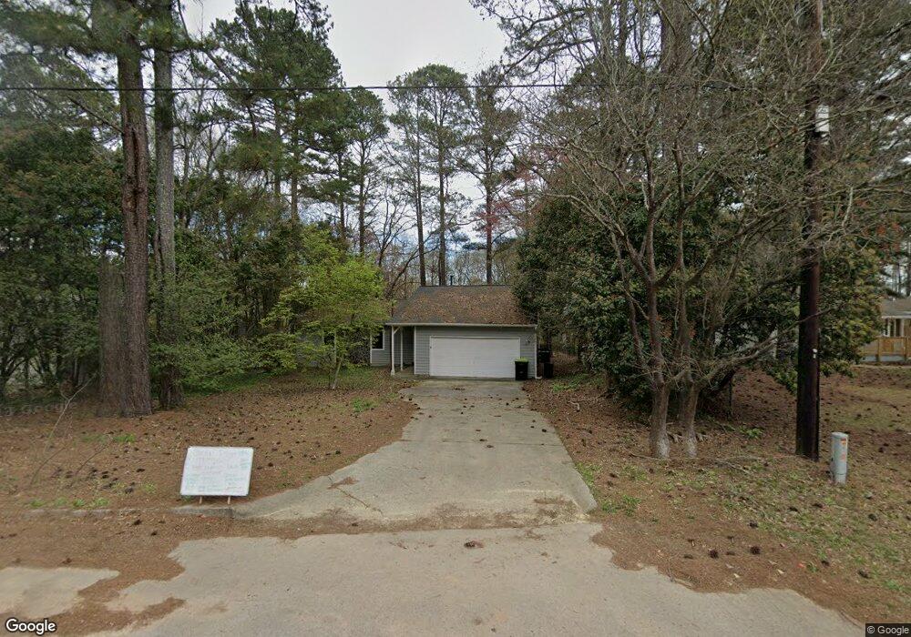
9062 Thomas Rd Jonesboro, GA 30238
Estimated Value: $159,000 - $223,000
3
Beds
2
Baths
1,520
Sq Ft
$131/Sq Ft
Est. Value
About This Home
This home is located at 9062 Thomas Rd, Jonesboro, GA 30238 and is currently estimated at $199,458, approximately $131 per square foot. 9062 Thomas Rd is a home located in Clayton County with nearby schools including Kemp Primary School, Kemp Elementary School, and Pointe South Middle School.
Ownership History
Date
Name
Owned For
Owner Type
Purchase Details
Closed on
May 2, 2017
Sold by
Norton Franklin L
Bought by
Eph 2 Assets Llc
Current Estimated Value
Purchase Details
Closed on
May 12, 2004
Sold by
Caliber Prop Llc
Bought by
Norton Franklin L
Home Financials for this Owner
Home Financials are based on the most recent Mortgage that was taken out on this home.
Original Mortgage
$85,500
Interest Rate
5.88%
Mortgage Type
New Conventional
Purchase Details
Closed on
Dec 29, 2003
Sold by
Southtrust Bank
Bought by
Caliber Prop Llc
Create a Home Valuation Report for This Property
The Home Valuation Report is an in-depth analysis detailing your home's value as well as a comparison with similar homes in the area
Home Values in the Area
Average Home Value in this Area
Purchase History
| Date | Buyer | Sale Price | Title Company |
|---|---|---|---|
| Eph 2 Assets Llc | $65,001 | -- | |
| Norton Franklin L | $95,000 | -- | |
| Caliber Prop Llc | $78,100 | -- |
Source: Public Records
Mortgage History
| Date | Status | Borrower | Loan Amount |
|---|---|---|---|
| Previous Owner | Norton Franklin L | $85,500 |
Source: Public Records
Tax History
| Year | Tax Paid | Tax Assessment Tax Assessment Total Assessment is a certain percentage of the fair market value that is determined by local assessors to be the total taxable value of land and additions on the property. | Land | Improvement |
|---|---|---|---|---|
| 2025 | $2,911 | $76,000 | $6,840 | $69,160 |
| 2024 | $2,965 | $79,000 | $7,200 | $71,800 |
| 2023 | $1,849 | $51,200 | $7,200 | $44,000 |
| 2022 | $2,009 | $51,200 | $7,200 | $44,000 |
| 2021 | $1,660 | $52,280 | $7,200 | $45,080 |
| 2020 | $1,681 | $42,019 | $7,200 | $34,819 |
| 2019 | $1,578 | $38,868 | $5,600 | $33,268 |
| 2018 | $1,056 | $26,000 | $5,600 | $20,400 |
| 2017 | $1,005 | $24,700 | $4,000 | $20,700 |
| 2016 | $1,031 | $25,347 | $4,000 | $21,347 |
| 2015 | $964 | $0 | $0 | $0 |
| 2014 | $1,083 | $27,233 | $4,000 | $23,233 |
Source: Public Records
Map
Nearby Homes
- 528 Raintree Dr
- 435 Windy Ln
- 8997 Liberty Ln
- 8908 Thomas Rd
- 9138 Sunset Dr Unit 3
- 337 Independence Dr
- 8896 Wellston Ct
- 535 Oak Trace Ct
- 640 Bramble Ct
- 8949 Raven Dr Unit I
- 513 Luke Ct
- 399 Sir Winston Ct
- 9043 Raven Dr
- 8846 Wesley Place
- 9224 Sunset Dr
- 616 Country Lane Dr
- 593 Country Lane Dr
- 9240 Sunset Dr Unit 5
- 657 Overlook Ct
- 9181 Welch Ct
- 9062 Thomas Rd
- 9060 Thomas Rd
- 9054 Thomas Rd
- 9046 Thomas Rd
- 9047 Hamilton Ct
- 9053 Hamilton Ct Unit 1
- 9053 Thomas Rd
- 9041 Hamilton Ct
- 9069 Thomas Rd
- 9080 Thomas Rd
- 9054 Hamilton Ct Unit 1
- 9034 Thomas Rd
- 9033 Hamilton Ct
- 9065 Greenwood Dr
- 512 Raintree Dr
- 9079 Thomas Rd
- 9087 Thomas Rd
- 9074 Greenwood Dr
- 9021 Hamilton Ct
- 9048 Hamilton Ct Unit 1
Your Personal Tour Guide
Ask me questions while you tour the home.