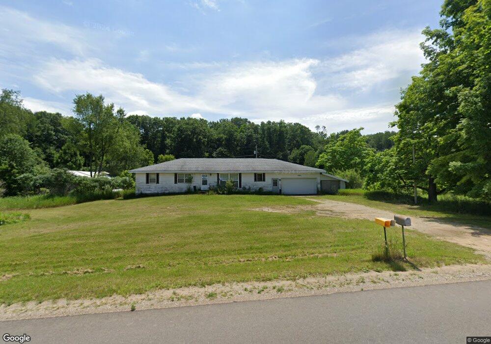
9081 E Baker Rd Hesperia, MI 49421
Estimated Value: $242,000 - $279,000
Studio
--
Bath
--
Sq Ft
1,274,130
Sq Ft Lot
About This Home
This home is located at 9081 E Baker Rd, Hesperia, MI 49421 and is currently estimated at $261,038. 9081 E Baker Rd is a home located in Oceana County with nearby schools including Patricia St. Clair Elementary School, Hesperia Middle School, and Hesperia High School.
Ownership History
Date
Name
Owned For
Owner Type
Purchase Details
Closed on
Dec 29, 2025
Sold by
Casa Verde Llc
Bought by
Heat Wave Land Llc
Current Estimated Value
Purchase Details
Closed on
Oct 10, 2025
Sold by
Casa Verde Llc
Bought by
Casa Verde Llc
Purchase Details
Closed on
Nov 5, 2024
Sold by
Stapel Doris J and Peplinski Floyd J
Bought by
Casa Verde Llc
Home Financials for this Owner
Home Financials are based on the most recent Mortgage that was taken out on this home.
Original Mortgage
$247,400
Interest Rate
6.08%
Mortgage Type
New Conventional
Purchase Details
Closed on
Mar 19, 2019
Sold by
Stapel Doris J and Smead Marlene
Bought by
Stapel Doris J
Purchase Details
Closed on
Dec 13, 2012
Sold by
Kalfsbeek Margaret and Kalfsbeek Joseph
Bought by
Stapel Doris J and Smead Marlene
Create a Home Valuation Report for This Property
The Home Valuation Report is an in-depth analysis detailing your home's value as well as a comparison with similar homes in the area
Purchase History
| Date | Buyer | Sale Price | Title Company |
|---|---|---|---|
| Heat Wave Land Llc | $115,000 | Irongate Title | |
| Casa Verde Llc | -- | None Listed On Document | |
| Derochey Neil G | $243,000 | Irongate Title | |
| Casa Verde Llc | $205,000 | Irongate Title | |
| Stapel Doris J | -- | None Available | |
| Stapel Doris J | -- | None Available |
Source: Public Records
Mortgage History
| Date | Status | Borrower | Loan Amount |
|---|---|---|---|
| Previous Owner | Casa Verde Llc | $247,400 |
Source: Public Records
Tax History
| Year | Tax Paid | Tax Assessment Tax Assessment Total Assessment is a certain percentage of the fair market value that is determined by local assessors to be the total taxable value of land and additions on the property. | Land | Improvement |
|---|---|---|---|---|
| 2025 | $1,756 | $121,600 | $121,600 | $0 |
| 2024 | $619 | $102,600 | $102,600 | $0 |
| 2023 | $1,565 | $95,900 | $95,900 | $0 |
| 2022 | $1,565 | $79,500 | $0 | $0 |
| 2021 | $1,526 | $71,200 | $71,200 | $0 |
| 2020 | $2,387 | $66,000 | $66,000 | $0 |
| 2019 | $2,371 | $65,300 | $0 | $0 |
| 2018 | $2,246 | $64,000 | $0 | $0 |
| 2017 | $2,265 | $64,900 | $0 | $0 |
| 2016 | -- | $50,500 | $0 | $0 |
| 2013 | -- | $51,200 | $0 | $0 |
Source: Public Records
Map
Nearby Homes
- 3521 S 204th Ave
- VL S 204th Ave
- 0 E Lake E Unit 26012437
- VL State St
- 3593 S Maple Island Rd
- 1945 S 200th Ave
- 1837 S 200th Ave
- 3733 S Brenlor Dr
- 3944 S Brenlor Dr
- 8356 E Loop Rd
- 8,9,10,&11 S Riverview Dr
- Lots 10&11 S Riverview Dr
- Lots 8 & 9 S Riverview Dr
- 8933 E M 20
- 7 S Elm St
- 152 N Greenback St
- 46 Hoskins St
- 22 N Greenback St
- 165 S Elm St
- 167 S Division St
- 8921 E Baker Rd
- 8965 E Baker Rd
- 8963 E Baker Rd
- V L E Baker Rd
- 9151 E Baker Rd
- 2861 S 204th Ave
- V L E Baker Rd
- 2791 S 204th Ave
- 9006 E Baker Rd
- 2925 S 204th Ave
- 9280 E Baker Rd
- 2850 S 204th Ave
- 2997 S 204th Ave
- 3041 S 204th Ave
- 8841 E Baker Rd
- 2620 S 204th Ave
- V/L E Baker Rd
- Lot 1 E Baker Rd
- 8960 E Baker Rd
- 0 E Baker Rd
Your Personal Tour Guide
Ask me questions while you tour the home.