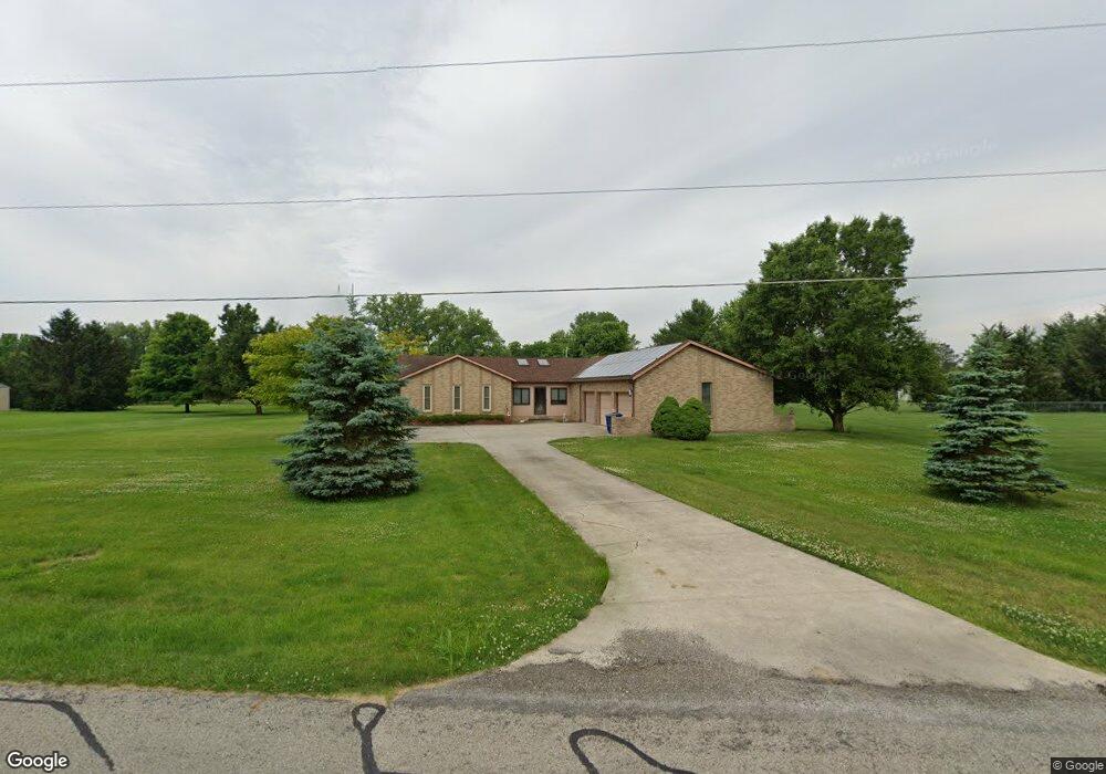
9085 Mccord Rd Orient, OH 43146
Estimated Value: $308,000 - $443,000
About This Home
This home is located at 9085 Mccord Rd, Orient, OH 43146 and is currently estimated at $367,360, approximately $234 per square foot. 9085 Mccord Rd is a home located in Pickaway County.
Ownership History
We collect this data history from publicly available records. To have your information removed, we recommend requesting removal directly through your county’s website.
Purchase Details
Home Financials for this Owner
Home Financials are based on the most recent Mortgage that was taken out on this home.Home Values in the Area
Average Home Value in this Area
Purchase History
We collect this data history from publicly available records. To have your information removed, we recommend requesting removal directly through your county’s website.
| Date | Buyer | Sale Price | Title Company |
|---|---|---|---|
| $163,500 | -- |
Mortgage History
We collect this data history from publicly available records. To have your information removed, we recommend requesting removal directly through your county’s website.
| Date | Status | Borrower | Loan Amount |
|---|---|---|---|
| Open | $155,300 |
Tax History
We collect this data history from publicly available records. To have your information removed, we recommend requesting removal directly through your county’s website.
| Year | Tax Paid | Tax Assessment Tax Assessment Total Assessment is a certain percentage of the fair market value that is determined by local assessors to be the total taxable value of land and additions on the property. | Land | Improvement |
|---|---|---|---|---|
| 2025 | $5,592 | $108,360 | $20,460 | $87,900 |
| 2024 | $5,592 | $130,330 | $20,460 | $109,870 |
| 2023 | $4,557 | $130,330 | $20,460 | $109,870 |
| 2022 | $3,441 | $92,780 | $13,640 | $79,140 |
| 2021 | $3,451 | $92,780 | $13,640 | $79,140 |
| 2020 | $3,452 | $92,780 | $13,640 | $79,140 |
| 2019 | $2,709 | $75,270 | $12,960 | $62,310 |
| 2018 | $2,592 | $75,270 | $12,960 | $62,310 |
| 2017 | $2,660 | $75,270 | $12,960 | $62,310 |
| 2016 | $2,603 | $73,700 | $11,250 | $62,450 |
| 2015 | $2,605 | $73,700 | $11,250 | $62,450 |
| 2014 | $2,608 | $73,700 | $11,250 | $62,450 |
| 2013 | $2,712 | $73,700 | $11,250 | $62,450 |
Map
- 1520 Hiner Rd
- 9205 Musket Place
- 5615 Lanterns Way Unit 529
- 5508 Patriot Ave Unit 306
- 1490 Hiner Rd
- 1470 Hiner Rd
- 9181 Constitution Ave Unit 69
- 9158 Constitution Ave
- 5258 Franklin St Unit 82
- 1800 Lynnbrook Ct
- 5616 Durrett Rd
- 5519 Durrett Rd
- 1736 Harvey Ln
- 1343 Wild Horse Dr
- 1373 Wild Horse Dr
- 1717 London Groveport Rd
- 1360 Great Hunter Ct
- 1271 River Trail Dr
- 6675 Borror Rd
- 30 Waterman Ave
- 9115 Mccord Rd
- 1635 Hiner Rd
- 1585 Hiner Rd
- 9096 Mccord Rd
- 9151 Mccord Rd
- 9040 Mccord Rd
- 1557 Hiner Rd
- 9136 Mccord Rd
- 1655 Hiner Rd
- 1643 Hiner Rd
- 1570 Hiner Rd
- 9155 Mccord Rd
- 1608 Hiner Rd
- 1665 Hiner Rd
- 1558 Hiner Rd
- 5790 Mattox Cir
- 5790 Mattox Cir Unit 330
- 5800 Mattox Cir
- 5780 Mattox Cir Unit 331
- 5810 Mattox Cir Unit 328
Ask me questions while you tour the home.