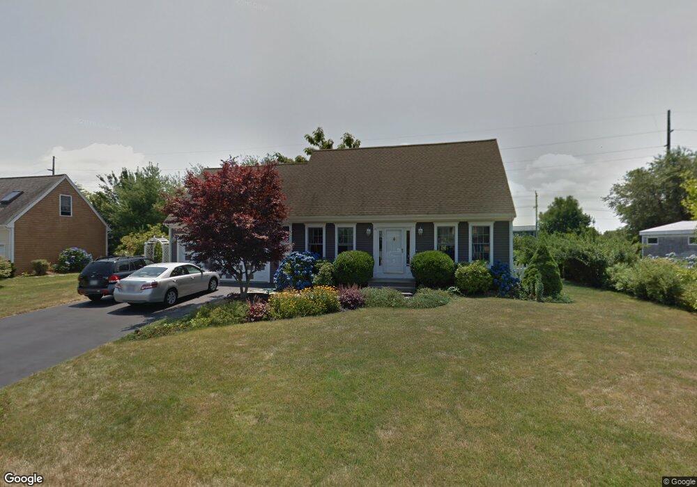
91 John Kesson Ln Middletown, RI 02842
Estimated Value: $795,726 - $959,000
3
Beds
2
Baths
2,535
Sq Ft
$342/Sq Ft
Est. Value
About This Home
This home is located at 91 John Kesson Ln, Middletown, RI 02842 and is currently estimated at $868,182, approximately $342 per square foot. 91 John Kesson Ln is a home located in Newport County with nearby schools including Middletown High School, All Saints STEAM Academy, and The Pennfield School.
Ownership History
Date
Name
Owned For
Owner Type
Purchase Details
Closed on
Nov 2, 1999
Sold by
Horan Building
Bought by
Birkhofer John B and Birkhofer Betty A
Current Estimated Value
Home Financials for this Owner
Home Financials are based on the most recent Mortgage that was taken out on this home.
Original Mortgage
$138,600
Interest Rate
7.78%
Mortgage Type
Purchase Money Mortgage
Create a Home Valuation Report for This Property
The Home Valuation Report is an in-depth analysis detailing your home's value as well as a comparison with similar homes in the area
Home Values in the Area
Average Home Value in this Area
Purchase History
| Date | Buyer | Sale Price | Title Company |
|---|---|---|---|
| Birkhofer John B | $55,000 | -- |
Source: Public Records
Mortgage History
| Date | Status | Borrower | Loan Amount |
|---|---|---|---|
| Open | Birkhofer John B | $75,000 | |
| Closed | Birkhofer John B | $23,000 | |
| Closed | Birkhofer John B | $120,000 | |
| Closed | Birkhofer John B | $138,600 |
Source: Public Records
Tax History
| Year | Tax Paid | Tax Assessment Tax Assessment Total Assessment is a certain percentage of the fair market value that is determined by local assessors to be the total taxable value of land and additions on the property. | Land | Improvement |
|---|---|---|---|---|
| 2025 | $8,088 | $686,000 | $327,100 | $358,900 |
| 2024 | $7,724 | $686,000 | $327,100 | $358,900 |
| 2023 | $6,405 | $508,700 | $221,100 | $287,600 |
| 2022 | $5,890 | $490,000 | $221,100 | $268,900 |
| 2021 | $5,890 | $490,000 | $221,100 | $268,900 |
| 2020 | $5,551 | $403,400 | $166,100 | $237,300 |
| 2018 | $5,547 | $403,400 | $166,100 | $237,300 |
| 2016 | $5,823 | $377,600 | $149,500 | $228,100 |
| 2015 | $5,679 | $377,600 | $149,500 | $228,100 |
| 2014 | $5,756 | $358,200 | $128,300 | $229,900 |
| 2013 | $5,627 | $358,200 | $128,300 | $229,900 |
Source: Public Records
Map
Nearby Homes
- 4 Phillips Ave
- 103 Gossets Turn Dr
- 11 Roy Ave
- 188 Greene Ln
- 10 J h Dwyer Dr
- 11 Barton Ln
- 546 Jepson Ln
- 48 Rebels Way
- 0 Revolution Way
- 39 Almy Knoll Terrace
- 1505 Fairway Dr
- 1304 Fairway Dr
- 0 Revolution Way
- 163 Revolution Way
- 206 Revolution Way
- 171 Revolution Way
- 136 Corporate Place
- 719 Forest Park
- 502 Forest Rd
- 738 Forest Avenue Mobile Home Park
- 81 John Kesson Ln
- 101 John Kesson Ln
- 0 John Kesson Ln
- 86 John Kesson Ln
- 104 Pasture Farm Dr
- 71 John Kesson Ln
- 102 John Kesson Ln
- 111 John Kesson Ln
- 76 John Kesson Ln
- 114 Pasture Farm Dr
- 110 John Kesson Ln
- 16 Evelin Cir
- 90 Pasture Farm Dr
- 121 John Kesson Ln
- 19 Evelin Cir
- 124 Pasture Farm Dr
- 64 John Kesson Ln
- 61 John Kesson Ln
- 91 Evelin Cir
- 17 Thelma Ln Unit 22
Your Personal Tour Guide
Ask me questions while you tour the home.