Estimated Value: $224,899 - $307,000
2
Beds
2
Baths
1,380
Sq Ft
$202/Sq Ft
Est. Value
About This Home
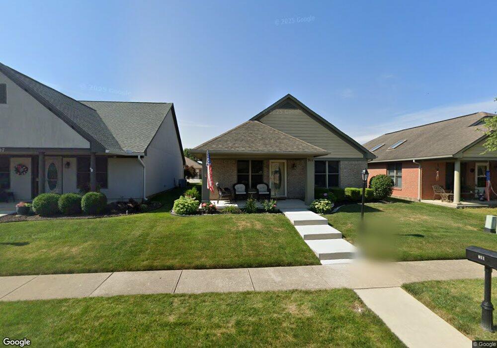
This home is located at 911 Wright Ave, Xenia, OH 45385 and is currently estimated at $278,475, approximately $201 per square foot. 911 Wright Ave is a home located in Greene County with nearby schools including Xenia High School, Summit Academy Community School for Alternative Learners - Xenia, and Legacy Christian Academy.
Ownership History
Date
Name
Owned For
Owner Type
Purchase Details
Closed on
May 6, 2016
Sold by
Allen Karen and Allen Darryl W
Bought by
Walke John D
Current Estimated Value
Purchase Details
Closed on
Aug 25, 2000
Sold by
Be Am Co Inc
Bought by
Burchfield Rick J
Home Financials for this Owner
Home Financials are based on the most recent Mortgage that was taken out on this home.
Original Mortgage
$44,900
Interest Rate
8.12%
Purchase Details
Closed on
Oct 30, 1997
Sold by
P F D Dev Pll
Bought by
Be/Am/Co Inc
Create a Home Valuation Report for This Property
The Home Valuation Report is an in-depth analysis detailing your home's value as well as a comparison with similar homes in the area
Home Values in the Area
Average Home Value in this Area
Purchase History
| Date | Buyer | Sale Price | Title Company |
|---|---|---|---|
| Walke John D | $140,000 | None Available | |
| Burchfield Rick J | $129,900 | -- | |
| Be/Am/Co Inc | $292,500 | -- |
Source: Public Records
Mortgage History
| Date | Status | Borrower | Loan Amount |
|---|---|---|---|
| Previous Owner | Burchfield Rick J | $44,900 |
Source: Public Records
Tax History
| Year | Tax Paid | Tax Assessment Tax Assessment Total Assessment is a certain percentage of the fair market value that is determined by local assessors to be the total taxable value of land and additions on the property. | Land | Improvement |
|---|---|---|---|---|
| 2025 | $2,155 | $60,760 | $10,500 | $50,260 |
| 2024 | $2,155 | $60,760 | $10,500 | $50,260 |
| 2023 | $2,126 | $60,760 | $10,500 | $50,260 |
| 2022 | $1,839 | $46,310 | $7,000 | $39,310 |
| 2021 | $1,864 | $46,310 | $7,000 | $39,310 |
| 2020 | $1,784 | $46,310 | $7,000 | $39,310 |
| 2019 | $1,888 | $46,160 | $6,430 | $39,730 |
| 2018 | $2,338 | $46,160 | $6,430 | $39,730 |
| 2017 | $2,153 | $46,160 | $6,430 | $39,730 |
| 2016 | $2,154 | $41,750 | $6,430 | $35,320 |
| 2015 | $2,160 | $41,750 | $6,430 | $35,320 |
| 2014 | $2,066 | $41,750 | $6,430 | $35,320 |
Source: Public Records
Map
Nearby Homes
- 938 Wright Ave
- 2102 High Wheel Dr
- 920 Wright Cycle Blvd
- 926 Wright Cycle Blvd
- 1978 Lakeview Dr
- 2276 Tandem Dr
- 2352 Pembury Dr
- 1955 Roxbury Dr
- 2516 Jenny Marie Dr
- 0 Berkshire Dr Unit 949217
- 1321 Massachusetts Dr
- 2813 Raxit Ct
- 2936 W Barnhill Place
- 1772 Pueblo Dr
- 2096 Alabama Dr
- 1068 Hedges Rd
- 1715 Sioux Dr
- 1001 Glen Kegley Dr
- 1182 Bellbrook Ave
- 1861 Nebraska Dr
- 915 Wright Ave
- 907 Wright Ave
- 919 Wright Ave
- 901 Wright Ave
- 923 Wright Ave
- 910 Cannondale Ave
- 914 Cannondale Ave
- 906 Cannondale Ave
- 927 Wright Ave
- 918 Cannondale Ave
- 900 Cannondale Ave
- 906 Wright Ave
- 914 Wright Ave
- 922 Cannondale Ave
- 918 Wright Ave
- 900 Wright Ave
- 931 Wright Ave
- 922 Wright Ave
- 926 Cannondale Ave
- 926 Wright Ave
Your Personal Tour Guide
Ask me questions while you tour the home.