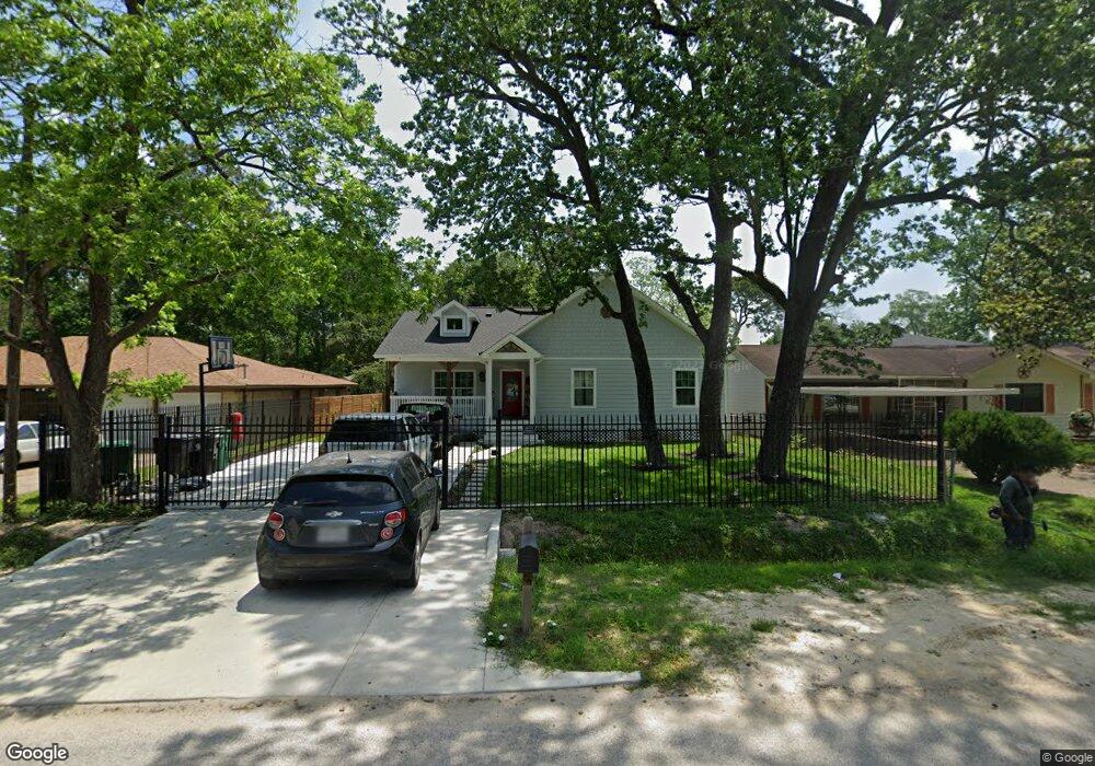
9110 Compton St Houston, TX 77016
Trinity-Houston Gardens NeighborhoodEstimated Value: $212,000 - $251,000
About This Home
This home is located at 9110 Compton St, Houston, TX 77016 and is currently estimated at $239,825, approximately $129 per square foot. 9110 Compton St is a home located in Harris County with nearby schools including Felix Cook Jr. Elementary School, Key Middle, and Kashmere High School.
Ownership History
We collect this data history from publicly available records. To have your information removed, we recommend requesting removal directly through your county’s website.
Purchase Details
Purchase Details
Purchase Details
Home Values in the Area
Average Home Value in this Area
Purchase History
We collect this data history from publicly available records. To have your information removed, we recommend requesting removal directly through your county’s website.
| Date | Buyer | Sale Price | Title Company |
|---|---|---|---|
| $31,000 | None Available | ||
| -- | None Available | ||
| -- | -- |
Tax History
We collect this data history from publicly available records. To have your information removed, we recommend requesting removal directly through your county’s website.
| Year | Tax Paid | Tax Assessment Tax Assessment Total Assessment is a certain percentage of the fair market value that is determined by local assessors to be the total taxable value of land and additions on the property. | Land | Improvement |
|---|---|---|---|---|
| 2025 | $3,283 | $264,965 | $51,795 | $213,170 |
| 2024 | $3,537 | $262,745 | $51,795 | $210,950 |
| 2023 | $3,537 | $394,000 | $38,846 | $355,154 |
| 2022 | $6,110 | $302,264 | $25,898 | $276,366 |
| 2021 | $5,879 | $252,248 | $17,265 | $234,983 |
| 2020 | $1,813 | $74,848 | $17,265 | $57,583 |
| 2019 | $350 | $13,812 | $13,812 | $0 |
| 2018 | $350 | $13,812 | $13,812 | $0 |
| 2017 | $712 | $28,167 | $13,812 | $14,355 |
| 2016 | $574 | $22,684 | $10,791 | $11,893 |
| 2015 | $618 | $24,048 | $9,927 | $14,121 |
| 2014 | $618 | $24,048 | $9,927 | $14,121 |
Map
- 9210 Compton St
- 8914 Lanewood Dr
- 9205 & 9207 Spaulding St
- 9319 Spaulding St
- 9118 Spaulding St
- 9227 Homestead Rd
- 6513 Laura Koppe Rd
- 8928 Homestead Rd
- 8725 Compton St
- 6320 Laura Koppe Rd
- 9306 Bertwood St
- 6514 Laura Koppe Rd
- 5009 Tidwell Rd
- 6110 Tidwell Rd
- 8706 Camay Dr
- 9011 Allwood St
- 9221 Sundown Dr
- 8700 Lanewood Dr
- 6012 Laura Koppe Rd
- 6213 Laura Koppe Rd
- 9106 Compton St
- 9112 Compton St
- 9114 Compton St
- 9022 Compton St
- 9101 Compton St
- 8933 Compton St
- 9101 Lanewood Dr
- 6410 Firnat St
- 9113 Lanewood Dr
- 9018 Compton St
- 9027 Lanewood Dr
- 9118 Compton St
- 9115 Lanewood Dr
- 0 NE Compton St Unit 18454038
- 9109 Compton St
- 9023 Lanewood Dr
- 9023 Lanewood Dr
- 9023 Lanewood Dr Unit B
- 9023 Lanewood Dr Unit A
- 9019 Compton St
Ask me questions while you tour the home.