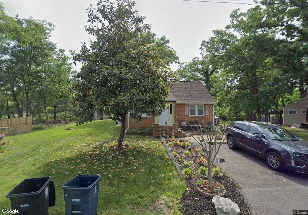
9117 Simpson Ln Clinton, MD 20735
Estimated Value: $297,854 - $428,000
About This Home
This home is located at 9117 Simpson Ln, Clinton, MD 20735 and is currently estimated at $380,464, approximately $316 per square foot. 9117 Simpson Ln is a home located in Prince George's County with nearby schools including Francis T. Evans Elementary School, Stephen Decatur Middle School, and Dr. Henry A. Wise Jr. High School.
Ownership History
We collect this data history from publicly available records. To have your information removed, we recommend requesting removal directly through your county’s website.
Purchase Details
Purchase Details
Home Values in the Area
Average Home Value in this Area
Purchase History
We collect this data history from publicly available records. To have your information removed, we recommend requesting removal directly through your county’s website.
| Date | Buyer | Sale Price | Title Company |
|---|---|---|---|
| -- | -- | ||
| $99,500 | -- |
Mortgage History
We collect this data history from publicly available records. To have your information removed, we recommend requesting removal directly through your county’s website.
| Date | Status | Borrower | Loan Amount |
|---|---|---|---|
| Closed | $108,000 | ||
| Closed | $88,000 | ||
| Closed | $50,000 | ||
| Closed | $140,000 |
Tax History
We collect this data history from publicly available records. To have your information removed, we recommend requesting removal directly through your county’s website.
| Year | Tax Paid | Tax Assessment Tax Assessment Total Assessment is a certain percentage of the fair market value that is determined by local assessors to be the total taxable value of land and additions on the property. | Land | Improvement |
|---|---|---|---|---|
| 2025 | $3,485 | $283,300 | $102,100 | $181,200 |
| 2024 | $3,485 | $271,800 | -- | -- |
| 2023 | $3,376 | $260,300 | $0 | $0 |
| 2022 | $2,767 | $248,800 | $102,100 | $146,700 |
| 2021 | $3,867 | $238,300 | $0 | $0 |
| 2020 | $6,087 | $227,800 | $0 | $0 |
| 2019 | $3,112 | $217,300 | $101,000 | $116,300 |
| 2018 | $2,851 | $210,000 | $0 | $0 |
| 2017 | $9,796 | $202,700 | $0 | $0 |
| 2016 | -- | $195,400 | $0 | $0 |
| 2015 | $2,497 | $194,933 | $0 | $0 |
| 2014 | $2,497 | $194,467 | $0 | $0 |
Map
- 7504 Foxcroft Ct
- 9401 Pine View Ln
- 9312 Fox Run Dr
- 6510 Horseshoe Rd
- 9510 Fox Run Dr
- 6601 Horseshoe Rd
- 7912 Fox Lair Ct
- 9200 Fox Park Rd
- 8750 Mimosa Ave
- 6706 Surratts Rd
- 7219 Branchwood Place
- 7223 Branchwood Place
- 9003 Woodyard Rd
- 6624 Bullrush Ct
- 9515 Pin Oak St
- 8504 Woodyard Rd
- 8403 Branchwood Cir
- 6510 Spoonbill Way
- 6704 Seabird Ct
- 7208 Huckleberry Ct
- 9119 Simpson Ln
- 9115 Simpson Ln
- 9121 Simpson Ln
- 9113 Simpson Ln
- 9114 Simpson Ln
- 9112 Simpson Ln
- 9116 Simpson Ln
- 9118 Simpson Ln
- 9110 Simpson Ln
- 9111 Simpson Ln
- 7303 Milligan Ln
- 9108 Simpson Ln
- 9109 Simpson Ln
- 9106 Simpson Ln
- 9218 Stuart Ln
- 7301 Milligan Ln
- 9115 Ballard Ln
- 7204 Milligan Rd
- 9113 Ballard Ln
- 9117 Ballard Ln
Ask me questions while you tour the home.