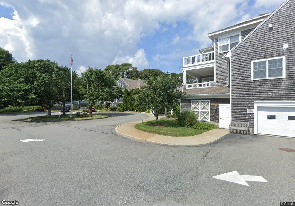
912 Main St Unit 205 Chatham, MA 02633
Chatham Village NeighborhoodEstimated Value: $357,000 - $482,000
2
Beds
2
Baths
996
Sq Ft
$413/Sq Ft
Est. Value
About This Home
This home is located at 912 Main St Unit 205, Chatham, MA 02633 and is currently estimated at $410,971, approximately $412 per square foot. 912 Main St Unit 205 is a home located in Barnstable County with nearby schools including Chatham Elementary School, Harwich Elementary School, and Monomoy Regional Middle School.
Ownership History
Date
Name
Owned For
Owner Type
Purchase Details
Closed on
Jun 6, 2011
Sold by
Est Horne Muriel A and Horne Suzanne F
Bought by
Pease Jr Jay J and Pease Delia S
Current Estimated Value
Purchase Details
Closed on
Jun 20, 2000
Sold by
Chatham 2 Rt and Cannistraro Ann Marie
Bought by
Horne Muriel A
Home Financials for this Owner
Home Financials are based on the most recent Mortgage that was taken out on this home.
Original Mortgage
$150,000
Interest Rate
8.24%
Mortgage Type
Purchase Money Mortgage
Create a Home Valuation Report for This Property
The Home Valuation Report is an in-depth analysis detailing your home's value as well as a comparison with similar homes in the area
Home Values in the Area
Average Home Value in this Area
Purchase History
We collect this data history from publicly available records. To have your information removed, we recommend requesting removal directly through your county’s website.
| Date | Buyer | Sale Price | Title Company |
|---|---|---|---|
| Pease Jr Jay J | $220,000 | -- | |
| Horne Muriel A | $249,500 | -- |
Source: Public Records
Mortgage History
We collect this data history from publicly available records. To have your information removed, we recommend requesting removal directly through your county’s website.
| Date | Status | Borrower | Loan Amount |
|---|---|---|---|
| Previous Owner | Horne Muriel A | $104,500 | |
| Previous Owner | Horne Muriel A | $150,000 |
Source: Public Records
Tax History
| Year | Tax Paid | Tax Assessment Tax Assessment Total Assessment is a certain percentage of the fair market value that is determined by local assessors to be the total taxable value of land and additions on the property. | Land | Improvement |
|---|---|---|---|---|
| 2025 | $1,107 | $319,000 | $0 | $319,000 |
| 2024 | $1,030 | $288,500 | $0 | $288,500 |
| 2023 | $1,200 | $309,400 | $0 | $309,400 |
| 2022 | $1,557 | $337,100 | $0 | $337,100 |
| 2021 | $1,573 | $315,900 | $0 | $315,900 |
| 2020 | $1,674 | $347,400 | $0 | $347,400 |
| 2019 | $1,770 | $364,900 | $0 | $364,900 |
| 2018 | $1,779 | $365,200 | $0 | $365,200 |
| 2017 | $1,819 | $361,600 | $0 | $361,600 |
| 2016 | $1,946 | $387,600 | $0 | $387,600 |
| 2015 | $1,738 | $348,200 | $0 | $348,200 |
| 2014 | $1,517 | $298,600 | $0 | $298,600 |
Source: Public Records
Map
Nearby Homes
- 912 Main St Unit 308
- 6 Munson Meeting Way
- 33 Crowell Rd
- 66 Snow Ln
- 32 Tip Cart Dr
- 99 Depot Rd Unit 23
- 231 Crowell Rd
- 243 Crowell Rd
- 92 Absegami Run
- 27 Martha Kendrick Dr
- 1068 Main St Unit 1068
- 58 Stepping Stones Rd
- 50 Eldredge Square S
- 230 Barcliff Ave
- 48 Glover Square
- 222 Barcliff Ave
- 99 Uncle Alberts Drive Extension
- 118 Wilfred Rd
- 137 Shane Dr
- 66 Ethelma Dr
- 912 Main St Unit 310
- 912 Main St Unit 309
- 912 Main St Unit 307
- 912 Main St Unit 306
- 912 Main St Unit 303
- 912 Main St Unit 302
- 912 Main St Unit 301
- 912 Main St Unit 217
- 912 Main St Unit 216
- 912 Main St Unit 215
- 912 Main St Unit 214
- 912 Main St Unit 213
- 912 Main St Unit 212
- 912 Main St Unit 211
- 912 Main St Unit 210
- 912 Main St Unit 209
- 912 Main St Unit 208
- 912 Main St Unit 207
- 912 Main St Unit 206
- 912 Main St Unit 204
Your Personal Tour Guide
Ask me questions while you tour the home.