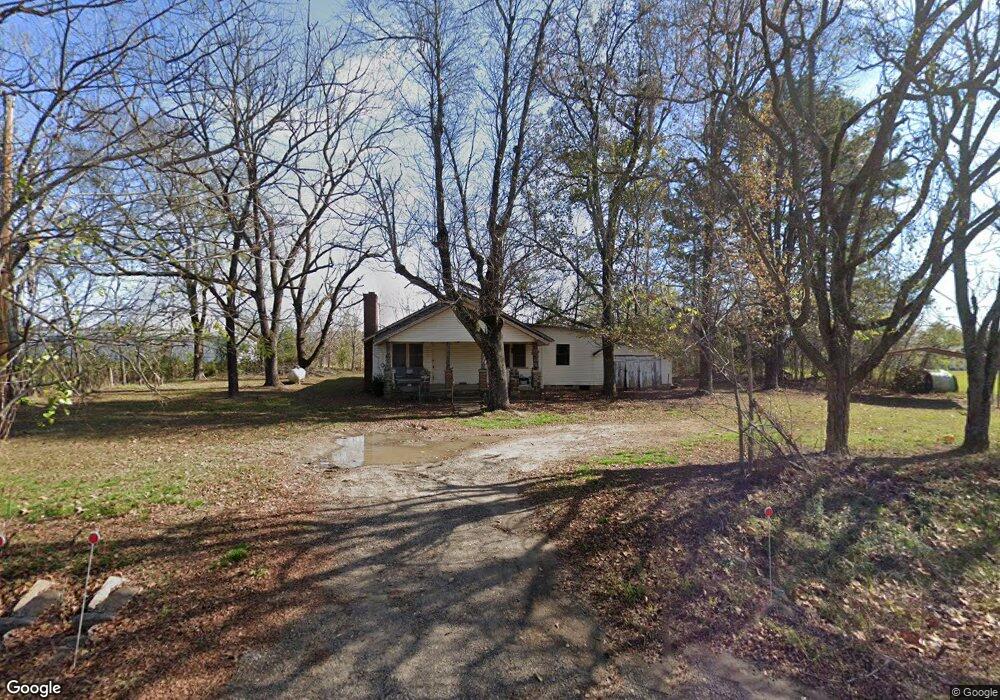
9124 Highway 215 Mulberry, AR 72947
Estimated Value: $60,169 - $190,000
Studio
1
Bath
1,216
Sq Ft
$100/Sq Ft
Est. Value
About This Home
This home is located at 9124 Highway 215, Mulberry, AR 72947 and is currently estimated at $121,792, approximately $100 per square foot. 9124 Highway 215 is a home located in Crawford County with nearby schools including Marvin Primary School, Pleasant View Junior High School, and Mulberry High School.
Ownership History
Date
Name
Owned For
Owner Type
Purchase Details
Closed on
Apr 15, 2015
Sold by
Millsap Mable
Bought by
Wilson Freda
Current Estimated Value
Purchase Details
Closed on
Oct 8, 2003
Bought by
Millsap John and Millsap Mable
Purchase Details
Closed on
May 22, 2001
Bought by
Coleman-Millsap
Purchase Details
Closed on
Oct 18, 2000
Bought by
Williams-Coleman
Purchase Details
Closed on
Mar 19, 1998
Bought by
Coleman-Williams
Create a Home Valuation Report for This Property
The Home Valuation Report is an in-depth analysis detailing your home's value as well as a comparison with similar homes in the area
Purchase History
| Date | Buyer | Sale Price | Title Company |
|---|---|---|---|
| Wilson Freda | -- | None Available | |
| Millsap John | $1,000 | -- | |
| Coleman-Millsap | $30,000 | -- | |
| Williams-Coleman | $37,000 | -- | |
| Coleman-Williams | $31,000 | -- |
Source: Public Records
Tax History
| Year | Tax Paid | Tax Assessment Tax Assessment Total Assessment is a certain percentage of the fair market value that is determined by local assessors to be the total taxable value of land and additions on the property. | Land | Improvement |
|---|---|---|---|---|
| 2025 | $205 | $4,350 | $1,560 | $2,790 |
| 2024 | $205 | $4,350 | $1,560 | $2,790 |
| 2023 | $205 | $4,350 | $1,560 | $2,790 |
| 2022 | $423 | $8,960 | $3,000 | $5,960 |
| 2021 | $392 | $8,960 | $3,000 | $5,960 |
| 2020 | $392 | $8,960 | $3,000 | $5,960 |
| 2019 | $486 | $11,130 | $3,000 | $8,130 |
| 2018 | $486 | $11,130 | $3,000 | $8,130 |
| 2017 | $477 | $10,910 | $3,000 | $7,910 |
| 2016 | $477 | $10,910 | $3,000 | $7,910 |
| 2015 | $477 | $11,020 | $3,110 | $7,910 |
| 2014 | $482 | $11,020 | $3,110 | $7,910 |
Source: Public Records
Map
Nearby Homes
- 14716 Oakleaf Rd
- TBD Piney Rd
- 8761 Slate Hill Rd
- 9943 Rough Branch Rd
- 5527 Wire Rd
- 000 Tba
- 8500 Rock Creek Rd
- 6639 Carriage Rd
- TBD Ford Ridge Rd
- 10117 Beth Lynn Rd
- 10119 Beth Lynn Rd
- 2150 Old Graphic St
- 14840 White Valley Rd
- 12140 County Line Rd
- TBD Beth Lynn Dr
- TBD Tract 3 Restful Dr
- 8 W 10th St
- TBD Tract 2 Sherman Creek Rd
- TBD Tract 1 Sherman Creek Rd
- 10418 Friendly Ln
- 9102 Highway 215
- 9207 Highway 215
- 9228 Highway 215
- 9046 Highway 215
- 9238 Highway 215
- 8900 Highway 215
- 16521 Plymouth Rd
- 16506 Plymouth Rd
- 0 Plymouth Rd
- 16061 Plymouth Rd
- TBD Plymouth Rd
- 8763 Highway 215
- 16817 Plymouth Rd
- 16822 Rivermist Way
- 9708 Highway 215
- 16215 Plymouth Rd
- 9607 Highway 215
- 9707 Highway 215
- TBD Rivermist Rd
- 16920 Plymouth Rd
Your Personal Tour Guide
Ask me questions while you tour the home.