9127 Red Stag Ln Conroe, TX 77303
Estimated Value: $482,000 - $503,000
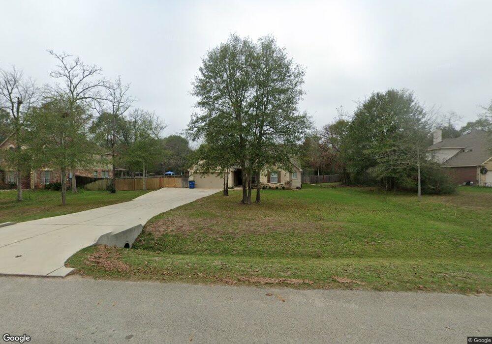
About This Home
This home is located at 9127 Red Stag Ln, Conroe, TX 77303 and is currently estimated at $489,763, approximately $199 per square foot. 9127 Red Stag Ln is a home located in Montgomery County with nearby schools including Patterson Elementary School, Bozman Intermediate School, and Stockton Junior High School.
Ownership History
We collect this data history from publicly available records. To have your information removed, we recommend requesting removal directly through your county’s website.
Purchase Details
Home Financials for this Owner
Home Financials are based on the most recent Mortgage that was taken out on this home.Purchase Details
Home Financials for this Owner
Home Financials are based on the most recent Mortgage that was taken out on this home.Purchase Details
Home Values in the Area
Average Home Value in this Area
Purchase History
We collect this data history from publicly available records. To have your information removed, we recommend requesting removal directly through your county’s website.
| Date | Buyer | Sale Price | Title Company |
|---|---|---|---|
| -- | Capital Title | ||
| -- | None Available | ||
| -- | -- |
Mortgage History
We collect this data history from publicly available records. To have your information removed, we recommend requesting removal directly through your county’s website.
| Date | Status | Borrower | Loan Amount |
|---|---|---|---|
| Open | $284,123 | ||
| Previous Owner | $251,740 |
Tax History
We collect this data history from publicly available records. To have your information removed, we recommend requesting removal directly through your county’s website.
| Year | Tax Paid | Tax Assessment Tax Assessment Total Assessment is a certain percentage of the fair market value that is determined by local assessors to be the total taxable value of land and additions on the property. | Land | Improvement |
|---|---|---|---|---|
| 2025 | $4,931 | $433,688 | -- | -- |
| 2024 | $4,397 | $394,262 | -- | -- |
| 2023 | $4,397 | $358,420 | $58,500 | $378,460 |
| 2022 | $5,676 | $325,840 | $58,500 | $354,460 |
| 2021 | $5,477 | $296,220 | $50,000 | $246,220 |
| 2020 | $6,314 | $324,760 | $15,000 | $309,760 |
| 2019 | $5,982 | $296,960 | $15,000 | $281,960 |
| 2018 | $5,125 | $285,480 | $15,000 | $270,480 |
| 2017 | $5,770 | $285,480 | $15,000 | $270,480 |
| 2016 | $5,452 | $269,790 | $15,000 | $254,790 |
| 2015 | $306 | $15,000 | $15,000 | $0 |
| 2014 | $306 | $15,000 | $15,000 | $0 |
Map
- 9107 Black Buck Ln
- 9115 Bush Buck Ln
- 6264 Rolling Hills Rd
- 12371 N Chestnut Hills Dr
- 9538 Travertine Ct
- 6185 White Oak Leaf Loop
- 12340 N Chestnut Hills Dr
- 12341 N Chestnut Hills Dr
- 6218 Rolling Hills Rd
- 6169 White Oak Leaf Loop
- 9348 Hard Rock Rd
- 9352 Hard Rock Rd
- 9233 Boulder Blvd
- 12898 Lime Stone Ln
- 9025 Water Buck Ln
- 11531 Brentwood Ct
- 12825 Lime Stone Ln
- 1004 Kelley Rd
- 13652 Armstrong St
- 13664 Armstrong St
- 9131 Red Stag Ln
- 9123 Red Stag Ln
- 9135 Red Stag Ln
- 9119 Red Stag Ln
- 9126 Red Stag Ln
- 9122 Red Stag Ln
- 9139 Red Stag Ln
- 9115 Red Stag Ln
- 9134 Red Stag Ln
- 12424 Red Stag Ct
- 9114 Red Stag Ln
- 12432 Red Stag Ct
- 12428 Red Stag Ct
- 9130 Red Stag Ln
- 12438 Red Stag Ct
- 9118 Red Stag Ln
- 9111 Red Stag Ln
- 9138 Red Stag Ln
- 9143 Red Stag Ln
- 12420 Red Stag Ct
Ask me questions while you tour the home.