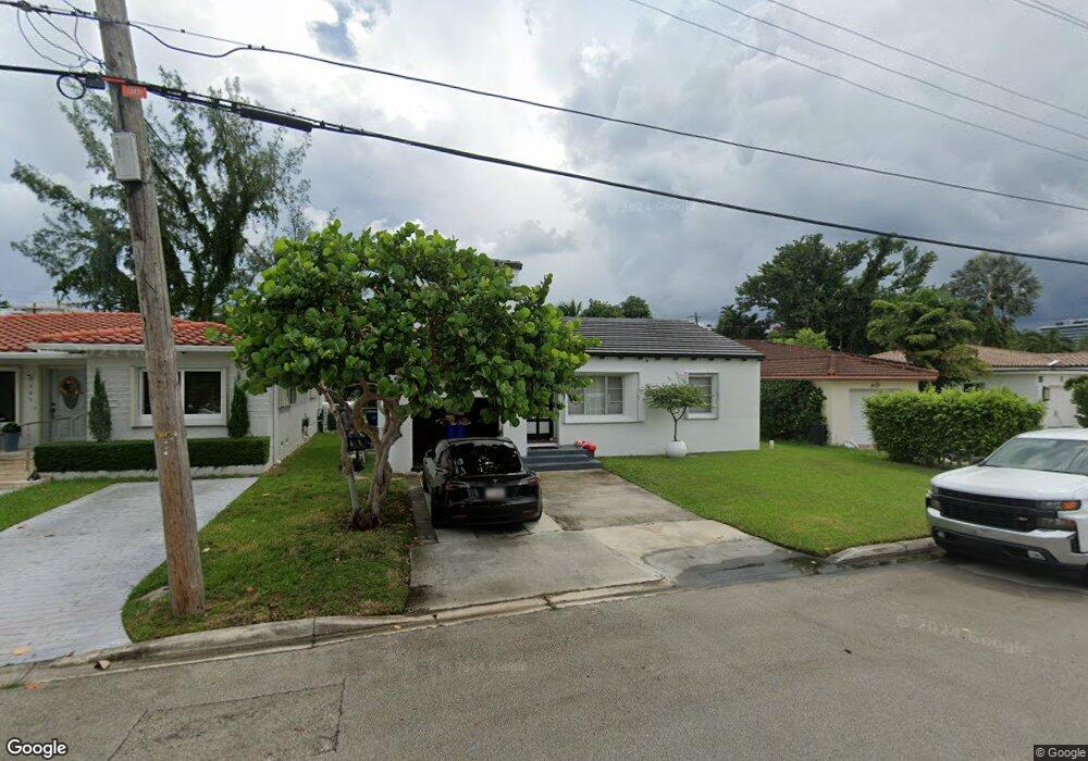
9133 Carlyle Ave Surfside, FL 33154
Estimated Value: $1,227,000 - $1,421,000
3
Beds
2
Baths
1,503
Sq Ft
$891/Sq Ft
Est. Value
About This Home
This home is located at 9133 Carlyle Ave, Surfside, FL 33154 and is currently estimated at $1,339,452, approximately $891 per square foot. 9133 Carlyle Ave is a home located in Miami-Dade County with nearby schools including Ruth K. Broad Bay Harbor K-8 Center, Nautilus Middle School, and Miami Beach Senior High School.
Ownership History
Date
Name
Owned For
Owner Type
Purchase Details
Closed on
Mar 14, 2019
Sold by
Kinzer Douglas and Kinzer Mitchell
Bought by
Dimitropoulos Spiros and Herreria Leon Lucero Andrea
Current Estimated Value
Home Financials for this Owner
Home Financials are based on the most recent Mortgage that was taken out on this home.
Original Mortgage
$456,000
Outstanding Balance
$400,902
Interest Rate
4.4%
Mortgage Type
New Conventional
Estimated Equity
$938,550
Purchase Details
Closed on
Apr 14, 2012
Sold by
Kinzer Marion
Bought by
Kinzer Marion
Create a Home Valuation Report for This Property
The Home Valuation Report is an in-depth analysis detailing your home's value as well as a comparison with similar homes in the area
Home Values in the Area
Average Home Value in this Area
Purchase History
| Date | Buyer | Sale Price | Title Company |
|---|---|---|---|
| Dimitropoulos Spiros | $570,000 | Chicago Title Ins Agcy Inc | |
| Kinzer Marion | -- | Attorney |
Source: Public Records
Mortgage History
| Date | Status | Borrower | Loan Amount |
|---|---|---|---|
| Open | Dimitropoulos Spiros | $456,000 |
Source: Public Records
Tax History
| Year | Tax Paid | Tax Assessment Tax Assessment Total Assessment is a certain percentage of the fair market value that is determined by local assessors to be the total taxable value of land and additions on the property. | Land | Improvement |
|---|---|---|---|---|
| 2025 | $9,505 | $545,631 | -- | -- |
| 2024 | $9,314 | $530,254 | -- | -- |
| 2023 | $9,314 | $514,810 | $0 | $0 |
| 2022 | $9,067 | $499,816 | $0 | $0 |
| 2021 | $9,022 | $485,259 | $0 | $0 |
| 2020 | $8,980 | $478,560 | $392,200 | $86,360 |
| 2019 | $10,149 | $494,138 | $386,188 | $107,950 |
| 2018 | $2,142 | $165,978 | $0 | $0 |
| 2017 | $2,090 | $162,565 | $0 | $0 |
| 2016 | $2,085 | $159,222 | $0 | $0 |
| 2015 | $2,107 | $158,116 | $0 | $0 |
| 2014 | $2,131 | $156,862 | $0 | $0 |
Source: Public Records
Map
Nearby Homes
- 9117 Carlyle Ave
- 9124 Byron Ave
- 9148 Carlyle Ave
- 9148 Abbott Ave
- 9116 Abbott Ave
- 9073 Dickens Ave
- 9048 Dickens Ave
- 9024 Abbott Ave
- 9165 Harding Ave
- 9033 Emerson Ave
- 9008 Dickens Ave
- 9208 Emerson Ave
- 9156 Collins Ave Unit 502
- 9156 Collins Ave Unit 107
- 9140 Collins Ave Unit C
- 9172 Collins Ave Unit 302
- 9172 Collins Ave Unit 212
- 9172 Collins Ave Unit 303
- 9172 Collins Ave Unit 214
- 9172 Collins Ave Unit 13
- 9125 Carlyle Ave
- 9141 Carlyle Ave
- 9149 Carlyle Ave
- 9148 Byron Ave
- 9116 Byron Ave
- 9157 Carlyle Ave
- 507 Surfside
- 9132 Carlyle Ave
- 525 91st St
- 517 91st St
- 9124 Carlyle Ave
- 517 Surfside Blvd
- 9140 Carlyle Ave
- 9116 Carlyle Ave
- 9156 Byron Ave
- 9165 Carlyle Ave
- 501 91st St
- 601 91st St
- 9160 Byron Ave
- 9156 Carlyle Ave
Your Personal Tour Guide
Ask me questions while you tour the home.