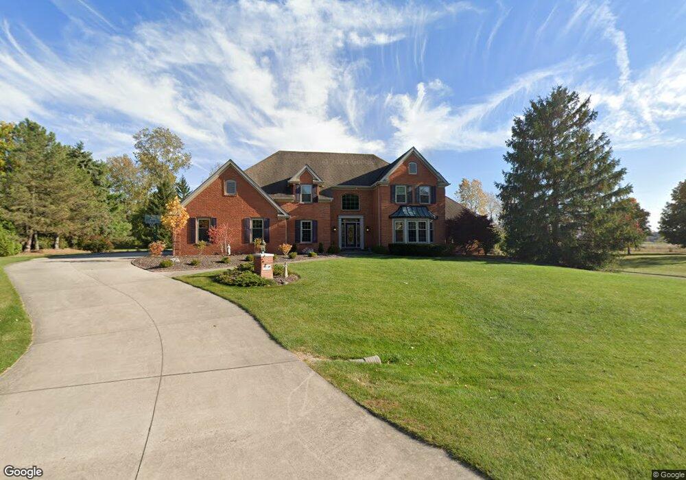
9136 Laurel Hurst Fort Wayne, IN 46835
Arlington Park NeighborhoodEstimated Value: $504,000 - $605,000
About This Home
This home is located at 9136 Laurel Hurst, Fort Wayne, IN 46835 and is currently estimated at $544,817, approximately $164 per square foot. 9136 Laurel Hurst is a home located in Allen County with nearby schools including Arlington Elementary School, Jefferson Middle School, and Northrop High School.
Ownership History
We collect this data history from publicly available records. To have your information removed, we recommend requesting removal directly through your county’s website.
Purchase Details
Home Financials for this Owner
Home Financials are based on the most recent Mortgage that was taken out on this home.Home Values in the Area
Average Home Value in this Area
Purchase History
We collect this data history from publicly available records. To have your information removed, we recommend requesting removal directly through your county’s website.
| Date | Buyer | Sale Price | Title Company |
|---|---|---|---|
| -- | Three Rivers Title Company I |
Mortgage History
We collect this data history from publicly available records. To have your information removed, we recommend requesting removal directly through your county’s website.
| Date | Status | Borrower | Loan Amount |
|---|---|---|---|
| Open | $263,000 | ||
| Closed | $25,000 | ||
| Closed | $208,000 | ||
| Closed | $42,500 | ||
| Closed | $268,000 |
Tax History
We collect this data history from publicly available records. To have your information removed, we recommend requesting removal directly through your county’s website.
| Year | Tax Paid | Tax Assessment Tax Assessment Total Assessment is a certain percentage of the fair market value that is determined by local assessors to be the total taxable value of land and additions on the property. | Land | Improvement |
|---|---|---|---|---|
| 2025 | $5,369 | $495,000 | $70,500 | $424,500 |
| 2024 | $5,168 | $461,000 | $70,500 | $390,500 |
| 2022 | $4,543 | $398,200 | $70,500 | $327,700 |
| 2021 | $3,907 | $344,700 | $57,300 | $287,400 |
| 2020 | $3,731 | $335,200 | $57,300 | $277,900 |
| 2019 | $3,397 | $307,000 | $57,300 | $249,700 |
| 2018 | $3,421 | $307,000 | $57,300 | $249,700 |
| 2017 | $3,371 | $299,600 | $57,300 | $242,300 |
| 2016 | $3,313 | $301,500 | $57,300 | $244,200 |
| 2014 | $3,028 | $291,400 | $57,300 | $234,100 |
| 2013 | $2,902 | $279,800 | $57,300 | $222,500 |
Map
- 9224 Laurel Hurst
- 8924 Laurel Hurst
- 4124 Cadena Ln
- 4009 Nadina Cove
- 4001 Nadina Cove
- 3949 Stanton Hall Pkwy
- 3911 Nadina Cove
- 5309 Litchfield Rd
- 10206 Maysville Rd
- 5102 Fox Mill Run
- 9023 Trier Rd
- 5108 Fox Mill Run
- 5420 Litchfield Rd
- 4505 Brookshire Cir
- 4608 Collbran Ct
- 8219 Quincy Ct
- 10501 Stellhorn Rd
- 5780 Wheelock Rd
- 5713 Kinlock Place
- 4515 Hartford Dr
- 9202 Laurel Hurst
- 9124 Laurel Hurst
- 9205 Laurel Hurst
- 9208 Laurel Hurst
- 9112 Laurel Hurst
- 9213 Laurel Hurst
- 4522 Wheelock Rd
- 9216 Laurel Hurst
- 9106 Laurel Hurst
- 9105 Laurel Hurst
- 9019 Stellhorn Rd
- 9019 Stellhorn Rd Unit LOT 1
- 9019 Stellhorn Rd Unit LOT 1 and LOT 2
- 4514 Wheelock Rd
- 8951 Stellhorn Rd
- 9219 Laurel Hurst
- 9034 Laurel Hurst
- 4628 Wheelock Rd
- 8931 Stellhorn Rd
- 9033 Laurel Hurst
Ask me questions while you tour the home.