Estimated Value: $292,000 - $309,000
About This Home
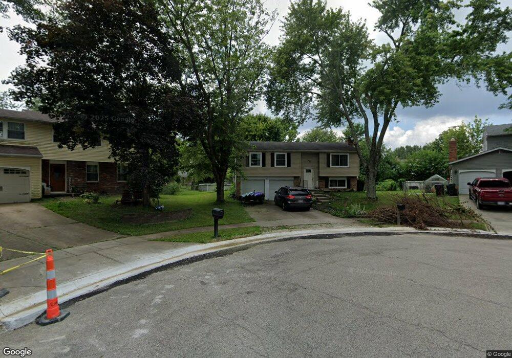
This home is located at 917 Leslie Ct, Mason, OH 45040 and is currently estimated at $302,259, approximately $294 per square foot. 917 Leslie Ct is a home located in Warren County with nearby schools including Mason Intermediate Elementary School, Mason Middle School, and William Mason High School.
Ownership History
We collect this data history from publicly available records. To have your information removed, we recommend requesting removal directly through your county’s website.
Purchase Details
Purchase Details
Home Financials for this Owner
Home Financials are based on the most recent Mortgage that was taken out on this home.Purchase Details
Home Financials for this Owner
Home Financials are based on the most recent Mortgage that was taken out on this home.Purchase Details
Purchase Details
Home Values in the Area
Average Home Value in this Area
Purchase History
We collect this data history from publicly available records. To have your information removed, we recommend requesting removal directly through your county’s website.
| Date | Buyer | Sale Price | Title Company |
|---|---|---|---|
| -- | None Available | ||
| $117,500 | -- | ||
| $113,000 | -- | ||
| $90,000 | -- | ||
| -- | -- |
Mortgage History
We collect this data history from publicly available records. To have your information removed, we recommend requesting removal directly through your county’s website.
| Date | Status | Borrower | Loan Amount |
|---|---|---|---|
| Previous Owner | $111,600 | ||
| Previous Owner | $90,400 |
Tax History
We collect this data history from publicly available records. To have your information removed, we recommend requesting removal directly through your county’s website.
| Year | Tax Paid | Tax Assessment Tax Assessment Total Assessment is a certain percentage of the fair market value that is determined by local assessors to be the total taxable value of land and additions on the property. | Land | Improvement |
|---|---|---|---|---|
| 2025 | $3,258 | $78,410 | $24,500 | $53,910 |
| 2024 | $3,258 | $78,410 | $24,500 | $53,910 |
| 2023 | $2,879 | $58,548 | $10,762 | $47,785 |
| 2022 | $2,841 | $58,548 | $10,763 | $47,786 |
| 2021 | $2,691 | $58,548 | $10,763 | $47,786 |
| 2020 | $2,559 | $47,600 | $8,750 | $38,850 |
| 2019 | $2,358 | $47,600 | $8,750 | $38,850 |
| 2018 | $2,366 | $47,600 | $8,750 | $38,850 |
| 2017 | $2,185 | $41,034 | $8,274 | $32,760 |
| 2016 | $2,250 | $41,034 | $8,274 | $32,760 |
| 2015 | $2,255 | $41,034 | $8,274 | $32,760 |
| 2014 | $2,260 | $38,350 | $7,730 | $30,620 |
| 2013 | $2,265 | $43,400 | $8,750 | $34,650 |
Map
- 1458 Southwind Dr
- 1371 Windward Dr
- 873 Tradewind Dr
- 994 Olympia Dr
- 1010 Stratford Place
- 6673 Fernshire Ct
- 6668 Ashley Ct Unit 20
- 6362 Chimney Ct Unit 6362
- 6510 Amber Ct
- 8446 Highridge Dr
- 6390 Coverage Ct
- 6386 Coverage Ct
- 6382 Coverage Ct
- 6378 Coverage Ct
- 6374 Coverage Ct
- 6364 Coverage Ct
- 6370 Coverage Ct
- 6191 Nicholas Way
- 6179 Nicholas Way
- 6175 Nicholas Way
- 901 Leslie Ct
- 1495 Saint Lawrence Dr
- 909 Leslie Ct
- 6442 Butler Warren Rd
- 1488 Saint Lawrence Dr
- 1479 Saint Lawrence Dr
- 1479 St Lawrence Dr
- 1492 Saint Lawrence Dr
- 1484 Saint Lawrence Dr
- 6454 Butler Warren Rd
- 904 Leslie Ct
- 6400 Butler Warren Rd
- 913 Leslie Ct
- 6466 Butler Warren Rd
- 1475 Saint Lawrence Dr
- 1476 Saint Lawrence Dr
- 908 Leslie Ct
- 797 Lind Place
- 6388 Butler Warren Rd
- 6478 Butler Warren Rd
Ask me questions while you tour the home.