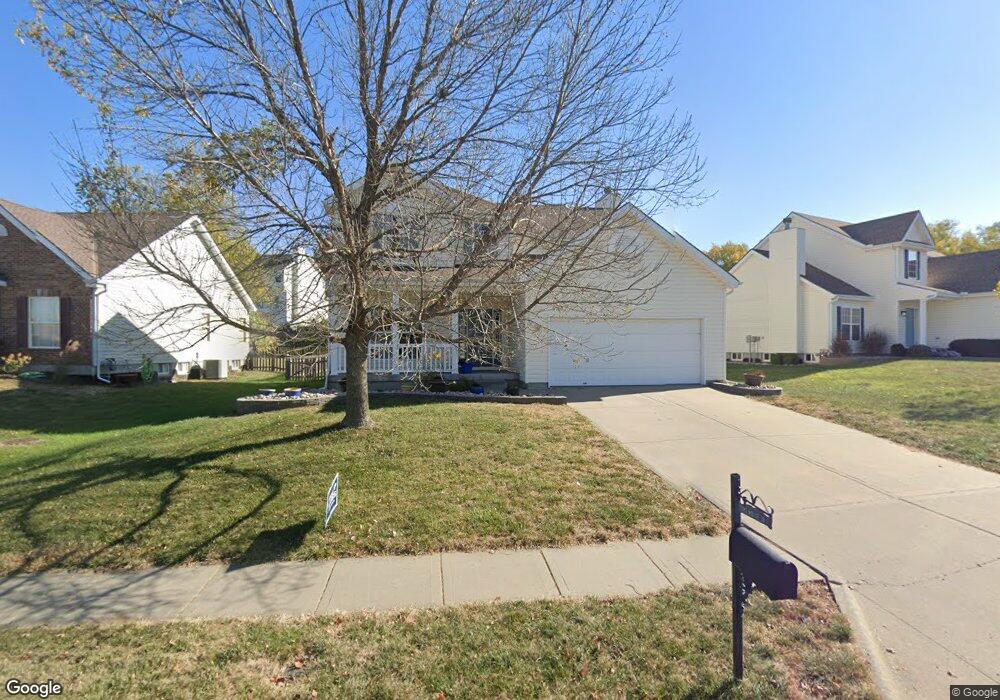
919 Midjay Dr Liberty, MO 64068
Estimated Value: $350,328 - $408,000
4
Beds
3
Baths
2,032
Sq Ft
$189/Sq Ft
Est. Value
About This Home
This home is located at 919 Midjay Dr, Liberty, MO 64068 and is currently estimated at $383,832, approximately $188 per square foot. 919 Midjay Dr is a home located in Clay County with nearby schools including Alexander Doniphan Elementary School, Discovery Middle School, and Liberty High School.
Ownership History
Date
Name
Owned For
Owner Type
Purchase Details
Closed on
Jul 2, 2004
Sold by
Mcbride & Son Homes Kansas City Llc
Bought by
Harvey Todd L and Harvey Tara M
Current Estimated Value
Home Financials for this Owner
Home Financials are based on the most recent Mortgage that was taken out on this home.
Original Mortgage
$145,200
Outstanding Balance
$70,871
Interest Rate
5.87%
Mortgage Type
Purchase Money Mortgage
Estimated Equity
$312,961
Create a Home Valuation Report for This Property
The Home Valuation Report is an in-depth analysis detailing your home's value as well as a comparison with similar homes in the area
Home Values in the Area
Average Home Value in this Area
Purchase History
We collect this data history from publicly available records. To have your information removed, we recommend requesting removal directly through your county’s website.
| Date | Buyer | Sale Price | Title Company |
|---|---|---|---|
| Harvey Todd L | -- | Thomson Title Corporation |
Source: Public Records
Mortgage History
We collect this data history from publicly available records. To have your information removed, we recommend requesting removal directly through your county’s website.
| Date | Status | Borrower | Loan Amount |
|---|---|---|---|
| Open | Harvey Todd L | $145,200 | |
| Closed | Harvey Todd L | $36,300 |
Source: Public Records
Tax History
| Year | Tax Paid | Tax Assessment Tax Assessment Total Assessment is a certain percentage of the fair market value that is determined by local assessors to be the total taxable value of land and additions on the property. | Land | Improvement |
|---|---|---|---|---|
| 2025 | $3,652 | $52,210 | -- | -- |
| 2024 | $3,652 | $47,480 | -- | -- |
| 2023 | $3,714 | $47,480 | $0 | $0 |
| 2022 | $3,373 | $42,580 | $0 | $0 |
| 2021 | $3,347 | $42,579 | $6,650 | $35,929 |
| 2020 | $3,162 | $37,770 | $0 | $0 |
| 2019 | $3,161 | $37,772 | $6,080 | $31,692 |
| 2018 | $2,753 | $32,300 | $0 | $0 |
| 2017 | $2,727 | $32,300 | $5,320 | $26,980 |
| 2016 | $2,727 | $32,300 | $5,320 | $26,980 |
| 2015 | $2,728 | $32,300 | $5,320 | $26,980 |
| 2014 | $2,749 | $32,300 | $5,320 | $26,980 |
Source: Public Records
Map
Nearby Homes
- 807 Melrose St
- Lot 2 Bent Oaks Dr
- 441 Wilshire Blvd
- Lot 2A Oak Crest Dr
- 2133 Winding Woods Dr
- 1500 Amesbury Ave
- 8820 Timber Creek Ln
- 8813 North Rd
- 7408 N Lane Ave
- 8808 Orchard St
- 1712 Welleslay Ln
- 7008 N Church Rd
- 7101 Fulton Rd
- 401 Smiley Rd
- 7431 N Lewis Ave
- 1605 High Dr
- 1617 Welleslay Ln
- 7514 N Lewis Ave
- 1561 Parkside Dr
- 1550 Dover Ct
- 923 Midjay Dr
- 915 Midjay Dr
- 916 Glendale Rd
- 920 Glendale Rd
- 927 Midjay Dr
- 911 Midjay Dr
- 912 Glendale Rd
- 908 Glendale Rd
- 907 Midjay Dr
- 904 Glendale Rd
- 1001 Glendale Rd
- 903 Midjay Dr
- 900 Glendale Rd
- 905 Glendale Rd
- 435 Kingsley St
- 435 Kingsley Ave
- 901 Glendale Rd
- 430 Kingsley St
- 431 Kingsley St
- 502 Pershing Ave
Your Personal Tour Guide
Ask me questions while you tour the home.