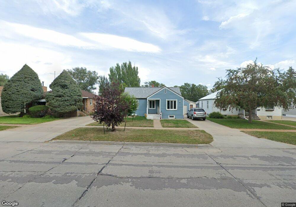
919 Platte Ave Alliance, NE 69301
Estimated Value: $89,000 - $198,000
2
Beds
1
Bath
885
Sq Ft
$148/Sq Ft
Est. Value
About This Home
This home is located at 919 Platte Ave, Alliance, NE 69301 and is currently estimated at $131,285, approximately $148 per square foot. 919 Platte Ave is a home located in Box Butte County with nearby schools including Alliance High School, St. Agnes Academy, and Immanuel Evangelical Lutheran School.
Ownership History
Date
Name
Owned For
Owner Type
Purchase Details
Closed on
Sep 14, 2023
Sold by
Secretary/Housing & Urban Dev
Bought by
Acosta Edgard A Guzman
Current Estimated Value
Purchase Details
Closed on
Jul 21, 2022
Sold by
First National Bank Of Omaha
Bought by
Secretary Of Housing And Urban Development
Purchase Details
Closed on
May 2, 2019
Sold by
Lucas Margaret L
Bought by
Schwartz Nicole M
Create a Home Valuation Report for This Property
The Home Valuation Report is an in-depth analysis detailing your home's value as well as a comparison with similar homes in the area
Home Values in the Area
Average Home Value in this Area
Purchase History
We collect this data history from publicly available records. To have your information removed, we recommend requesting removal directly through your county’s website.
| Date | Buyer | Sale Price | Title Company |
|---|---|---|---|
| Acosta Edgard A Guzman | -- | Title Express Services | |
| Secretary Of Housing And Urban Development | -- | None Listed On Document | |
| Schwartz Nicole M | $76,500 | -- | |
| First National Bank Of Omaha | $51,150 | None Listed On Document |
Source: Public Records
Tax History
| Year | Tax Paid | Tax Assessment Tax Assessment Total Assessment is a certain percentage of the fair market value that is determined by local assessors to be the total taxable value of land and additions on the property. | Land | Improvement |
|---|---|---|---|---|
| 2025 | $1,050 | $88,429 | $6,930 | $81,499 |
| 2024 | $1,007 | $80,390 | $6,300 | $74,090 |
| 2023 | $1,382 | $80,390 | $6,300 | $74,090 |
| 2022 | $1,336 | $73,370 | $5,950 | $67,420 |
| 2021 | $1,352 | $73,370 | $5,950 | $67,420 |
| 2020 | $1,349 | $73,370 | $5,950 | $67,420 |
| 2019 | $1,317 | $73,370 | $5,950 | $67,420 |
| 2018 | $1,311 | $73,370 | $5,950 | $67,420 |
| 2017 | $338 | $68,325 | $4,550 | $63,775 |
| 2016 | $70 | $68,325 | $4,550 | $63,775 |
| 2015 | $1,205 | $64,715 | $4,550 | $60,165 |
| 2014 | $1,205 | $62,780 | $4,550 | $58,230 |
Source: Public Records
Map
Nearby Homes
- 823 Emerson Ave
- 928 Black Hills Ave
- 820 Big Horn Ave
- 719 Toluca Ave
- 1021 Dakota Ave
- 607 Black Hills Ave
- 1034 Dakota Ave
- 1228 Emerson Ave
- 1027 Sheridan Ave
- 1232 Emerson Ave
- 1103 Cheyenne Ave
- 1232 Cheyenne Ave
- 407 Platte Ave
- 408 Toluca Ave
- 114 W 8th St
- 506 Cheyenne Ave
- 1329 Buchfinck Ave
- 112 E 11th St
- 122 W 4th St
- 20th St Emerson Ave To Colorado Ave
- 923 Platte Ave
- 915 Platte Ave
- 927 Platte Ave
- 911 Platte Ave
- 931 Platte Ave
- 907 Platte Ave
- 920 Emerson Ave
- 924 Emerson Ave
- 916 Emerson Ave
- 928 Emerson Ave
- 912 Emerson Ave
- 935 Platte Ave
- 903 Platte Ave
- 920 Platte Ave
- 932 Emerson Ave
- 908 Emerson Ave
- 916 Platte Ave
- 928 Platte Ave
- 610 W 9th St
- 912 Platte Ave
Your Personal Tour Guide
Ask me questions while you tour the home.