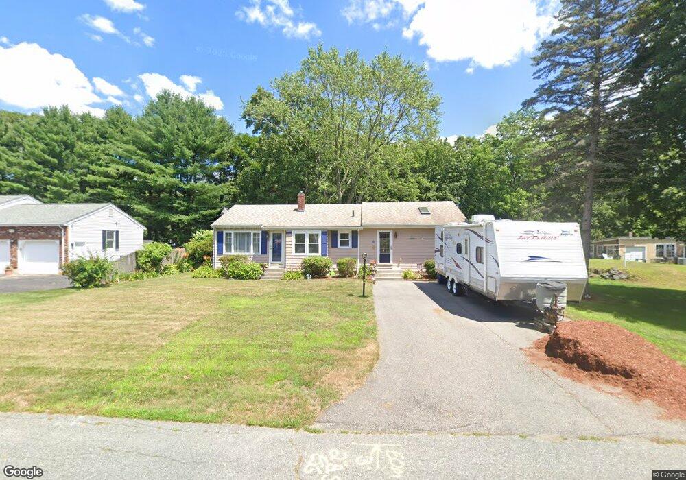
92 Hebron Ave Seekonk, MA 02771
Estimated Value: $450,394 - $531,000
About This Home
This home is located at 92 Hebron Ave, Seekonk, MA 02771 and is currently estimated at $474,599, approximately $390 per square foot. 92 Hebron Ave is a home located in Bristol County with nearby schools including Seekonk High School, St Cecilia School, and Grace Baptist Christian Academy.
Ownership History
We collect this data history from publicly available records. To have your information removed, we recommend requesting removal directly through your county’s website.
Purchase Details
Home Financials for this Owner
Home Financials are based on the most recent Mortgage that was taken out on this home.Home Values in the Area
Average Home Value in this Area
Purchase History
We collect this data history from publicly available records. To have your information removed, we recommend requesting removal directly through your county’s website.
| Date | Buyer | Sale Price | Title Company |
|---|---|---|---|
| $88,000 | -- |
Mortgage History
We collect this data history from publicly available records. To have your information removed, we recommend requesting removal directly through your county’s website.
| Date | Status | Borrower | Loan Amount |
|---|---|---|---|
| Open | $15,000 | ||
| Open | $93,000 | ||
| Closed | $86,623 |
Tax History
We collect this data history from publicly available records. To have your information removed, we recommend requesting removal directly through your county’s website.
| Year | Tax Paid | Tax Assessment Tax Assessment Total Assessment is a certain percentage of the fair market value that is determined by local assessors to be the total taxable value of land and additions on the property. | Land | Improvement |
|---|---|---|---|---|
| 2025 | $4,264 | $345,300 | $160,900 | $184,400 |
| 2024 | $4,131 | $334,500 | $160,900 | $173,600 |
| 2023 | $3,912 | $298,400 | $136,900 | $161,500 |
| 2022 | $3,405 | $269,600 | $131,300 | $138,300 |
| 2021 | $3,405 | $250,900 | $115,100 | $135,800 |
| 2020 | $3,328 | $252,700 | $115,400 | $137,300 |
| 2019 | $3,163 | $242,200 | $110,100 | $132,100 |
| 2018 | $3,103 | $232,400 | $107,100 | $125,300 |
| 2017 | $3,006 | $223,300 | $104,400 | $118,900 |
| 2016 | $2,966 | $221,200 | $104,400 | $116,800 |
| 2015 | $2,908 | $219,800 | $104,400 | $115,400 |
Map
- 206 Burnside Ave
- 152 R Burnside Ave
- 22 Hillcrest Ave
- 67 Cherry Hill Dr
- 144 Burnside Ave
- 2 Burnside Ave
- 5 Robin Hood Dr
- 52 Carpenter St
- 178 Willis Ave
- 160 Willis Ave
- 319 Central Ave
- 34 Oakhill Ave
- 15 Willow Creek Dr
- 1531 County St
- 72 Mayfield St
- 0 Woodland Ave
- 149 Thurber Ave
- 0
- 56 Sims Ave
- 1340 County St
- 104 Hebron Ave
- 103 Hebron Ave
- 100 Oak Hill Ave
- 0 Hebron Ave
- 97 Hebron Ave
- 98 Hebron Ave
- 86 Oakhill Ave
- 111 Oak Hill Ave
- 121 Oak Hill Ave
- 86 Oak Hill Ave
- 97 Oak Hill Ave
- 16 Bourne Ave
- 16 Bourne Ave
- 127 Oak Hill Ave
- 81 Hebron Ave
- 91 Oak Hill Ave
- 91 Oak Hill Ave Unit 1
- 85 Oak Hill Ave
- 72 Hebron Ave
- 85 Oakhill Ave
Ask me questions while you tour the home.