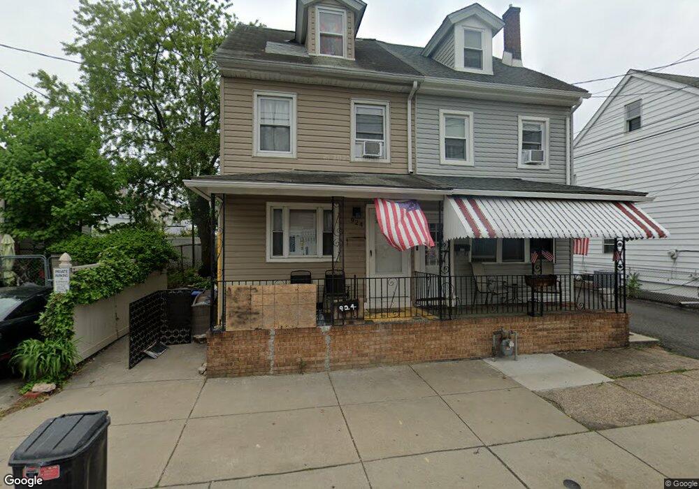
922 Pond St Bristol, PA 19007
Estimated Value: $275,000 - $292,000
Studio
2
Baths
1,365
Sq Ft
$209/Sq Ft
Est. Value
About This Home
This home is located at 922 Pond St, Bristol, PA 19007 and is currently estimated at $285,541, approximately $209 per square foot. 922 Pond St is a home located in Bucks County with nearby schools including Snyder-Girotti Elementary School, Bristol High School, and St. Mark Elementary School.
Ownership History
Date
Name
Owned For
Owner Type
Purchase Details
Closed on
Oct 27, 2006
Sold by
Nicoletti Stephen J
Bought by
Crilly Karen M
Current Estimated Value
Home Financials for this Owner
Home Financials are based on the most recent Mortgage that was taken out on this home.
Original Mortgage
$150,000
Outstanding Balance
$54,728
Interest Rate
6.31%
Mortgage Type
Purchase Money Mortgage
Estimated Equity
$230,813
Purchase Details
Closed on
Jun 3, 1966
Bought by
Nicoletti Elizabeth and Nicoletti Stephen J
Create a Home Valuation Report for This Property
The Home Valuation Report is an in-depth analysis detailing your home's value as well as a comparison with similar homes in the area
Home Values in the Area
Average Home Value in this Area
Purchase History
We collect this data history from publicly available records. To have your information removed, we recommend requesting removal directly through your county’s website.
| Date | Buyer | Sale Price | Title Company |
|---|---|---|---|
| Crilly Karen M | $150,000 | None Available | |
| Nicoletti Elizabeth | -- | -- |
Source: Public Records
Mortgage History
We collect this data history from publicly available records. To have your information removed, we recommend requesting removal directly through your county’s website.
| Date | Status | Borrower | Loan Amount |
|---|---|---|---|
| Open | Crilly Karen M | $150,000 |
Source: Public Records
Tax History
| Year | Tax Paid | Tax Assessment Tax Assessment Total Assessment is a certain percentage of the fair market value that is determined by local assessors to be the total taxable value of land and additions on the property. | Land | Improvement |
|---|---|---|---|---|
| 2025 | $3,167 | $13,600 | $2,640 | $10,960 |
| 2024 | $3,167 | $13,600 | $2,640 | $10,960 |
| 2023 | $3,139 | $13,600 | $2,640 | $10,960 |
| 2022 | $3,139 | $13,600 | $2,640 | $10,960 |
| 2021 | $3,139 | $13,600 | $2,640 | $10,960 |
| 2020 | $3,228 | $13,600 | $2,640 | $10,960 |
| 2019 | $3,214 | $13,600 | $2,640 | $10,960 |
| 2018 | $3,214 | $13,600 | $2,640 | $10,960 |
| 2017 | $3,197 | $13,600 | $2,640 | $10,960 |
| 2016 | $3,197 | $13,600 | $2,640 | $10,960 |
| 2015 | -- | $13,600 | $2,640 | $10,960 |
| 2014 | -- | $13,600 | $2,640 | $10,960 |
Source: Public Records
Map
Nearby Homes
- 418 Jefferson Ave Unit 10
- 420 Lafayette St
- 340 Lincoln Ave
- 368 Dorrance St
- 209 Dorrance St
- 509 Pond St
- 332 Madison St
- 111 Taylor St
- 832 Jefferson Ave
- 323 Walnut St
- 1516 Wilson Ave
- 226 Jackson St
- 916 Jefferson Ave
- 104 Monroe St
- 628 Pine St
- 637 Spruce St
- 793 Route 13
- 210 Pond St
- 256 Hayes St
- 16422 River View Cir
Your Personal Tour Guide
Ask me questions while you tour the home.