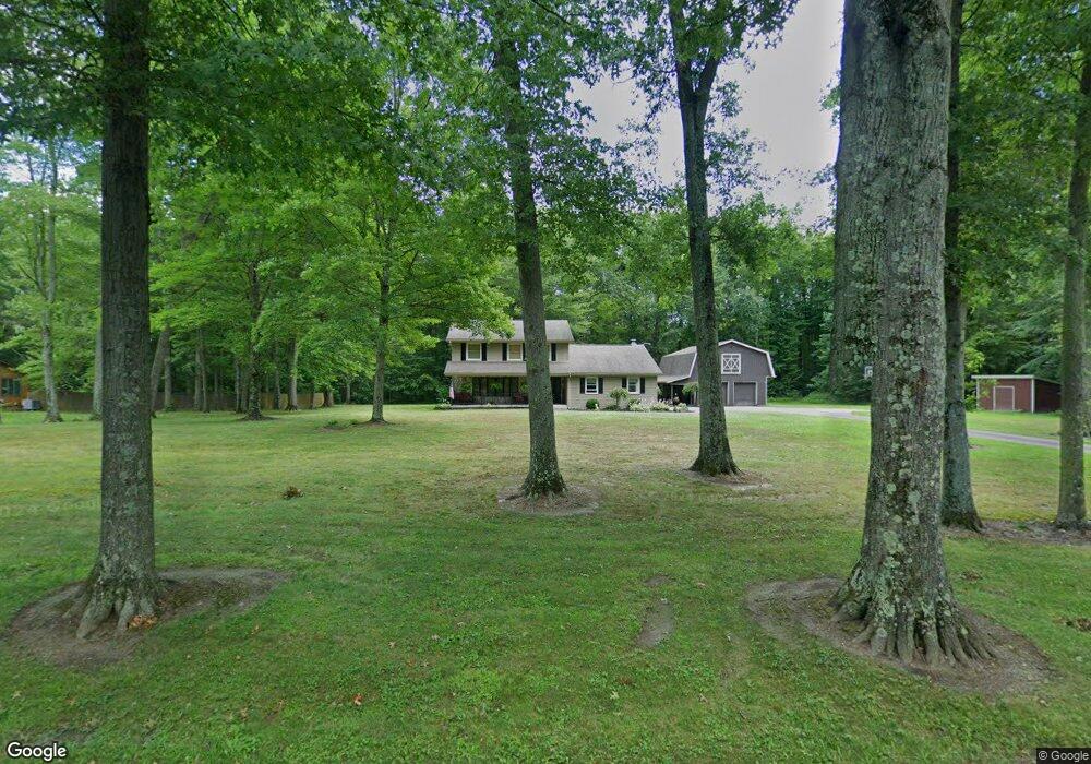
9229 Beloit Snodes Rd North Benton, OH 44449
Estimated Value: $240,000 - $386,000
3
Beds
3
Baths
1,808
Sq Ft
$167/Sq Ft
Est. Value
About This Home
This home is located at 9229 Beloit Snodes Rd, North Benton, OH 44449 and is currently estimated at $301,245, approximately $166 per square foot. 9229 Beloit Snodes Rd is a home located in Mahoning County with nearby schools including West Branch Middle School and West Branch High School.
Ownership History
Date
Name
Owned For
Owner Type
Purchase Details
Closed on
Nov 30, 2004
Sold by
The Provident Bank
Bought by
Mulinix Rick M and Mulinix Angela M
Current Estimated Value
Home Financials for this Owner
Home Financials are based on the most recent Mortgage that was taken out on this home.
Original Mortgage
$98,400
Outstanding Balance
$47,509
Interest Rate
5.71%
Mortgage Type
Purchase Money Mortgage
Estimated Equity
$253,736
Purchase Details
Closed on
Jul 13, 2004
Sold by
Russell Charles J and Russell Maria Lourdes
Bought by
The Provident Bank
Purchase Details
Closed on
Sep 24, 1990
Bought by
Russell Charles J and Russell Maria
Create a Home Valuation Report for This Property
The Home Valuation Report is an in-depth analysis detailing your home's value as well as a comparison with similar homes in the area
Purchase History
| Date | Buyer | Sale Price | Title Company |
|---|---|---|---|
| Mulinix Rick M | $123,000 | -- | |
| The Provident Bank | $169,900 | -- | |
| Russell Charles J | $112,000 | -- |
Source: Public Records
Mortgage History
| Date | Status | Borrower | Loan Amount |
|---|---|---|---|
| Open | Mulinix Rick M | $98,400 | |
| Closed | Mulinix Rick M | $12,300 |
Source: Public Records
Tax History
| Year | Tax Paid | Tax Assessment Tax Assessment Total Assessment is a certain percentage of the fair market value that is determined by local assessors to be the total taxable value of land and additions on the property. | Land | Improvement |
|---|---|---|---|---|
| 2025 | $2,497 | $69,350 | $5,660 | $63,690 |
| 2024 | $2,497 | $69,350 | $5,660 | $63,690 |
| 2023 | $2,450 | $68,990 | $5,300 | $63,690 |
| 2022 | $2,018 | $51,370 | $4,530 | $46,840 |
| 2021 | $2,021 | $51,370 | $4,530 | $46,840 |
| 2020 | $2,041 | $51,370 | $4,530 | $46,840 |
| 2019 | $1,821 | $43,560 | $4,530 | $39,030 |
| 2018 | $1,812 | $43,560 | $4,530 | $39,030 |
| 2017 | $1,809 | $43,560 | $4,530 | $39,030 |
| 2016 | $1,746 | $42,370 | $4,550 | $37,820 |
| 2015 | $1,693 | $42,370 | $4,550 | $37,820 |
| 2014 | $1,702 | $42,370 | $4,550 | $37,820 |
| 2013 | $1,684 | $42,370 | $4,550 | $37,820 |
Source: Public Records
Map
Nearby Homes
- 105 Hartzell Rd
- 10745 Leffingwell Rd
- 208 State Route 14
- 10024 Cummins Ln
- 11488 N 12th St
- 8820 Cook Rd
- 15938 W South Range Rd
- 717 Bandy Rd
- 18262 W Pine Lake Rd
- 1071 State Route 14
- 945 N 12th St
- 0 W Nevada Ave Unit 5181868
- 14355 W Middletown Rd
- 155 E Michigan Ave
- 166 E Michigan Ave
- 57 Redwood St
- 345 E Indiana Ave
- 18280 5th St
- 125 E Indiana Ave
- 14665 W Akron Canfield Rd
- 9157 Beloit Snodes Rd
- 9097 Beloit Snodes Rd
- 17997 Western Reserve Rd
- 17929 Western Reserve Rd
- 17901 Western Reserve Rd
- 18050 Western Reserve Rd
- 18000 Western Reserve Rd
- 0 Western Reserve Rd Unit 3866242
- 0 Western Reserve Rd Unit 1020153
- 17930 Western Reserve Rd
- 18440 Western Reserve Rd
- 18370 Western Reserve Rd
- 8975 Bedell Rd
- 8828 Bedell Rd
- 18391 State Route 14
- 18333 State Route 14
- 18443 State Route 14
- 18510 State Route 14
- 8789 Bedell Rd
- 8708 Bedell Rd
Your Personal Tour Guide
Ask me questions while you tour the home.