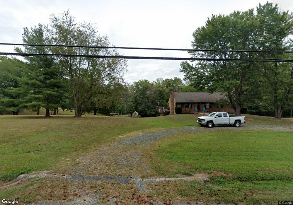
928 High Peak Rd Monroe, VA 24574
Estimated Value: $307,910 - $425,000
3
Beds
2
Baths
1,708
Sq Ft
$217/Sq Ft
Est. Value
About This Home
This home is located at 928 High Peak Rd, Monroe, VA 24574 and is currently estimated at $369,970, approximately $216 per square foot. 928 High Peak Rd is a home located in Amherst County with nearby schools including Elon Elementary School, Monelison Middle School, and Amherst County High School.
Ownership History
Date
Name
Owned For
Owner Type
Purchase Details
Closed on
Sep 1, 2022
Sold by
Kieras Robert A and Kieras Barbara L
Bought by
Moyer Scott
Current Estimated Value
Purchase Details
Closed on
Nov 9, 2021
Sold by
Roche Iii Richard M
Bought by
Fitzpatrick Carolyn P and Fitzpatrick James E
Create a Home Valuation Report for This Property
The Home Valuation Report is an in-depth analysis detailing your home's value as well as a comparison with similar homes in the area
Purchase History
We collect this data history from publicly available records. To have your information removed, we recommend requesting removal directly through your county’s website.
| Date | Buyer | Sale Price | Title Company |
|---|---|---|---|
| Moyer Scott | -- | -- | |
| Fitzpatrick Carolyn P | $38,000 | None Listed On Document |
Source: Public Records
Tax History
| Year | Tax Paid | Tax Assessment Tax Assessment Total Assessment is a certain percentage of the fair market value that is determined by local assessors to be the total taxable value of land and additions on the property. | Land | Improvement |
|---|---|---|---|---|
| 2026 | $1,878 | $307,800 | $44,500 | $263,300 |
| 2025 | $1,131 | $185,400 | $37,000 | $148,400 |
| 2024 | $1,131 | $185,400 | $37,000 | $148,400 |
| 2023 | $1,131 | $185,400 | $37,000 | $148,400 |
| 2022 | $1,131 | $186,100 | $37,000 | $149,100 |
| 2021 | $1,119 | $183,400 | $37,000 | $146,400 |
| 2020 | $1,119 | $183,400 | $37,000 | $146,400 |
| 2019 | $1,092 | $179,000 | $43,000 | $136,000 |
| 2018 | $1,092 | $179,000 | $43,000 | $136,000 |
| 2017 | $578 | $179,000 | $43,000 | $136,000 |
| 2016 | $1,092 | $179,000 | $43,000 | $136,000 |
| 2015 | $249 | $179,000 | $43,000 | $136,000 |
| 2014 | $395 | $179,000 | $43,000 | $136,000 |
Source: Public Records
Map
Nearby Homes
- 197 Burford Farm Rd
- 216 Burford Farm Rd
- 1249 Cedar Gate Rd
- 1285 Cedar Gate Rd
- 893 Cedar Gate Rd
- 424 Father Judge Rd
- 240 Ned Brown Rd
- 129 Ned Brown Rd
- 1481 Winesap Rd
- 117 Monroe St
- 111 Partridge Place
- 134 Hunt Club Dr
- 122 Brooks St
- 126 Rothwood Rd
- 123 Lynchburg Ave
- 270 Rothwood Rd
- 124-138 Cedar Gate Rd
- 109 Cedar Gate Rd
- 0 S Amherst Hwy Unit 336267
- 0 Rothwood Rd
- 914 High Peak Rd
- 1250 High Peak Rd
- 942 High Peak Rd
- 114 Macon Ln
- 114 Burford Farm Rd
- 892 High Peak Rd
- 961 High Peak Rd
- 907 High Peak Rd
- 895 High Peak Rd
- 966 High Peak Rd
- 971 High Peak Rd
- 138 Macon Ln
- 152 Burford Farm Rd
- 877 High Peak Rd
- 872 High Peak Rd
- 145 Burford Farm Rd
- 147 Macon Ln
- 858 High Peak Rd
- 156 Macon Ln
- 997 High Peak Rd
Your Personal Tour Guide
Ask me questions while you tour the home.