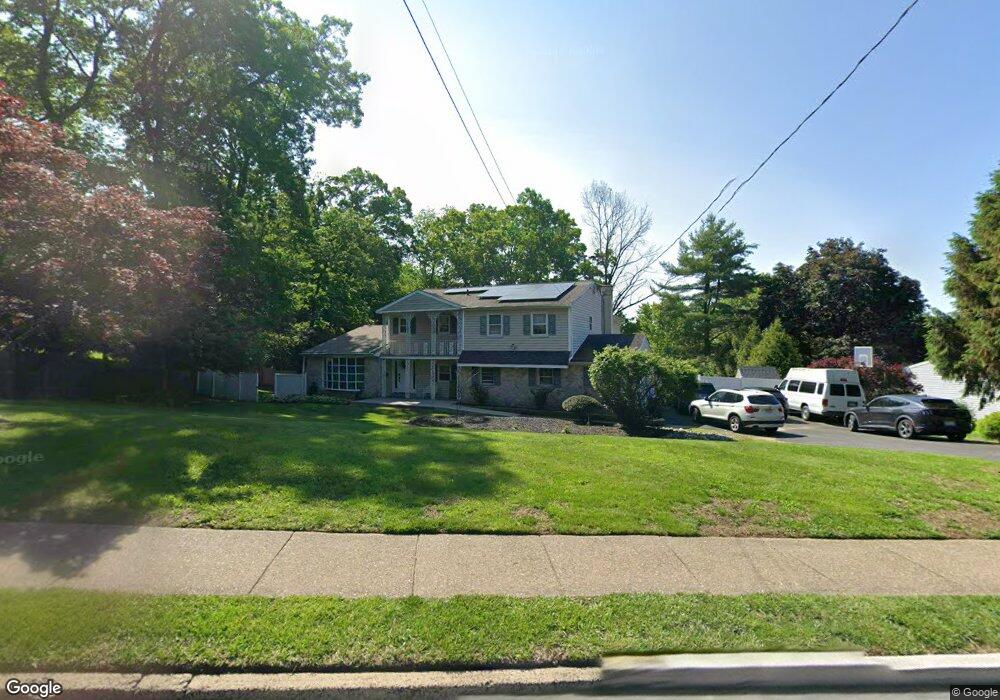
929 Twining Rd Dresher, PA 19025
Estimated Value: $681,000 - $823,000
About This Home
This home is located at 929 Twining Rd, Dresher, PA 19025 and is currently estimated at $762,563, approximately $261 per square foot. 929 Twining Rd is a home located in Montgomery County with nearby schools including Thomas Fitzwater Elementary School, Sandy Run Middle School, and Upper Dublin High School.
Ownership History
We collect this data history from publicly available records. To have your information removed, we recommend requesting removal directly through your county’s website.
Purchase Details
Home Financials for this Owner
Home Financials are based on the most recent Mortgage that was taken out on this home.Purchase Details
Home Values in the Area
Average Home Value in this Area
Purchase History
We collect this data history from publicly available records. To have your information removed, we recommend requesting removal directly through your county’s website.
| Date | Buyer | Sale Price | Title Company |
|---|---|---|---|
| $370,000 | None Available | ||
| -- | -- |
Mortgage History
We collect this data history from publicly available records. To have your information removed, we recommend requesting removal directly through your county’s website.
| Date | Status | Borrower | Loan Amount |
|---|---|---|---|
| Open | $33,000 |
Tax History
We collect this data history from publicly available records. To have your information removed, we recommend requesting removal directly through your county’s website.
| Year | Tax Paid | Tax Assessment Tax Assessment Total Assessment is a certain percentage of the fair market value that is determined by local assessors to be the total taxable value of land and additions on the property. | Land | Improvement |
|---|---|---|---|---|
| 2026 | $12,038 | $228,490 | -- | -- |
| 2025 | $11,142 | $228,490 | -- | -- |
| 2024 | $11,142 | $228,490 | -- | -- |
| 2023 | $10,166 | $213,470 | $54,020 | $159,450 |
| 2022 | $9,945 | $213,470 | $54,020 | $159,450 |
| 2021 | $9,697 | $213,470 | $54,020 | $159,450 |
| 2020 | $9,417 | $213,470 | $54,020 | $159,450 |
| 2019 | $9,260 | $213,470 | $54,020 | $159,450 |
| 2018 | $9,259 | $213,470 | $54,020 | $159,450 |
| 2017 | $8,922 | $213,470 | $54,020 | $159,450 |
| 2016 | $8,838 | $213,470 | $54,020 | $159,450 |
| 2015 | $8,349 | $213,470 | $54,020 | $159,450 |
| 2014 | $8,349 | $213,470 | $54,020 | $159,450 |
Map
- 1001 Windsor Ave
- 1905 Limekiln Pike
- 1975 Audubon Dr
- 214 Brookdale Ct
- 401 Woodside Cir Unit 31
- 142 Green Valley Cir
- 533 Martin Ln
- 1780 S Limekiln Pike
- 795 N Hills Ave
- 2972 Madison Ave
- 203 Dresher Woods Dr
- 2001 Hyview Terrace
- 563 Applewood Dr
- 1317 Fitzwatertown Rd
- 1223 Boone Ave
- 1214 Hall Ave
- 851 Maple Ave
- 1431 Dreshertown Rd Unit 11
- 2845 Turner Ave
- 1346 Clarke Rd
- 925 Twining Rd
- 3278 Lenape Dr
- 3263 Pebblewood Ln
- 3274 Lenape Dr
- 928 Twining Rd
- 932 Twining Rd
- 3259 Pebblewood Ln
- 3270 Lenape Dr
- 921 Twining Rd
- 3301 Jeffrey Dr
- 3267 Pebblewood Ln
- 936 Twining Rd
- 0000-B Windsor Ave
- 0000-A Windsor Ave
- 3266 Lenape Dr
- 1001 Twining Rd
- 3277 Lenape Dr
- 3305 Jeffrey Dr
- 3301 Craig y Nos Ave
- 3255 Pebblewood Ln
Ask me questions while you tour the home.