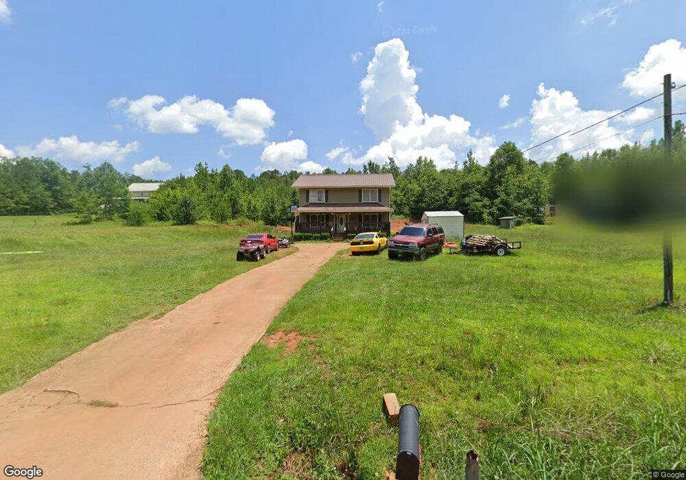
93 Murphy Rd Lagrange, GA 30240
Estimated Value: $223,554 - $273,000
3
Beds
2
Baths
1,980
Sq Ft
$125/Sq Ft
Est. Value
About This Home
This home is located at 93 Murphy Rd, Lagrange, GA 30240 and is currently estimated at $248,389, approximately $125 per square foot. 93 Murphy Rd is a home located in Troup County with nearby schools including Whitesville Road Elementary School, Berta Weathersbee Elementary School, and Rosemont Elementary School.
Ownership History
Date
Name
Owned For
Owner Type
Purchase Details
Closed on
Jun 5, 2024
Sold by
Rhodes Jerry Lynn
Bought by
Foy Crystal Rhodes and Rhodes Crystal Pike
Current Estimated Value
Purchase Details
Closed on
Nov 30, 2009
Sold by
Spencers Way
Bought by
Rhodes Jerry Lynn
Home Financials for this Owner
Home Financials are based on the most recent Mortgage that was taken out on this home.
Original Mortgage
$109,900
Interest Rate
5.01%
Mortgage Type
New Conventional
Purchase Details
Closed on
Feb 17, 2004
Bought by
Spencers Way Llc
Create a Home Valuation Report for This Property
The Home Valuation Report is an in-depth analysis detailing your home's value as well as a comparison with similar homes in the area
Purchase History
| Date | Buyer | Sale Price | Title Company |
|---|---|---|---|
| Foy Crystal Rhodes | -- | -- | |
| Rhodes Jerry Lynn | $119,900 | -- | |
| Rhodes Jerry Lynn | $119,900 | -- | |
| Spencers Way Llc | -- | -- |
Source: Public Records
Mortgage History
| Date | Status | Borrower | Loan Amount |
|---|---|---|---|
| Previous Owner | Rhodes Jerry Lynn | $109,900 |
Source: Public Records
Tax History
| Year | Tax Paid | Tax Assessment Tax Assessment Total Assessment is a certain percentage of the fair market value that is determined by local assessors to be the total taxable value of land and additions on the property. | Land | Improvement |
|---|---|---|---|---|
| 2025 | $1,792 | $71,200 | $5,400 | $65,800 |
| 2024 | $1,607 | $60,920 | $5,000 | $55,920 |
| 2023 | $1,559 | $59,160 | $5,000 | $54,160 |
| 2022 | $1,495 | $55,560 | $5,000 | $50,560 |
| 2021 | $1,156 | $40,320 | $3,600 | $36,720 |
| 2020 | $1,156 | $40,320 | $3,600 | $36,720 |
| 2019 | $1,198 | $41,720 | $3,600 | $38,120 |
| 2018 | $1,093 | $38,240 | $3,600 | $34,640 |
| 2017 | $1,093 | $38,240 | $3,600 | $34,640 |
| 2016 | $1,067 | $37,371 | $3,600 | $33,771 |
| 2015 | $1,069 | $37,371 | $3,600 | $33,771 |
| 2014 | $1,017 | $35,594 | $3,600 | $31,994 |
| 2013 | -- | $38,027 | $3,600 | $34,427 |
Source: Public Records
Map
Nearby Homes
- 620 Old Hutchinson Mill Rd
- 1688 Bartley Rd
- 3913 Whitesville Rd
- 11.59+/- AC Hunt Rd
- 143 Willis Cir
- 209 Grace Ct
- 312 Lana Ln
- 557 Lago Ct
- 130 Hamilton Lake Dr
- 241 Rooker Dr
- 243 Rooker Dr
- 235 Rooker Dr
- 233 Rooker Dr
- 239 Rooker Dr
- 231 Rooker Dr
- 212 Rooker Dr
- 214 Rooker Dr
- 216 Rooker Dr
- 501 Lago Ct
- 226 Rooker Dr
- 123 Murphy Rd
- 89 Murphy Rd
- 143 Murphy Rd
- 173 Murphy Rd
- 211 Murphy Rd
- 231 Murphy Rd
- 0 Murphy Rd Unit 8367454
- 0 Murphy Rd Unit 298&292 8139952
- 0 Murphy Rd Unit 7086479
- 263 Murphy Rd
- 3286 Whitesville Rd
- 3288 Whitesville Rd
- 3290 Whitesville Rd
- 292 Murphy Rd
- 2964 Whitesville Rd
- 3342 Whitesville Rd
- 3167 Whitesville Rd
- 295 Murphy Rd
- 298 Murphy Rd
- 298 Murphy Rd
Your Personal Tour Guide
Ask me questions while you tour the home.