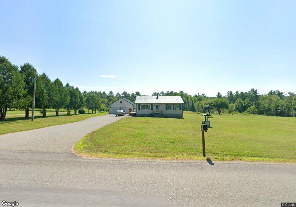
93 Sampson Rd Windsor, ME 04363
Estimated Value: $234,866 - $386,000
2
Beds
2
Baths
752
Sq Ft
$385/Sq Ft
Est. Value
About This Home
This home is located at 93 Sampson Rd, Windsor, ME 04363 and is currently estimated at $289,217, approximately $384 per square foot. 93 Sampson Rd is a home with nearby schools including Windsor Elementary School.
Create a Home Valuation Report for This Property
The Home Valuation Report is an in-depth analysis detailing your home's value as well as a comparison with similar homes in the area
Home Values in the Area
Average Home Value in this Area
Tax History
We collect this data history from publicly available records. To have your information removed, we recommend requesting removal directly through your county’s website.
| Year | Tax Paid | Tax Assessment Tax Assessment Total Assessment is a certain percentage of the fair market value that is determined by local assessors to be the total taxable value of land and additions on the property. | Land | Improvement |
|---|---|---|---|---|
| 2025 | $2,139 | $227,500 | $38,700 | $188,800 |
| 2024 | $2,093 | $227,500 | $38,700 | $188,800 |
| 2023 | $1,760 | $121,400 | $20,400 | $101,000 |
| 2022 | $1,663 | $121,400 | $20,400 | $101,000 |
| 2021 | $1,578 | $121,400 | $20,400 | $101,000 |
| 2020 | $1,554 | $121,400 | $20,400 | $101,000 |
| 2019 | $6,345 | $121,400 | $20,400 | $101,000 |
| 2018 | $1,566 | $121,400 | $20,400 | $101,000 |
| 2017 | $5,709 | $121,400 | $20,400 | $101,000 |
| 2016 | $1,542 | $121,400 | $20,400 | $101,000 |
| 2015 | $1,434 | $120,500 | $20,400 | $100,100 |
| 2014 | $1,567 | $120,500 | $20,400 | $100,100 |
| 2013 | $1,591 | $120,500 | $20,400 | $100,100 |
Source: Public Records
Map
Nearby Homes
- 1008 S Belfast Rd
- 122 Greeley Rd
- Lot 5 Greeley Rd
- Lot 4 Savade Pond Way Greeley Rd
- Lot 3 Savade Pond Way
- Lot 2 Savade Pond Way
- Lot 1 Savade Pond Way
- Lot 5 Woody Ln
- Lot 3 Woody Ln
- Lot 2 Woody Ln
- Lot 1 Woody Ln
- 62 Crosby Rd
- 216 Windsor Neck Rd
- Lot 38-D Choate Rd
- 753 Ridge Rd
- 38 Deer Ridge Ln
- 824 Ridge Rd
- 6 Shuman Rd
- 20 Pitt Rd
- 5 Pinewood Dr
- 101 Sampson Rd
- 92 Sampson Rd
- 0 Sampson Rd Unit RD
- 117 Sampson Rd
- 118 Sampson Rd
- 22 Trevors Way
- 63 Sampson Rd
- 154 Sampson Rd
- Lot 11 Sampson Rd
- 14 Sampson Rd
- 944 S Belfast Rd
- Lot 10 Sampson Rd
- 200 Sampson Rd
- 1 Sampson Rd
- 960 S Belfast Rd
- 951 S Belfast Rd
- 936 S Belfast Rd
- TBD S Belfast Ave
- 1008 S Belfast Rd
- 7 Coopers Mills Rd
Your Personal Tour Guide
Ask me questions while you tour the home.