Estimated Value: $177,167 - $251,000
3
Beds
2
Baths
1,050
Sq Ft
$201/Sq Ft
Est. Value
About This Home
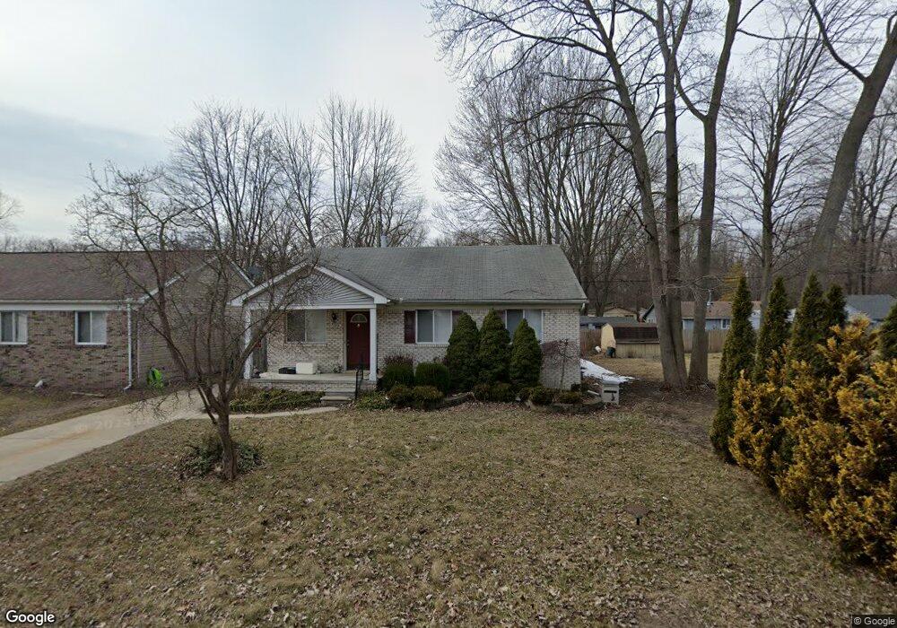
This home is located at 9314 Maple Rd, Clay, MI 48001 and is currently estimated at $210,542, approximately $200 per square foot. 9314 Maple Rd is a home located in St. Clair County.
Ownership History
Date
Name
Owned For
Owner Type
Purchase Details
Closed on
Jul 29, 2021
Sold by
Devuyst Ronald J and Devuyst Carol A
Bought by
Devuyst Donavon
Current Estimated Value
Purchase Details
Closed on
Apr 29, 2014
Sold by
Devuyst Donavon
Bought by
Devuyst Ronald J and Devuyst Carol A
Purchase Details
Closed on
Apr 1, 2005
Sold by
Devuyst Ronald J and Devuyst Carol A
Bought by
Devnyst Ronald J and Devnyst Carol A
Home Financials for this Owner
Home Financials are based on the most recent Mortgage that was taken out on this home.
Original Mortgage
$240,000
Interest Rate
5.88%
Mortgage Type
Future Advance Clause Open End Mortgage
Create a Home Valuation Report for This Property
The Home Valuation Report is an in-depth analysis detailing your home's value as well as a comparison with similar homes in the area
Home Values in the Area
Average Home Value in this Area
Purchase History
| Date | Buyer | Sale Price | Title Company |
|---|---|---|---|
| Devuyst Donavon | -- | None Available | |
| Devuyst Ronald J | -- | None Available | |
| Devnyst Ronald J | -- | None Available | |
| Devuyst Ronald J | -- | None Available |
Source: Public Records
Mortgage History
| Date | Status | Borrower | Loan Amount |
|---|---|---|---|
| Closed | Devuyst Ronald J | $240,000 |
Source: Public Records
Tax History
| Year | Tax Paid | Tax Assessment Tax Assessment Total Assessment is a certain percentage of the fair market value that is determined by local assessors to be the total taxable value of land and additions on the property. | Land | Improvement |
|---|---|---|---|---|
| 2025 | $730 | $76,900 | $0 | $0 |
| 2024 | $716 | $71,800 | $0 | $0 |
| 2023 | $690 | $67,700 | $0 | $0 |
| 2022 | $1,283 | $62,300 | $0 | $0 |
| 2020 | $1,213 | $56,700 | $56,700 | $0 |
| 2019 | $1,193 | $50,400 | $0 | $0 |
| 2018 | $1,174 | $41,300 | $0 | $0 |
| 2017 | $1,084 | $40,100 | $0 | $0 |
| 2016 | $566 | $40,100 | $0 | $0 |
| 2015 | -- | $37,600 | $37,600 | $0 |
| 2014 | -- | $29,200 | $29,200 | $0 |
| 2013 | -- | $28,800 | $0 | $0 |
Source: Public Records
Map
Nearby Homes
- 9399 Oakdale St
- 9309 Oakdale
- 9279 Oakdale St
- 24 Vacant Lots Land
- 9665 River St
- 9084 Island Dr
- 3202 Fruit St
- 0000 Taft Rd
- 00 Taft Rd
- 00 Dickinson Island
- 2435 Fruit St
- 407-425 N Channel Dr
- 00000 N Channel Dr
- 00 N Channel Dr
- 9658 Seaway Dr Unit 91
- 9634 Seaway Dr Unit 38
- 5966 Starboard Ct Unit 284
- 9642 Nook Rd Unit 7
- 9761 Marina Cir Unit 292
- 1103 Beth Ct
Your Personal Tour Guide
Ask me questions while you tour the home.