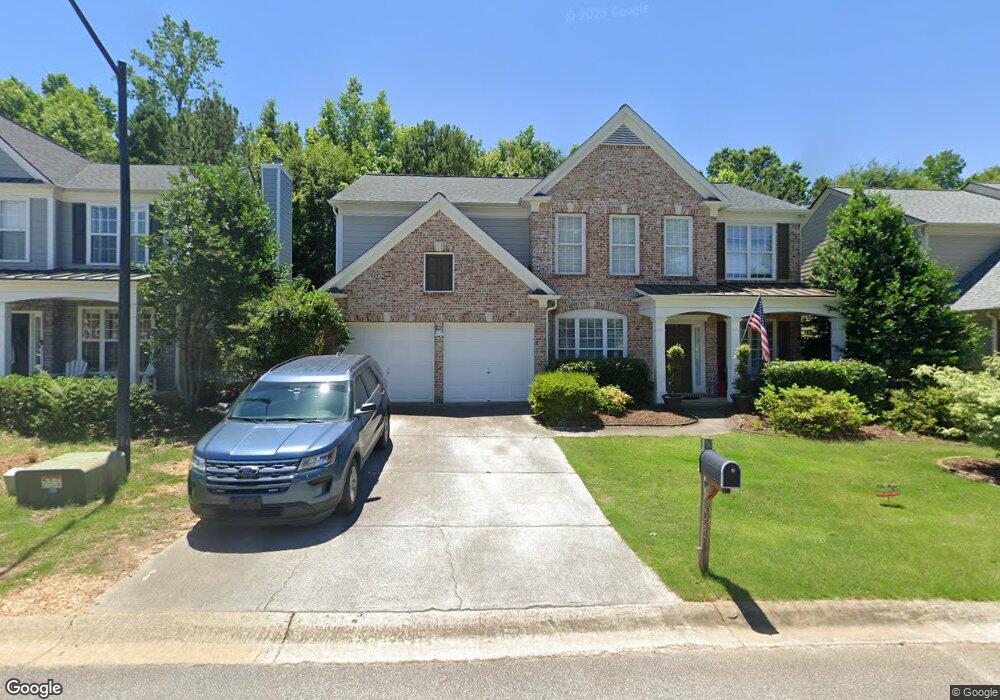
933 Bendleton Dr Woodstock, GA 30188
Estimated Value: $547,770 - $551,000
4
Beds
3
Baths
2,363
Sq Ft
$232/Sq Ft
Est. Value
About This Home
This home is located at 933 Bendleton Dr, Woodstock, GA 30188 and is currently estimated at $549,385, approximately $232 per square foot. 933 Bendleton Dr is a home located in Cherokee County with nearby schools including Little River Elementary, Mill Creek Middle School, and River Ridge High School.
Ownership History
Date
Name
Owned For
Owner Type
Purchase Details
Closed on
Oct 23, 2005
Sold by
Quinn Christian S and Quinn Holly
Bought by
Quinn Christian S and Quinn Holly
Current Estimated Value
Home Financials for this Owner
Home Financials are based on the most recent Mortgage that was taken out on this home.
Original Mortgage
$20,000
Outstanding Balance
$6,253
Interest Rate
5.9%
Mortgage Type
New Conventional
Estimated Equity
$543,132
Purchase Details
Closed on
Oct 30, 2003
Sold by
Pulte Home Corp
Bought by
Rabourn Holly L
Home Financials for this Owner
Home Financials are based on the most recent Mortgage that was taken out on this home.
Original Mortgage
$30,472
Interest Rate
5.09%
Mortgage Type
New Conventional
Create a Home Valuation Report for This Property
The Home Valuation Report is an in-depth analysis detailing your home's value as well as a comparison with similar homes in the area
Home Values in the Area
Average Home Value in this Area
Purchase History
| Date | Buyer | Sale Price | Title Company |
|---|---|---|---|
| Quinn Christian S | -- | -- | |
| Rabourn Holly L | $202,600 | -- |
Source: Public Records
Mortgage History
| Date | Status | Borrower | Loan Amount |
|---|---|---|---|
| Open | Quinn Christian S | $20,000 | |
| Open | Quinn Christian S | $192,000 | |
| Previous Owner | Rabourn Holly L | $30,472 | |
| Previous Owner | Rabourn Holly L | $162,032 |
Source: Public Records
Tax History
| Year | Tax Paid | Tax Assessment Tax Assessment Total Assessment is a certain percentage of the fair market value that is determined by local assessors to be the total taxable value of land and additions on the property. | Land | Improvement |
|---|---|---|---|---|
| 2025 | $6,356 | $222,252 | $44,000 | $178,252 |
| 2024 | $5,884 | $207,556 | $44,000 | $163,556 |
| 2023 | $1,024 | $189,624 | $38,800 | $150,824 |
| 2022 | $4,558 | $155,488 | $31,600 | $123,888 |
| 2021 | $3,314 | $131,716 | $28,000 | $103,716 |
| 2020 | $3,860 | $121,200 | $25,600 | $95,600 |
| 2019 | $3,011 | $119,760 | $25,600 | $94,160 |
| 2018 | $2,910 | $114,920 | $24,000 | $90,920 |
| 2017 | $2,788 | $273,200 | $24,000 | $85,280 |
| 2016 | $2,735 | $265,600 | $22,400 | $83,840 |
| 2015 | $2,607 | $251,000 | $18,000 | $82,400 |
| 2014 | $2,445 | $234,900 | $18,000 | $75,960 |
Source: Public Records
Map
Nearby Homes
- 308 Montgomery Way
- 215 Cornerstone Dr
- 220 Revillion Way
- 153 Towey Trail
- 215 Revillion Way
- 503 Azalea Ct
- 307 Cornerstone Trace
- 140 Apple Valley Dr
- 139 Susobell Place
- 230 Apple Branch Dr
- 324 Village Cir
- 224 Apple Branch Dr
- 206 Village Square Dr Unit 710
- 142 Weatherstone Square Dr
- 308 Balaban Cir
- 132 Churchcliff Dr
- 502 Oxeye Dr
- 200 Persimmon Trail
- 226 Sumac Trail
- 175 Regent Place
- 935 Bendleton Dr
- 931 Bendleton Dr
- 937 Bendleton Dr
- 929 Bendleton Dr
- 927 Bendleton Dr
- 932 Bendleton Dr
- 930 Bendleton Dr
- 934 Bendleton Dr
- 928 Bendleton Dr
- 925 Bendleton Dr
- 926 Bendleton Dr Unit 514
- 926 Bendleton Dr
- 936 Bendleton Dr
- 0 Ragsdale Terrace Unit 8518670
- 0 Ragsdale Terrace
- 923 Bendleton Dr
- 941 Bendleton Dr
- 924 Bendleton Dr
- 121 Towey Trail
- 119 Towey Trail
Your Personal Tour Guide
Ask me questions while you tour the home.