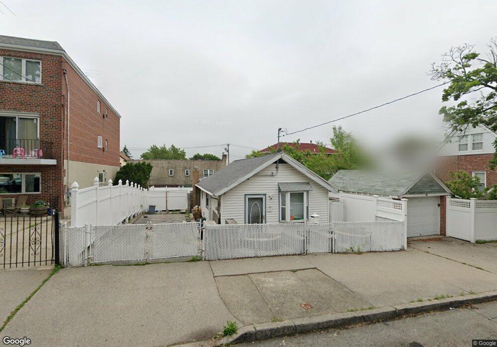
933 Calhoun Ave Bronx, NY 10465
Throgs Neck-Edgewater Park NeighborhoodEstimated Value: $448,000 - $641,000
Studio
--
Bath
684
Sq Ft
$753/Sq Ft
Est. Value
About This Home
This home is located at 933 Calhoun Ave, Bronx, NY 10465 and is currently estimated at $515,281, approximately $753 per square foot. 933 Calhoun Ave is a home located in Bronx County with nearby schools including P.S. 14 Senator John Calandra, Herbert H Lehman High School, and St Benedict School.
Ownership History
Date
Name
Owned For
Owner Type
Purchase Details
Closed on
Apr 24, 2000
Sold by
First Home Properties Corp
Bought by
Rivera Samuel
Current Estimated Value
Home Financials for this Owner
Home Financials are based on the most recent Mortgage that was taken out on this home.
Original Mortgage
$197,395
Interest Rate
7.69%
Mortgage Type
FHA
Purchase Details
Closed on
Mar 29, 2000
Sold by
Federal National Mortgage Association
Bought by
First Home Properties Corp
Home Financials for this Owner
Home Financials are based on the most recent Mortgage that was taken out on this home.
Original Mortgage
$197,395
Interest Rate
7.69%
Mortgage Type
FHA
Create a Home Valuation Report for This Property
The Home Valuation Report is an in-depth analysis detailing your home's value as well as a comparison with similar homes in the area
Home Values in the Area
Average Home Value in this Area
Purchase History
We collect this data history from publicly available records. To have your information removed, we recommend requesting removal directly through your county’s website.
| Date | Buyer | Sale Price | Title Company |
|---|---|---|---|
| Rivera Samuel | $200,000 | Fidelity National Title Ins | |
| First Home Properties Corp | $136,000 | Fidelity National Title Ins |
Source: Public Records
Mortgage History
We collect this data history from publicly available records. To have your information removed, we recommend requesting removal directly through your county’s website.
| Date | Status | Borrower | Loan Amount |
|---|---|---|---|
| Previous Owner | Rivera Samuel | $197,395 |
Source: Public Records
Tax History
| Year | Tax Paid | Tax Assessment Tax Assessment Total Assessment is a certain percentage of the fair market value that is determined by local assessors to be the total taxable value of land and additions on the property. | Land | Improvement |
|---|---|---|---|---|
| 2026 | $4,192 | $23,628 | $8,751 | $14,877 |
| 2025 | $3,950 | $22,291 | $7,381 | $14,910 |
| 2024 | $3,950 | $21,064 | $7,840 | $13,224 |
| 2023 | $3,751 | $19,872 | $6,356 | $13,516 |
| 2022 | $3,459 | $26,940 | $9,000 | $17,940 |
| 2021 | $3,841 | $28,260 | $9,000 | $19,260 |
| 2020 | $3,636 | $31,200 | $9,000 | $22,200 |
| 2019 | $3,379 | $25,140 | $9,000 | $16,140 |
| 2018 | $3,078 | $16,560 | $8,308 | $8,252 |
| 2017 | $3,061 | $16,488 | $7,086 | $9,402 |
| 2016 | $2,970 | $16,408 | $7,573 | $8,835 |
| 2015 | $1,656 | $15,480 | $10,020 | $5,460 |
| 2014 | $1,656 | $14,628 | $8,948 | $5,680 |
Source: Public Records
Map
Nearby Homes
- 1015 Revere Ave
- 1039 Calhoun Ave
- 1062 Calhoun Ave
- 2864 Bruckner Blvd
- 836 Revere Ave
- 815 Quincy Ave
- 934 Balcom Ave
- 812 Swinton Ave
- 1049 Huntington Ave
- 836 Edison Ave
- 755 Quincy Ave
- 754 Calhoun Ave
- 750 Swinton Ave
- 2955 Philip Ave
- 769 Edison Ave
- 717 Calhoun Ave
- 820 Hollywood Ave
- 822 Hollywood Ave
- 2910 Baisley Ave
- 725 Logan Ave
- 931 Calhoun Ave
- 931 Calhoun Ave Unit 1
- 2838 Barkley Ave
- 2834 Barkley Ave
- 929 Calhoun Ave
- 947 Calhoun Ave
- 2830 Barkley Ave
- 938 Quincy Ave
- 925 Calhoun Ave
- 932 Quincy Ave
- 928 Quincy Ave
- 2828 Barkley Ave
- 940 Calhoun Ave
- 926 Quincy Ave
- 2826 Barkley Ave
- 936 Calhoun Ave
- 944 Calhoun Ave
- 934 Calhoun Ave
- 924 Quincy Ave
- 923 Calhoun Ave
Your Personal Tour Guide
Ask me questions while you tour the home.