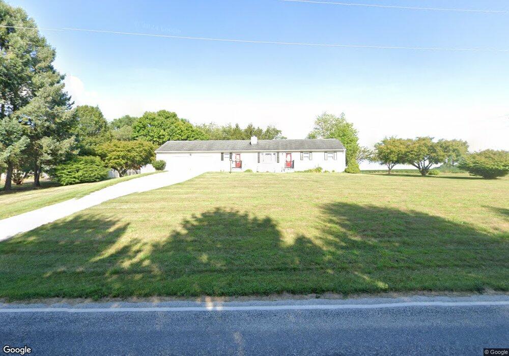
935 Bollinger Rd Unit 1 Littlestown, PA 17340
Estimated Value: $309,288 - $444,000
3
Beds
2
Baths
1,566
Sq Ft
$238/Sq Ft
Est. Value
About This Home
This home is located at 935 Bollinger Rd Unit 1, Littlestown, PA 17340 and is currently estimated at $372,822, approximately $238 per square foot. 935 Bollinger Rd Unit 1 is a home located in Adams County with nearby schools including Rolling Acres El School, Maple Avenue Middle School, and Littlestown Senior High School.
Ownership History
Date
Name
Owned For
Owner Type
Purchase Details
Closed on
Aug 13, 2010
Sold by
Pazdziorko Timothy and Lee Kelley A
Bought by
Starner Robert L and Starner Diana J
Current Estimated Value
Home Financials for this Owner
Home Financials are based on the most recent Mortgage that was taken out on this home.
Original Mortgage
$137,000
Outstanding Balance
$90,981
Interest Rate
4.63%
Mortgage Type
New Conventional
Estimated Equity
$281,841
Create a Home Valuation Report for This Property
The Home Valuation Report is an in-depth analysis detailing your home's value as well as a comparison with similar homes in the area
Purchase History
| Date | Buyer | Sale Price | Title Company |
|---|---|---|---|
| Starner Robert L | $215,000 | -- |
Source: Public Records
Mortgage History
| Date | Status | Borrower | Loan Amount |
|---|---|---|---|
| Open | Starner Robert L | $137,000 |
Source: Public Records
Tax History
| Year | Tax Paid | Tax Assessment Tax Assessment Total Assessment is a certain percentage of the fair market value that is determined by local assessors to be the total taxable value of land and additions on the property. | Land | Improvement |
|---|---|---|---|---|
| 2025 | $3,350 | $177,000 | $34,800 | $142,200 |
| 2024 | $3,203 | $177,000 | $34,800 | $142,200 |
| 2023 | $3,139 | $177,000 | $34,800 | $142,200 |
| 2022 | $3,138 | $177,000 | $34,800 | $142,200 |
| 2021 | $3,027 | $177,000 | $34,800 | $142,200 |
| 2020 | $2,983 | $177,000 | $34,800 | $142,200 |
| 2019 | $2,920 | $177,000 | $34,800 | $142,200 |
| 2018 | $2,856 | $177,000 | $34,800 | $142,200 |
| 2017 | $2,758 | $177,000 | $34,800 | $142,200 |
| 2016 | -- | $177,000 | $34,800 | $142,200 |
| 2015 | -- | $177,000 | $34,800 | $142,200 |
| 2014 | -- | $177,000 | $34,800 | $142,200 |
Source: Public Records
Map
Nearby Homes
- LOT 9 Mehring Rd
- 1120 Hanover Pike
- 50 Mummert Dr
- 80 E Summit Dr Unit 50
- 24 Ashfield Dr Unit 48
- 43 Ashfield Dr Unit 14
- 567 Lumber St
- 559 Lumber St
- 535 Lumber St
- 36 W Summit Dr
- 4 Straw Ct Unit 166
- 316 Mathias Rd Unit 4
- 20 Union St Unit 190
- 6016 Baltimore Pike
- 31 E Lakeview Dr Unit 18
- 117 Wheaton Dr Unit 119
- 23 Crescent Ln Unit 34
- 41 Smith Cir
- 408 S Queen St
- 5130 Littlestown Pike
- 951 Bollinger Rd Unit 2
- 975 Bollinger Rd Unit 3
- 991 Bollinger Rd
- 1009 Bollinger Rd Unit 5
- 967 Bollinger Rd Unit 1B
- 982 Bollinger Rd
- 982 Bollinger Rd
- 1025 Bollinger Rd
- 1037 Bollinger Rd Unit 7
- 867 Bollinger Rd
- 1075 Bollinger Rd
- 1051 Bollinger Rd Unit 8
- 257 Chestnut Hill Rd
- 1060 Bollinger Rd Unit 6
- 1067 Bollinger Rd Unit 9
- 895 Bollinger Rd
- 1076 Bollinger Rd Unit 5
- 820 Bollinger Rd
- 1088 Bollinger Rd
Your Personal Tour Guide
Ask me questions while you tour the home.