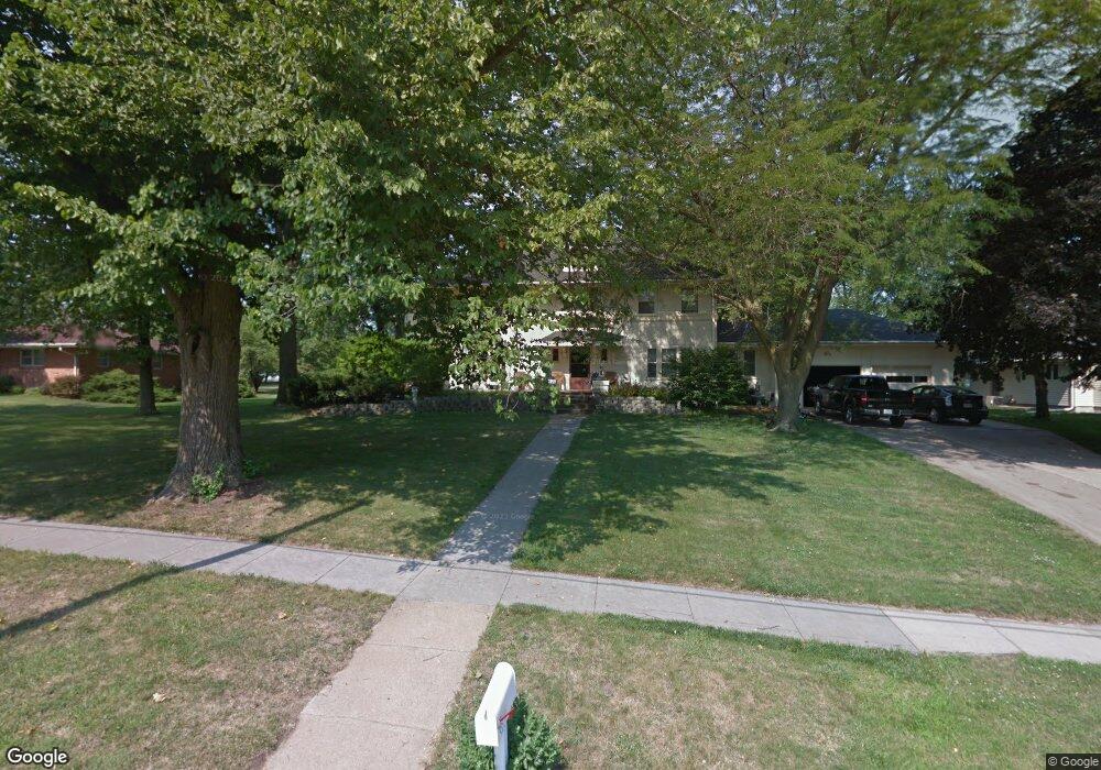
935 Maple St Friend, NE 68359
Estimated Value: $272,000 - $400,000
4
Beds
4
Baths
4,167
Sq Ft
$83/Sq Ft
Est. Value
About This Home
This home is located at 935 Maple St, Friend, NE 68359 and is currently estimated at $346,497, approximately $83 per square foot. 935 Maple St is a home located in Saline County with nearby schools including Friend Elementary School and Friend High School.
Ownership History
Date
Name
Owned For
Owner Type
Purchase Details
Closed on
Dec 31, 2021
Sold by
Stutzman Jared L and Stutzman Alicia M
Bought by
Cobraska Holdings Llc
Current Estimated Value
Purchase Details
Closed on
Jul 2, 2015
Sold by
Zeilinger David M and Zeilinger Sharon K
Bought by
Stutzman Jared L and Stutzman Alicia M
Purchase Details
Closed on
Sep 13, 2002
Sold by
Lauber Family Trust
Bought by
Zeilinger David M and Zeilinger Sharon K
Create a Home Valuation Report for This Property
The Home Valuation Report is an in-depth analysis detailing your home's value as well as a comparison with similar homes in the area
Purchase History
| Date | Buyer | Sale Price | Title Company |
|---|---|---|---|
| Cobraska Holdings Llc | -- | None Listed On Document | |
| Stutzman Jared L | -- | None Available | |
| Zeilinger David M | $160,000 | -- |
Source: Public Records
Tax History
| Year | Tax Paid | Tax Assessment Tax Assessment Total Assessment is a certain percentage of the fair market value that is determined by local assessors to be the total taxable value of land and additions on the property. | Land | Improvement |
|---|---|---|---|---|
| 2025 | $4,829 | $329,650 | $26,210 | $303,440 |
| 2024 | $4,747 | $302,065 | $26,210 | $275,855 |
| 2023 | $5,603 | $288,930 | $26,210 | $262,720 |
| 2022 | $4,725 | $229,800 | $23,400 | $206,400 |
| 2021 | $4,605 | $223,790 | $23,400 | $200,390 |
| 2020 | $4,563 | $219,860 | $23,400 | $196,460 |
| 2019 | $4,155 | $208,740 | $23,400 | $185,340 |
| 2018 | $3,914 | $195,010 | $23,400 | $171,610 |
| 2017 | $4,040 | $195,010 | $23,400 | $171,610 |
| 2016 | $4,110 | $198,510 | $23,400 | $175,110 |
| 2015 | $4,518 | $195,065 | $26,685 | $168,380 |
| 2014 | $4,022 | $188,590 | $26,685 | $161,905 |
Source: Public Records
Map
Nearby Homes
Your Personal Tour Guide
Ask me questions while you tour the home.