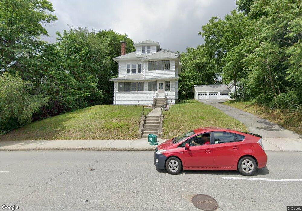
94 Burncoat St Unit 1 Worcester, MA 01605
North Lincoln Street NeighborhoodEstimated Value: $565,291 - $640,000
2
Beds
1
Bath
1,400
Sq Ft
$429/Sq Ft
Est. Value
About This Home
This home is located at 94 Burncoat St Unit 1, Worcester, MA 01605 and is currently estimated at $600,073, approximately $428 per square foot. 94 Burncoat St Unit 1 is a home located in Worcester County with nearby schools including Jacob Hiatt Magnet School, Chandler Magnet, and Wawecus Road School.
Ownership History
Date
Name
Owned For
Owner Type
Purchase Details
Closed on
Sep 12, 2017
Sold by
Rheaume Dorothy
Bought by
Laviolette John and Laviolette Gregge D
Current Estimated Value
Home Financials for this Owner
Home Financials are based on the most recent Mortgage that was taken out on this home.
Original Mortgage
$150,000
Outstanding Balance
$123,209
Interest Rate
3.92%
Mortgage Type
New Conventional
Estimated Equity
$476,864
Purchase Details
Closed on
Mar 18, 1998
Sold by
Greaney Paul and Greaney Stephem T
Bought by
Rheaume Dorothy
Home Financials for this Owner
Home Financials are based on the most recent Mortgage that was taken out on this home.
Original Mortgage
$109,600
Interest Rate
6.92%
Mortgage Type
Purchase Money Mortgage
Create a Home Valuation Report for This Property
The Home Valuation Report is an in-depth analysis detailing your home's value as well as a comparison with similar homes in the area
Home Values in the Area
Average Home Value in this Area
Purchase History
We collect this data history from publicly available records. To have your information removed, we recommend requesting removal directly through your county’s website.
| Date | Buyer | Sale Price | Title Company |
|---|---|---|---|
| Laviolette John | $200,000 | -- | |
| Rheaume Dorothy | $137,000 | -- |
Source: Public Records
Mortgage History
We collect this data history from publicly available records. To have your information removed, we recommend requesting removal directly through your county’s website.
| Date | Status | Borrower | Loan Amount |
|---|---|---|---|
| Open | Laviolette John | $150,000 | |
| Previous Owner | Rheaume Dorothy | $36,000 | |
| Previous Owner | Rheaume Dorothy | $109,600 |
Source: Public Records
Tax History
| Year | Tax Paid | Tax Assessment Tax Assessment Total Assessment is a certain percentage of the fair market value that is determined by local assessors to be the total taxable value of land and additions on the property. | Land | Improvement |
|---|---|---|---|---|
| 2025 | $6,843 | $518,800 | $118,700 | $400,100 |
| 2024 | $6,551 | $476,400 | $118,700 | $357,700 |
| 2023 | $6,117 | $426,600 | $103,200 | $323,400 |
| 2022 | $5,900 | $387,900 | $82,600 | $305,300 |
| 2021 | $5,270 | $323,700 | $66,100 | $257,600 |
| 2020 | $4,930 | $290,000 | $66,100 | $223,900 |
| 2019 | $5,089 | $282,700 | $59,500 | $223,200 |
| 2018 | $4,970 | $262,800 | $59,500 | $203,300 |
| 2017 | $4,697 | $244,400 | $59,500 | $184,900 |
| 2016 | $4,627 | $224,500 | $43,700 | $180,800 |
| 2015 | $4,506 | $224,500 | $43,700 | $180,800 |
| 2014 | $4,387 | $224,500 | $43,700 | $180,800 |
Source: Public Records
Map
Nearby Homes
- 9 Kenwood Ave
- 104 Burncoat St
- 94 Burncoat St
- 10 Kenwood Ave
- 93 Burncoat St
- 15 Kenwood Ave
- 106 Burncoat St
- 103 Burncoat St
- 14 Kenwood Ave
- 105 Burncoat St
- 90 Burncoat St
- 8 Barnard Rd
- 1 Belvidere Ave
- 17 Kenwood Ave
- 12 Barnard Rd
- 3 Clearview Ave
- 115 Burncoat St
- 5 Clearview Ave
- 3 Belvidere Ave
- 108 Burncoat St
Your Personal Tour Guide
Ask me questions while you tour the home.